No Watches or Warnings for Beasley
Issued: 11:31 am CST Dec 18, 2025 Latitude: 33.2120659 Longitude: -88.1000261 View on Google Maps
|
|
|
|
|
|
|
|
|
|
 |
 |
 |
|
 |
 |
|
|
| High: °F |
Low: °F |
High: °F |
High: °F |
High: °F |
High: °F |
High: °F |
High: °F |
| Low: °F |
Low: °F |
Low: °F |
Low: °F |
Low: °F |
|
| Thunderstorms |
Thunderstorms |
Sunny |
Sunny |
Rain |
Mostly Sunny |
Mostly Sunny |
Mostly Sunny |
Current Conditions at
TUSCALOOSA - (KTCL)
64°
Mostly Cloudy
as of 11:06 AM CST
Rel. Humidity: 77%
Dew Point: 57°F
Visibility: 10 Miles
Pressure: 29.89 in.
Flight Rule: VFR
Wind Data
8 MPH
120° Southeast
Cloud Level(s): Few at 1400ft, Scattered at 3100ft, Broken at 6500ft
Current Conditions at
COLUMBUS ARPT - (KGTR)
57°
Cloudy
as of 11:05 AM CST
Rel. Humidity: 100%
Dew Point: 57°F
Visibility: 10 Miles
Pressure: 29.86 in.
Flight Rule: IFR
Wind Data
12 MPH
160° South
Cloud Level(s): Solid Overcast at 500ft
Current Conditions at
COLUMBUS AFB - (KCBM)
59°
Cloudy
as of 11:24 AM CST
Rel. Humidity: 93%
Dew Point: 57°F
Visibility: 10 Miles
Pressure: 29.80 in.
Flight Rule: IFR
Wind Data
12 MPH
170° South
Cloud Level(s): Broken at 600ft, Solid Overcast at 1200ft
Current Conditions at
MERIDIAN NAS - (KNMM)
64°
Cloudy
as of 11:25 AM CST
Rel. Humidity: 88%
Dew Point: 61°F
Visibility: 10 Miles
Pressure: 29.86 in.
Flight Rule: MVFR
Cloud Level(s): Solid Overcast at 1000ft
|
Today... Rain likely, mainly before noon, then showers likely and possibly a thunderstorm after 3pm. Mostly cloudy, with a high near 64. South wind around 10 mph, with gusts as high as 25 mph. Chance of precipitation is 70%. New rainfall amounts between a tenth and quarter of an inch, except higher amounts possible in thunderstorms. |
|
|
Tonight... Showers and possibly a thunderstorm before 9pm, then a slight chance of rain between 9pm and midnight. Low around 35. South wind around 10 mph becoming northwest after midnight. Winds could gust as high as 25 mph. Chance of precipitation is 80%. New precipitation amounts between a tenth and quarter of an inch, except higher amounts possible in thunderstorms. |
|
|
Friday... Sunny, with a high near 50. Northwest wind around 5 mph becoming calm in the afternoon. |
|
 |
Friday Night... Mostly clear, with a low around 33. Calm wind becoming south around 5 mph. |
|
|
Saturday... Sunny, with a high near 62. South wind 5 to 10 mph. |
|
 |
Saturday Night... A 30 percent chance of rain after midnight. Increasing clouds, with a low around 47. |
|
|
Sunday... A 20 percent chance of rain. Partly sunny, with a high near 59. |
|
 |
Sunday Night... Partly cloudy, with a low around 39. |
|
|
Monday... Mostly sunny, with a high near 59. |
|
|
Monday Night... Partly cloudy, with a low around 44. |
|
|
Tuesday... Mostly sunny, with a high near 65. |
|
|
Tuesday Night... Mostly clear, with a low around 49. |
|
|
Wednesday... Mostly sunny, with a high near 71. |
|
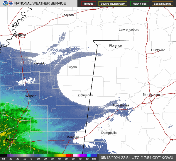
Current Radar Image
Sun Almanac for Beasley, Alabama
Sunrise: 06:51 AM
Sunset: 4:48 PM
Civil Sunrise:06:23 AM
Civil Sunset: 5:15 PM
Nautical Sunrise: 05:52 AM
Nautical Sunset: 5:46 PM
Astro Sunrise: 05:22 AM
Astro Sunset: 6:17 PM
Alabama's Current Temperatures
 Alabama's Satellite Image
 Alabama's Current Wind Direction
| National Summary |
of upper and lower values of current conditions amongst 7193 locations
in the contiguous United States |
|
High
Temp |
84° |
Boca Raton, Florida
and 1 other location
|
|
Low
Temp |
-6° |
Rolla Municipal A/P, North Dakota
and 2 other locations
|
|
Wind
Speed |
49mph |
Hastings, Nebraska
|
|
Wind
Gust |
75mph |
Russell, Kansas
|
|
Wind
Chill |
-35° |
Rolla Municipal A/P, North Dakota
|
|
High
Pressure |
30.93Hg |
Charlie, Montana
|
|
Low
Pressure |
29.06Hg |
Grand Marais, Minnesota
|
|
| # Locations Reporting Snow |
90 |
|
| # Locations Reporting Rain |
219 |
|
| # Locations Reporting Thunderstorms / Lightning |
1 |
|
| # Locations Reporting Fog |
35 |
|
| Average Temperature in the Contiguous USA |
49° |
|
Any use of the information on this page is at your own risk. This information should not be relied upon in life-threatening situations, potential financial loss situations or in lieu of any officially disseminated information. Visit the
National Weather Service for official information.