Bethany, South Carolina Weather
No Watches or Warnings for Bethany
Issued: 12:45 am EDT Jul 18, 2025 Latitude: 33.8495726 Longitude: -82.1506764 View on Google Maps
|
|
|
|
|
|
|
|
|
|
 |
 |
 |
 |
 |
 |
|
|
| High: °F |
Low: °F |
High: °F |
High: °F |
High: °F |
High: °F |
High: °F |
High: °F |
| Low: °F |
Low: °F |
Low: °F |
Low: °F |
Low: °F |
|
| Thunderstorms |
Mostly Clear |
Sunny |
Thunderstorms |
Thunderstorms |
Thunderstorms |
Thunderstorms |
Thunderstorms |
Current Conditions at
GREENWOOD - (KGRD)
77°
Clear
as of 3:56 AM EDST
Rel. Humidity: 88%
Dew Point: 73°F
Visibility: 10 Miles
Pressure: 30.11 in.
Flight Rule: VFR
Cloud Level(s): Clear
Current Conditions at
AUGUSTA DANIEL FIELD - (KDNL)
79°
Clear
as of 3:53 AM EDST
Rel. Humidity: 83%
Dew Point: 73°F
Visibility: 10 Miles
Pressure: 30.11 in.
Flight Rule: VFR
Cloud Level(s): Clear
Current Conditions at
THOMSON - (KHQU)
77°
Clear
as of 4:35 AM EDST
Rel. Humidity: 88%
Dew Point: 73°F
Visibility: 10 Miles
Pressure: 30.16 in.
Flight Rule: VFR
Cloud Level(s): Clear
Current Conditions at
AUGUSTA BUSH FIELD - (KAGS)
75°
Clear
as of 3:53 AM EDST
Rel. Humidity: 94%
Dew Point: 73°F
Visibility: 10 Miles
Pressure: 30.08 in.
Flight Rule: VFR
Cloud Level(s): Clear
|
Today... A slight chance of showers and thunderstorms before 3pm, then a slight chance of showers and thunderstorms after 5pm. Sunny and hot, with a high near 97. Heat index values as high as 107. Calm wind becoming southwest around 5 mph in the afternoon. Chance of precipitation is 20%. |
|
|
Tonight... Mostly clear, with a low around 76. Calm wind. |
|
|
Saturday... Sunny and hot, with a high near 99. Heat index values as high as 106. Calm wind becoming west 5 to 7 mph in the morning. |
|
|
Saturday Night... Mostly clear, with a low around 77. Light west wind. |
|
|
Sunday... A chance of showers and thunderstorms after 2pm. Mostly sunny and hot, with a high near 98. West wind 3 to 7 mph. Chance of precipitation is 30%. New rainfall amounts of less than a tenth of an inch, except higher amounts possible in thunderstorms. |
|
 |
Sunday Night... A chance of showers and thunderstorms before 8pm. Partly cloudy, with a low around 77. Chance of precipitation is 30%. New precipitation amounts of less than a tenth of an inch, except higher amounts possible in thunderstorms. |
|
|
Monday... A chance of showers and thunderstorms after 2pm. Mostly sunny and hot, with a high near 100. Chance of precipitation is 40%. |
|
 |
Monday Night... A chance of showers and thunderstorms before 2am. Mostly cloudy, with a low around 75. Chance of precipitation is 30%. |
|
|
Tuesday... A chance of showers and thunderstorms after 2pm. Partly sunny, with a high near 94. Chance of precipitation is 50%. |
|
 |
Tuesday Night... A chance of showers and thunderstorms before 2am. Mostly cloudy, with a low around 72. Chance of precipitation is 40%. |
|
|
Wednesday... A chance of showers and thunderstorms. Mostly sunny, with a high near 93. Chance of precipitation is 30%. |
|
|
Wednesday Night... A chance of showers and thunderstorms. Partly cloudy, with a low around 73. Chance of precipitation is 30%. |
|
|
Thursday... A chance of showers and thunderstorms. Mostly sunny, with a high near 95. Chance of precipitation is 30%. |
|
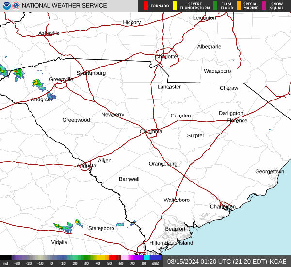
Current Radar Image
Sun Almanac for Bethany, South Carolina
Sunrise: 06:31 AM
Sunset: 8:39 PM
Civil Sunrise:06:03 AM
Civil Sunset: 9:07 PM
Nautical Sunrise: 05:29 AM
Nautical Sunset: 9:41 PM
Astro Sunrise: 04:52 AM
Astro Sunset: 10:18 PM
South Carolina's Current Temperatures
 South Carolina's Satellite Image
 South Carolina's Current Wind Direction
| National Summary |
of upper and lower values of current conditions amongst 7018 locations
in the contiguous United States |
|
High
Temp |
113° |
Sumter A/P, South Carolina
|
|
Low
Temp |
41° |
Kings, Wisconsin
|
|
Wind
Speed |
56mph |
Bellefontaine, Ohio
|
|
Wind
Gust |
31mph |
Powell, Wyoming
and 4 other locations
|
|
Wind
Chill |
37° |
Salida Mountain, Colorado
|
|
Heat
Index |
306° |
Sumter A/P, South Carolina
|
|
High
Pressure |
30.72Hg |
Salida Mountain, Colorado
|
|
Low
Pressure |
29.61Hg |
Presque Isle, Maine
|
|
| # Locations Reporting Rain |
47 |
|
| # Locations Reporting Thunderstorms / Lightning |
8 |
|
| # Locations Reporting Fog |
19 |
|
| Average Temperature in the Contiguous USA |
69° |
|
Any use of the information on this page is at your own risk. This information should not be relied upon in life-threatening situations, potential financial loss situations or in lieu of any officially disseminated information. Visit the
National Weather Service for official information.