Everlea, Maryland Weather
Current Conditions at
GEORGETOWN - (KGED)
59°
Cloudy
Light Rain Mist
as of 3:42 PM EDST
Rel. Humidity: 93%
Dew Point: 57°F
Visibility: 3 Miles
Pressure: 29.84 in.
Flight Rule: MVFR
Cloud Level(s): Scattered at 6000ft, Broken at 7500ft, Solid Overcast at 9000ft
Current Conditions at
US NAVAL ACADEMY - (KNAK)
61°
Cloudy
Light Rain
as of 3:17 PM EDST
Rel. Humidity: 87%
Dew Point: 57°F
Visibility: 10 Miles
Pressure: 29.86 in.
Flight Rule: MVFR
Cloud Level(s): Scattered at 1400ft, Broken at 2100ft, Solid Overcast at 10000ft
Current Conditions at
SALISBURY - (KSBY)
59°
Cloudy
Rain Mist
as of 3:39 PM EDST
Rel. Humidity: 93%
Dew Point: 57°F
Visibility: 3 Miles
Pressure: 29.86 in.
Flight Rule: MVFR
Cloud Level(s): Scattered at 3600ft, Broken at 5500ft, Solid Overcast at 7000ft
Current Conditions at
PATUXENT RIV NAS - (KNHK)
63°
Cloudy
Light Rain Mist
as of 2:52 PM EDST
Rel. Humidity: 82%
Dew Point: 57°F
Visibility: 5 Miles
Pressure: 29.85 in.
Flight Rule: MVFR
Cloud Level(s): Few at 3400ft, Broken at 5500ft, Solid Overcast at 7000ft
Moon Almanac for Everlea, Maryland
Moon Phase: Waning Gibbous
Moon Illumination: 87%
Moon Age: 18.2 Days
Moon is currently below the horizon
Distance from Moon to Earth: 251,517 miles
Upcoming Lunar Events for
Everlea: |
| Next Event | Event Time | Illum |
|
|
|
| Moonrise: | 11:32 pm Sun | 85.0% |
| High Moon: | 04:10 am Mon | 83.6% |
| Moonset: | 08:45 am Mon | 82.2% |
 | New Moon: Wed Mar 18 |
 | First Quarter: Wed Mar 25 |
 | Full Moon: Wed Apr 1 |
 | Last Quarter: Fri Apr 10 |
| New Moon: Fri Apr 17 |
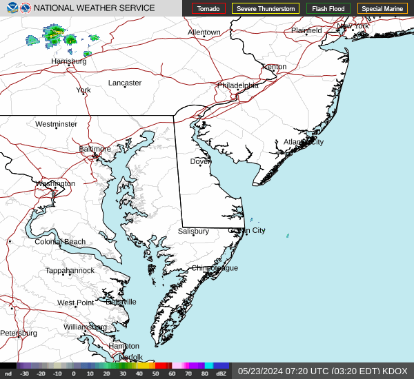
Current Radar Image
| Maryland State Summary |
of upper and lower values of current conditions amongst 17 locations
in Maryland |
|
High
Temp |
63° |
Patuxent Riv NAS
|
|
Low
Temp |
41° |
Garrett Cnty A/P
|
|
Wind
Speed |
20mph |
Camp David
|
|
Wind
Gust |
33mph |
Camp David
|
|
Wind
Chill |
33° |
Garrett Cnty A/P
|
|
High
Pressure |
29.99Hg |
Greater Cumberland Arpt
|
|
Low
Pressure |
29.84Hg |
Baltimore Inner Harbor
and 4 other locations
|
|
| Average temperature in Maryland |
57° |
|
| # Locations Reporting Rain |
6 |
|
# Locations Reporting MVFR
(Marginal Visual Flight Rules) |
4 |
|
# Locations Reporting VFR
(Visual Flight Rules) |
13 |
|
Maryland's Current Temperatures
 Maryland's Satellite Image
 Maryland's Current Wind Direction
| National Summary |
of upper and lower values of current conditions amongst 6984 locations
in the contiguous United States |
|
High
Temp |
91° |
Gila Bend (Aaf), Arizona
and 1 other location
|
|
Low
Temp |
28° |
Otsego County Arpt, Michigan
|
|
Wind
Speed |
32mph |
Manteo/Dare, North Carolina
|
|
Wind
Gust |
40mph |
OceanaNAS, Virginia
and 1 other location
|
|
Wind
Chill |
16° |
Chippewa Intl Arpt, Michigan
and 2 other locations
|
|
High
Pressure |
30.62Hg |
Salida Mountain, Colorado
|
|
Low
Pressure |
29.58Hg |
Frenchville, Maine
|
|
| # Locations Reporting Snow |
2 |
|
| # Locations Reporting Rain |
204 |
|
| # Locations Reporting Thunderstorms / Lightning |
4 |
|
| # Locations Reporting Fog |
3 |
|
| Average Temperature in the Contiguous USA |
60° |
|
Any use of the information on this page is at your own risk. This information should not be relied upon in life-threatening situations, potential financial loss situations or in lieu of any officially disseminated information. Visit the
National Weather Service for official information.