Edgefield, Alabama Weather
No Watches or Warnings for Edgefield
Issued: 5:06 am CST Dec 17, 2025 Latitude: 31.7168319 Longitude: -85.3721595 View on Google Maps
|
|
|
|
|
|
|
|
|
|
 |
 |
 |
 |
|
 |
|
|
| High: °F |
Low: °F |
High: °F |
High: °F |
High: °F |
High: °F |
High: °F |
High: °F |
| Low: °F |
Low: °F |
Low: °F |
Low: °F |
Low: °F |
|
| Mostly Cloudy |
Rain |
Thunderstorms |
Sunny |
Sunny |
Mostly Sunny |
Mostly Sunny |
Mostly Sunny |
Current Conditions at
DOTHAN - (KDHN)
55°
Clear
as of 9:53 AM CST
Rel. Humidity: 66%
Dew Point: 45°F
Visibility: 10 Miles
Pressure: 30.26 in.
Flight Rule: VFR
Cloud Level(s): Clear
Current Conditions at
BLAKELY EARLY C - (KBIJ)
54°
Mostly Cloudy
as of 10:55 AM EST
Rel. Humidity: 66%
Dew Point: 43°F
Visibility: 10 Miles
Pressure: 30.26 in.
Flight Rule: VFR
Cloud Level(s): Scattered at 1900ft, Broken at 3100ft
Current Conditions at
FT RUCKER - (KOZR)
54°
Mostly Clear
as of 9:55 AM CST
Rel. Humidity: 62%
Dew Point: 41°F
Visibility: 10 Miles
Pressure: 30.21 in.
Flight Rule: VFR
Cloud Level(s): Few at 19000ft
|
Today... Mostly cloudy, with a high near 62. Calm wind becoming east around 5 mph. |
|
|
Tonight... A 20 percent chance of showers after 3am. Mostly cloudy, with a low around 46. Calm wind. |
|
|
Thursday... Rain before 1pm, then showers between 1pm and 3pm, then showers and possibly a thunderstorm after 3pm. High near 64. East wind 5 to 10 mph becoming south in the afternoon. Chance of precipitation is 80%. New rainfall amounts between a quarter and half of an inch possible. |
|
 |
Thursday Night... Showers likely and possibly a thunderstorm before midnight, then a chance of showers between midnight and 3am, then a chance of rain after 3am. Mostly cloudy, with a low around 43. South wind 5 to 10 mph becoming northwest after midnight. Chance of precipitation is 70%. |
|
|
Friday... Sunny, with a high near 56. Northwest wind 5 to 10 mph. |
|
 |
Friday Night... Clear, with a low around 31. |
|
|
Saturday... Sunny, with a high near 61. |
|
 |
Saturday Night... Mostly clear, with a low around 38. |
|
|
Sunday... Mostly sunny, with a high near 67. |
|
 |
Sunday Night... Partly cloudy, with a low around 44. |
|
|
Monday... Mostly sunny, with a high near 67. |
|
|
Monday Night... Partly cloudy, with a low around 45. |
|
|
Tuesday... Mostly sunny, with a high near 67. |
|
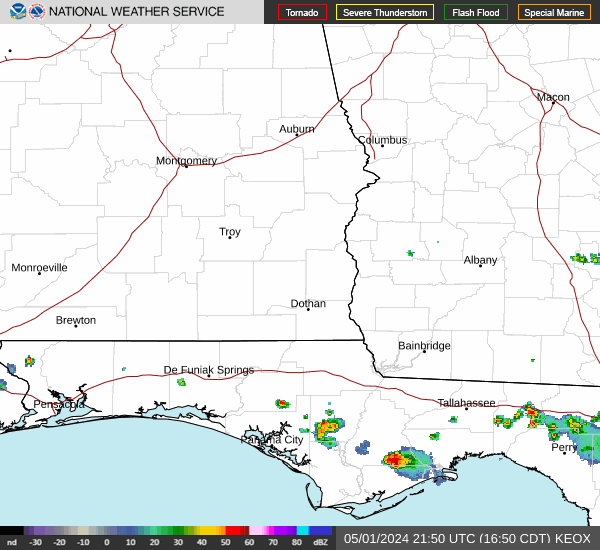
Current Radar Image
Sun Almanac for Edgefield, Alabama
Sunrise: 06:35 AM
Sunset: 4:40 PM
Civil Sunrise:06:08 AM
Civil Sunset: 5:07 PM
Nautical Sunrise: 05:38 AM
Nautical Sunset: 5:38 PM
Astro Sunrise: 05:08 AM
Astro Sunset: 6:07 PM
Alabama's Current Temperatures
 Alabama's Satellite Image
 Alabama's Current Wind Direction
| National Summary |
of upper and lower values of current conditions amongst 5324 locations
in the contiguous United States |
|
High
Temp |
79° |
Lantana/Palm Bea, Florida
and 2 other locations
|
|
Low
Temp |
14° |
Solon Springs, Wisconsin
|
|
Wind
Speed |
44mph |
Salida Mountain, Colorado
|
|
Wind
Gust |
66mph |
Lewiston, Idaho
|
|
Wind
Chill |
3° |
Cavalier Municipal A/P, North Dakota
|
|
High
Pressure |
30.32Hg |
Thomson, Georgia
|
|
Low
Pressure |
29.03Hg |
Havre, Montana
|
|
| # Locations Reporting Snow |
5 |
|
| # Locations Reporting Rain |
50 |
|
| # Locations Reporting Fog |
27 |
|
| Average Temperature in the Contiguous USA |
46° |
|
Any use of the information on this page is at your own risk. This information should not be relied upon in life-threatening situations, potential financial loss situations or in lieu of any officially disseminated information. Visit the
National Weather Service for official information.