No Watches or Warnings for Lehua
Issued: 10:48 am HST May 5, 2024 Latitude: 19.5333005 Longitude: -155.1409006 View on Google Maps
|
|
|
|
|
|
|
|
|
|
 |
 |
 |
 |
 |
|
|
|
| High: °F |
Low: °F |
High: °F |
High: °F |
High: °F |
High: °F |
High: °F |
High: °F |
| Low: °F |
Low: °F |
Low: °F |
Low: °F |
Low: °F |
|
| Rain |
Rain |
Thunderstorms |
Rain |
Rain |
Rain |
Rain |
Rain |
Current Conditions at
HILO/GEN LYMAN FL - (PHTO)
77°
Mostly Cloudy
as of 12:53 PM HDST
Rel. Humidity: 78%
Dew Point: 70°F
Visibility: 10 Miles
Pressure: 30.10 in.
Flight Rule: VFR
Wind Data
12 MPH
Gust: 22 MPH
070° East
Cloud Level(s): Few at 2000ft, Scattered at 2700ft, Broken at 3300ft
Current Conditions at
BRADSHAW AAF - (PHSF)
70°
Partly Cloudy
as of 12:55 PM HDST
Rel. Humidity: 49%
Dew Point: 50°F
Visibility: 10 Miles
Pressure: 30.35 in.
Flight Rule: VFR
Wind Data
8 MPH
150° Southeast
Cloud Level(s): Few at 24000ft, Scattered at 27000ft, Scattered at 35000ft
Current Conditions at
KONA/KEAHOLE - (PHKO)
81°
Partly Cloudy
as of 12:53 PM HDST
Rel. Humidity: 61%
Dew Point: 66°F
Visibility: 10 Miles
Pressure: 30.03 in.
Flight Rule: VFR
Wind Data
8 MPH
230° Southwest
Cloud Level(s): Few at 4000ft, Scattered at 5000ft
Current Conditions at
KAHULUI/MAUI - (PHOG)
81°
Partly Cloudy
as of 12:54 PM HDST
Rel. Humidity: 54%
Dew Point: 63°F
Visibility: 10 Miles
Pressure: 30.05 in.
Flight Rule: VFR
Wind Data
21 MPH
Gust: 39 MPH
080° East
Cloud Level(s): Few at 4500ft, Scattered at 6500ft
|
This Afternoon... Showers likely. Mostly cloudy, with a high near 67. North northeast wind around 8 mph. Chance of precipitation is 70%. New precipitation amounts between a tenth and quarter of an inch possible. |
|
|
Tonight... Occasional showers. Low around 61. North wind 6 to 8 mph. Chance of precipitation is 80%. New precipitation amounts between a quarter and half of an inch possible. |
|
|
Monday... Occasional showers, with thunderstorms also possible after noon. High near 67. East northeast wind around 8 mph. Chance of precipitation is 80%. New rainfall amounts between a tenth and quarter of an inch, except higher amounts possible in thunderstorms. |
|
 |
Monday Night... Showers likely. Mostly cloudy, with a low around 61. East northeast wind 6 to 8 mph becoming north northwest after midnight. Chance of precipitation is 70%. New precipitation amounts between a tenth and quarter of an inch possible. |
|
|
Tuesday... Scattered showers. Cloudy, with a high near 69. North northwest wind 6 to 9 mph becoming east northeast in the morning. Chance of precipitation is 50%. New precipitation amounts between a tenth and quarter of an inch possible. |
|
 |
Tuesday Night... Showers. Low around 61. East northeast wind 5 to 9 mph becoming calm in the evening. Chance of precipitation is 90%. New precipitation amounts between a quarter and half of an inch possible. |
|
|
Wednesday... Showers. High near 70. East northeast wind 3 to 8 mph. Chance of precipitation is 80%. |
|
 |
Wednesday Night... Showers. Low around 61. North wind 3 to 6 mph. Chance of precipitation is 100%. |
|
|
Thursday... Showers, mainly before noon. High near 70. East northeast wind 5 to 8 mph. Chance of precipitation is 80%. |
|
|
Thursday Night... Showers. Low around 61. Northeast wind around 5 mph becoming calm in the evening. Chance of precipitation is 80%. |
|
|
Friday... Scattered showers. Cloudy, with a high near 70. East wind 3 to 6 mph. Chance of precipitation is 50%. |
|
|
Friday Night... Showers. Low around 62. North northeast wind 3 to 7 mph. Chance of precipitation is 80%. |
|
|
Saturday... Scattered showers. Cloudy, with a high near 70. Northeast wind 7 to 9 mph. Chance of precipitation is 50%. |
|
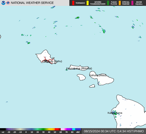
Current Radar Image
Sun Almanac for Lehua, Hawaii
Sunrise: 06:49 AM
Sunset: 7:45 PM
Civil Sunrise:06:26 AM
Civil Sunset: 8:08 PM
Nautical Sunrise: 05:59 AM
Nautical Sunset: 8:36 PM
Astro Sunrise: 05:31 AM
Astro Sunset: 9:04 PM
Hawaii's Current Temperatures
 Hawaii's Satellite Image
 Hawaii's Current Wind Direction
| National Summary |
of upper and lower values of current conditions amongst 6967 locations
in the contiguous United States |
|
High
Temp |
95° |
Zapata Cnty A/P, Texas
|
|
Low
Temp |
32° |
Ely, Nevada
and 1 other location
|
|
Wind
Speed |
39mph |
Daggett, California
and 1 other location
|
|
Wind
Gust |
58mph |
Winslow, Arizona
|
|
Wind
Chill |
16° |
Pagosa Springs, Colorado
|
|
Heat
Index |
110° |
Ft Rucker/Hanche, Alabama
|
|
High
Pressure |
30.26Hg |
Nantucket, Massachusetts
and 1 other location
|
|
Low
Pressure |
29.35Hg |
South Big Horn, Wyoming
|
|
| # Locations Reporting Snow |
7 |
|
| # Locations Reporting Rain |
206 |
|
| # Locations Reporting Thunderstorms / Lightning |
12 |
|
| # Locations Reporting Fog |
6 |
|
| Average Temperature in the Contiguous USA |
68° |
|
Any use of the information on this page is at your own risk. This information should not be relied upon in life-threatening situations, potential financial loss situations or in lieu of any officially disseminated information. Visit the
National Weather Service for official information.