No Watches or Warnings for Knobs
Issued: 8:59 pm MDT Apr 28, 2024 Latitude: 45.9841674 Longitude: -104.0877136 View on Google Maps
|
|
|
|
|
|
|
|
|
|
 |
 |
 |
 |
 |
 |
|
|
| Low: °F |
High: °F |
High: °F |
High: °F |
High: °F |
High: °F |
High: °F |
High: °F |
| Low: °F |
Low: °F |
Low: °F |
Low: °F |
Low: °F |
Low: °F |
|
| Morning Fog |
Morning Fog |
Rain |
Mostly Sunny |
Rain |
Rain |
Rain |
Mostly Sunny |
Current Conditions at
BAKER - (KBHK)
39°
Clear
as of 8:51 PM MDST
Rel. Humidity: 69%
Dew Point: 30°F
Visibility: 10 Miles
Pressure: 29.85 in.
Flight Rule: VFR
Wind Data
7 MPH
140° Southeast
Cloud Level(s): Clear
Current Conditions at
BUFFALO - (K2WX)
39°
Mostly Clear
as of 8:56 PM MDST
Rel. Humidity: 80%
Dew Point: 34°F
Pressure: 29.83 in.
Wind Data
6 MPH
150° Southeast
Current Conditions at
HETTINGER - (KHEI)
39°
Mostly Cloudy
as of 9:41 PM MDST
Rel. Humidity: 86%
Dew Point: 36°F
Visibility: 10 Miles
Pressure: 29.87 in.
Flight Rule: MVFR
Cloud Level(s): Broken at 1400ft
Current Conditions at
DICKINSON - (KDIK)
39°
Mostly Clear
as of 8:56 PM MDST
Rel. Humidity: 80%
Dew Point: 34°F
Visibility: 10 Miles
Pressure: 29.86 in.
Flight Rule: VFR
Cloud Level(s): Few at 12000ft
|
Tonight... Areas of fog after 3am. Otherwise, mostly clear, with a low around 32. Southeast wind 6 to 10 mph becoming southwest after midnight. |
|
|
Monday... Areas of fog before 9am. Otherwise, mostly sunny, with a high near 65. Southwest wind 6 to 10 mph becoming northwest in the morning. |
|
 |
Monday Night... A 50 percent chance of showers. Mostly cloudy, with a low around 38. South southeast wind 9 to 18 mph becoming west after midnight. |
|
|
Tuesday... A 20 percent chance of rain before noon. Partly sunny, then gradually becoming sunny, with a high near 56. West northwest wind 26 to 30 mph, with gusts as high as 44 mph. |
|
 |
Tuesday Night... Partly cloudy, with a low around 33. West wind 21 to 26 mph decreasing to 10 to 15 mph after midnight. Winds could gust as high as 39 mph. |
|
|
Wednesday... Mostly sunny, with a high near 58. West wind 10 to 18 mph. |
|
 |
Wednesday Night... A 30 percent chance of rain, mainly after midnight. Mostly cloudy, with a low around 33. North northwest wind 11 to 17 mph. |
|
|
Thursday... A 40 percent chance of rain. Partly sunny, with a high near 53. North northwest wind 13 to 18 mph. |
|
 |
Thursday Night... A slight chance of rain before 3am, then a slight chance of rain and snow. Partly cloudy, with a low around 31. North northwest wind 8 to 15 mph becoming south after midnight. Chance of precipitation is 20%. |
|
|
Friday... A 20 percent chance of rain. Mostly sunny, with a high near 58. West wind 8 to 14 mph becoming north northeast in the morning. |
|
|
Friday Night... A 30 percent chance of rain. Mostly cloudy, with a low around 33. Northeast wind 11 to 15 mph. |
|
|
Saturday... A 20 percent chance of rain. Mostly sunny, with a high near 58. Northwest wind 10 to 14 mph. |
|
 |
Saturday Night... Mostly clear, with a low around 36. Northwest wind 10 to 13 mph becoming south southeast after midnight. |
|
|
Sunday... Mostly sunny, with a high near 69. South southeast wind 10 to 16 mph. |
|
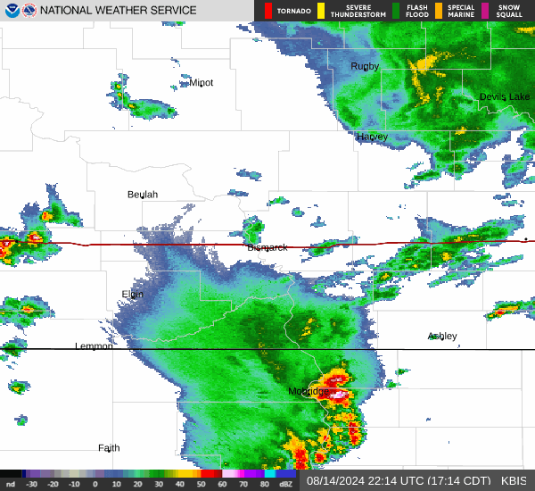
Current Radar Image
Sun Almanac for Knobs, Montana
Sunrise: 05:47 AM
Sunset: 8:01 PM
Civil Sunrise:05:14 AM
Civil Sunset: 8:34 PM
Nautical Sunrise: 04:33 AM
Nautical Sunset: 9:15 PM
Astro Sunrise: 03:47 AM
Astro Sunset: 10:00 PM
Montana's Current Temperatures
 Montana's Satellite Image
 Montana's Current Wind Direction
| National Summary |
of upper and lower values of current conditions amongst 6906 locations
in the contiguous United States |
|
High
Temp |
84° |
Imperial, California
and 1 other location
|
|
Low
Temp |
1° |
Imperial Beach NAS, California
|
|
Wind
Speed |
35mph |
Duluth Sky Harbor, Minnesota
|
|
Wind
Gust |
53mph |
Roswell, New Mexico
|
|
Wind
Chill |
0° |
Berthoud Pass, Colorado
|
|
High
Pressure |
30.79Hg |
Ottawa, Ohio
|
|
Low
Pressure |
29.66Hg |
Sheldon, Iowa
|
|
| # Locations Reporting Snow |
10 |
|
| # Locations Reporting Rain |
171 |
|
| # Locations Reporting Thunderstorms / Lightning |
4 |
|
| # Locations Reporting Fog |
11 |
|
| Average Temperature in the Contiguous USA |
60° |
|
Any use of the information on this page is at your own risk. This information should not be relied upon in life-threatening situations, potential financial loss situations or in lieu of any officially disseminated information. Visit the
National Weather Service for official information.