Jamison, California Weather
No Watches or Warnings for Jamison
Issued: 1:31 pm PDT Apr 25, 2024 Latitude: 39.7760082 Longitude: -120.6821651 View on Google Maps
|
|
|
|
|
|
|
|
|
|
 |
 |
 |
 |
|
|
|
 |
| Low: °F |
High: °F |
High: °F |
High: °F |
High: °F |
High: °F |
High: °F |
High: °F |
| Low: °F |
Low: °F |
Low: °F |
Low: °F |
Low: °F |
Low: °F |
|
| Thunderstorms |
Thunderstorms |
Mostly Sunny |
Sunny |
Sunny |
Sunny |
Sunny |
Snow |
Current Conditions at
BLUE CANYON - (KBLU)
Clear
Light Rain Mist
as of 8:28 PM PDST
Rel. Humidity: 86%
Dew Point: 39°F
Visibility: 3/4 Miles
Pressure: 30.01 in.
Flight Rule: MVFR
Wind Data
12 MPH
Gust: 22 MPH
180° South
Current Conditions at
TRUCKEE - (KTRK)
41°
Cloudy
as of 8:15 PM PDST
Rel. Humidity: 75%
Dew Point: 34°F
Visibility: 10 Miles
Pressure: 30.00 in.
Flight Rule: VFR
Cloud Level(s): Scattered at 2900ft, Broken at 3800ft, Solid Overcast at 5000ft
Current Conditions at
RENO - (KRNO)
55°
Mostly Cloudy
as of 7:55 PM PDST
Rel. Humidity: 43%
Dew Point: 34°F
Visibility: 10 Miles
Pressure: 29.92 in.
Flight Rule: VFR
Wind Data
10 MPH
Gust: 20 MPH
290° West
Cloud Level(s): Broken at 5000ft, Broken at 10000ft
Current Conditions at
OROVILLE - (KOVE)
61°
Cloudy
Light Rain
as of 7:53 PM PDST
Rel. Humidity: 82%
Dew Point: 55°F
Visibility: 10 Miles
Pressure: 29.96 in.
Flight Rule: VFR
Wind Data
5 MPH
060° Northeast
Cloud Level(s): Solid Overcast at 4700ft
|
Tonight... Showers and possibly a thunderstorm before 2am, then showers likely. Snow level 7500 feet lowering to 6400 feet after midnight . Low around 36. West wind around 5 mph. Chance of precipitation is 90%. New rainfall amounts between a quarter and half of an inch possible. |
|
|
Friday... A chance of showers, then showers and possibly a thunderstorm after 8am. Snow level 6200 feet. High near 48. West wind around 5 mph. Chance of precipitation is 80%. New rainfall amounts between a quarter and half of an inch possible. |
|
 |
Friday Night... A 20 percent chance of showers and thunderstorms before 11pm. Snow level 6600 feet lowering to 5600 feet after midnight . Mostly cloudy, with a low around 31. West wind around 5 mph becoming calm in the evening. |
|
|
Saturday... Mostly sunny, with a high near 58. Southeast wind 5 to 10 mph becoming west in the morning. |
|
 |
Saturday Night... Partly cloudy, with a low around 35. West wind 5 to 10 mph becoming light southwest in the evening. |
|
|
Sunday... Sunny, with a high near 62. Light and variable wind becoming west 10 to 15 mph in the afternoon. |
|
 |
Sunday Night... Clear, with a low around 35. |
|
|
Monday... Sunny, with a high near 66. |
|
|
Monday Night... Clear, with a low around 36. |
|
|
Tuesday... Sunny, with a high near 69. |
|
 |
Tuesday Night... Mostly clear, with a low around 39. |
|
|
Wednesday... Sunny, with a high near 68. |
|
|
Wednesday Night... Mostly clear, with a low around 39. |
|
|
Thursday... A chance of showers. Snow level 6700 feet. Mostly sunny, with a high near 61. |
|
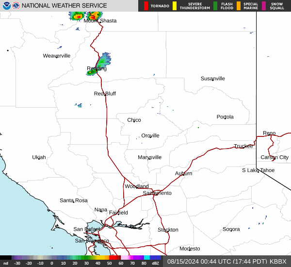
Current Radar Image
Sun Almanac for Jamison, California
Sunrise: 06:10 AM
Sunset: 7:51 PM
Civil Sunrise:05:41 AM
Civil Sunset: 8:20 PM
Nautical Sunrise: 05:06 AM
Nautical Sunset: 8:55 PM
Astro Sunrise: 04:29 AM
Astro Sunset: 9:32 PM
California's Current Temperatures
 California's Satellite Image
 California's Current Wind Direction
| National Summary |
of upper and lower values of current conditions amongst 6938 locations
in the contiguous United States |
|
High
Temp |
84° |
Del Rio, Texas
and 1 other location
|
|
Low
Temp |
23° |
Berthoud Pass, Colorado
|
|
Wind
Speed |
32mph |
Gage, Oklahoma
and 1 other location
|
|
Wind
Gust |
48mph |
Sandburg, California
|
|
Wind
Chill |
7° |
Salida Mountain, Colorado
|
|
High
Pressure |
30.40Hg |
Franklin Cnty Airpor, Vermont
and 7 other locations
|
|
Low
Pressure |
29.45Hg |
Goodland, Kansas
|
|
| # Locations Reporting Rain |
108 |
|
| # Locations Reporting Thunderstorms / Lightning |
2 |
|
| # Locations Reporting Fog |
4 |
|
| Average Temperature in the Contiguous USA |
56° |
|
Any use of the information on this page is at your own risk. This information should not be relied upon in life-threatening situations, potential financial loss situations or in lieu of any officially disseminated information. Visit the
National Weather Service for official information.