Honouliuli, Hawaii Weather
No Watches or Warnings for Honouliuli
Issued: 6:03 pm HST May 4, 2024 Latitude: 21.3642105 Longitude: -158.0327511 View on Google Maps
|
|
|
|
|
|
|
|
|
|
 |
 |
 |
 |
|
 |
|
|
| Low: °F |
High: °F |
High: °F |
High: °F |
High: °F |
High: °F |
High: °F |
High: °F |
| Low: °F |
Low: °F |
Low: °F |
Low: °F |
Low: °F |
Low: °F |
|
| Rain |
Partly Sunny |
Rain |
Rain |
Partly Sunny |
Rain |
Rain |
Rain |
Current Conditions at
BARBERS POINT NAS - (PHJR)
77°
Clear
as of 6:53 PM HDST
Rel. Humidity: 57%
Dew Point: 61°F
Visibility: 10 Miles
Pressure: 30.03 in.
Flight Rule: VFR
Wind Data
15 MPH
Gust: 26 MPH
080° East
Cloud Level(s): Clear
Current Conditions at
HONOLULU - (PHNL)
77°
Mostly Clear
as of 6:53 PM HDST
Rel. Humidity: 61%
Dew Point: 63°F
Visibility: 10 Miles
Pressure: 30.03 in.
Flight Rule: VFR
Cloud Level(s): Few at 3300ft, Few at 6000ft
Current Conditions at
WHEELER AFB - (PHHI)
73°
Partly Cloudy
as of 7:15 PM HDST
Rel. Humidity: 64%
Dew Point: 61°F
Visibility: 10 Miles
Pressure: 30.07 in.
Flight Rule: VFR
Cloud Level(s): Scattered at 2700ft, Scattered at 6000ft
Current Conditions at
KANEOHE BAY MCAS - (PHNG)
79°
Cloudy
as of 6:57 PM HDST
Rel. Humidity: 61%
Dew Point: 64°F
Visibility: 10 Miles
Pressure: 30.03 in.
Flight Rule: VFR
Wind Data
15 MPH
Gust: 26 MPH
090° East
Cloud Level(s): Scattered at 2700ft, Broken at 4700ft, Solid Overcast at 7000ft
|
Tonight... Isolated showers. Mostly cloudy, with a low around 69. Breezy, with an east northeast wind 9 to 17 mph, with gusts as high as 24 mph. Chance of precipitation is 20%. |
|
|
Sunday... Isolated showers. Partly sunny, with a high near 83. Breezy, with an east northeast wind 10 to 15 mph increasing to 17 to 22 mph in the morning. Winds could gust as high as 31 mph. Chance of precipitation is 20%. |
|
 |
Sunday Night... Scattered showers, mainly after midnight. Mostly cloudy, with a low around 69. Breezy, with an east northeast wind 13 to 18 mph, with gusts as high as 25 mph. Chance of precipitation is 30%. |
|
|
Monday... Isolated showers before noon. Mostly cloudy, with a high near 83. Breezy, with an east northeast wind 13 to 17 mph, with gusts as high as 24 mph. Chance of precipitation is 20%. |
|
 |
Monday Night... Isolated showers after midnight. Partly cloudy, with a low around 69. Breezy, with an east northeast wind 10 to 16 mph, with gusts as high as 22 mph. Chance of precipitation is 20%. |
|
|
Tuesday... Isolated showers after noon. Mostly sunny, with a high near 83. Breezy, with an east northeast wind 10 to 16 mph, with gusts as high as 22 mph. Chance of precipitation is 20%. |
|
|
Tuesday Night... Scattered showers, mainly after midnight. Mostly cloudy, with a low around 69. Breezy, with an east northeast wind 11 to 16 mph, with gusts as high as 22 mph. Chance of precipitation is 30%. |
|
|
Wednesday... Scattered showers. Partly sunny, with a high near 84. Breezy, with an east northeast wind 11 to 16 mph, with gusts as high as 22 mph. Chance of precipitation is 40%. |
|
 |
Wednesday Night... Scattered showers. Mostly cloudy, with a low around 70. Breezy, with an east northeast wind 14 to 16 mph, with gusts as high as 22 mph. Chance of precipitation is 50%. |
|
|
Thursday... Scattered showers, mainly before noon. Mostly sunny, with a high near 83. Breezy, with an east northeast wind 14 to 17 mph, with gusts as high as 24 mph. Chance of precipitation is 40%. |
|
|
Thursday Night... Isolated showers. Partly cloudy, with a low around 69. Breezy, with an east northeast wind 14 to 17 mph, with gusts as high as 24 mph. Chance of precipitation is 20%. |
|
|
Friday... Isolated showers. Mostly sunny, with a high near 83. Breezy, with an east northeast wind 14 to 18 mph, with gusts as high as 25 mph. Chance of precipitation is 20%. |
|
|
Friday Night... Isolated showers. Partly cloudy, with a low around 69. Breezy, with an east northeast wind 13 to 18 mph, with gusts as high as 25 mph. Chance of precipitation is 20%. |
|
|
Saturday... Isolated showers. Mostly sunny, with a high near 83. Breezy, with an east northeast wind 13 to 17 mph, with gusts as high as 24 mph. Chance of precipitation is 20%. |
|
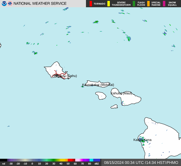
Current Radar Image
Sun Almanac for Honouliuli, Hawaii
Sunrise: 06:58 AM
Sunset: 7:59 PM
Civil Sunrise:06:35 AM
Civil Sunset: 8:23 PM
Nautical Sunrise: 06:07 AM
Nautical Sunset: 8:51 PM
Astro Sunrise: 05:38 AM
Astro Sunset: 9:19 PM
Hawaii's Current Temperatures
 Hawaii's Satellite Image
 Hawaii's Current Wind Direction
| National Summary |
of upper and lower values of current conditions amongst 6903 locations
in the contiguous United States |
|
High
Temp |
86° |
Phoenix, Arizona
and 1 other location
|
|
Low
Temp |
30° |
Pagosa Springs, Colorado
|
|
Wind
Speed |
40mph |
Wendover, Utah
|
|
Wind
Gust |
51mph |
Wendover, Utah
|
|
Wind
Chill |
21° |
Pagosa Springs, Colorado
|
|
High
Pressure |
30.41Hg |
Bar Harbor, Maine
and 1 other location
|
|
Low
Pressure |
29.39Hg |
Mountain Home AFB, Idaho
|
|
| # Locations Reporting Snow |
3 |
|
| # Locations Reporting Rain |
184 |
|
| # Locations Reporting Thunderstorms / Lightning |
20 |
|
| # Locations Reporting Fog |
8 |
|
| Average Temperature in the Contiguous USA |
59° |
|
Any use of the information on this page is at your own risk. This information should not be relied upon in life-threatening situations, potential financial loss situations or in lieu of any officially disseminated information. Visit the
National Weather Service for official information.