Holman, Washington Weather
No Watches or Warnings for Holman
Issued: 11:41 am PDT May 3, 2024 Latitude: 46.3264888 Longitude: -124.0548778 View on Google Maps
|
|
|
|
|
|
|
|
|
|
 |
 |
 |
 |
 |
 |
 |
 |
| High: °F |
Low: °F |
High: °F |
High: °F |
High: °F |
High: °F |
High: °F |
High: °F |
| Low: °F |
Low: °F |
Low: °F |
Low: °F |
Low: °F |
|
| Rain |
Rain |
Rain |
Rain |
Rain |
Rain |
Partly Sunny |
Sunny |
Current Conditions at
ASTORIA - (KAST)
59°
Mostly Cloudy
as of 10:55 AM PDST
Rel. Humidity: 62%
Dew Point: 46°F
Visibility: 10 Miles
Pressure: 29.90 in.
Flight Rule: VFR
Cloud Level(s): Broken at 12000ft
Current Conditions at
HOQUIAM - (KHQM)
57°
Clear
as of 10:53 AM PDST
Rel. Humidity: 67%
Dew Point: 46°F
Visibility: 10 Miles
Pressure: 29.90 in.
Flight Rule: VFR
Cloud Level(s): Clear
Current Conditions at
CHEHALIS-CENTRALIA - (KCLS)
59°
Clear
as of 11:35 AM PDST
Rel. Humidity: 62%
Dew Point: 46°F
Visibility: 10 Miles
Pressure: 29.91 in.
Flight Rule: VFR
Wind Data
5 MPH
210° Southwest
Cloud Level(s): Clear
Current Conditions at
SHELTON - (KSHN)
57°
Clear
as of 10:53 AM PDST
Rel. Humidity: 62%
Dew Point: 45°F
Visibility: 10 Miles
Pressure: 29.91 in.
Flight Rule: VFR
Wind Data
3 MPH
140° Southeast
Cloud Level(s): Clear
|
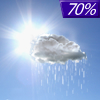
Today... Rain, mainly after 1pm. High near 57. Southeast wind 10 to 13 mph, with gusts as high as 20 mph. Chance of precipitation is 100%. New precipitation amounts between a quarter and half of an inch possible. |
|
|
Tonight... Rain. Low around 45. South wind 8 to 11 mph becoming northwest after midnight. Chance of precipitation is 100%. New precipitation amounts between a half and three quarters of an inch possible. |
|
|
Saturday... Rain. High near 54. Northwest wind around 10 mph. Chance of precipitation is 80%. New precipitation amounts between a quarter and half of an inch possible. |
|
 |
Saturday Night... A 40 percent chance of rain. Mostly cloudy, with a low around 46. West wind around 11 mph. |
|
|
Sunday... A 40 percent chance of rain. Mostly cloudy, with a high near 56. West southwest wind 11 to 14 mph, with gusts as high as 18 mph. |
|
 |
Sunday Night... Rain, mainly after 11pm. Low around 47. Breezy. Chance of precipitation is 90%. |
|
|
Monday... Rain. High near 55. Breezy. Chance of precipitation is 90%. |
|
 |
Monday Night... A chance of showers and thunderstorms, then rain likely after 11pm. Mostly cloudy, with a low around 45. Breezy. |
|
|
Tuesday... Rain likely, mainly before 11am. Mostly sunny, with a high near 55. Breezy. |
|
 |
Tuesday Night... A chance of showers, mainly after 11pm. Mostly cloudy, with a low around 46. Breezy. |
|
|
Wednesday... A chance of showers. Partly sunny, with a high near 56. |
|
 |
Wednesday Night... Mostly clear, with a low around 46. Breezy. |
|
|
Thursday... Sunny, with a high near 61. Breezy. |
|
Current Radar Image
Sun Almanac for Holman, Washington
Sunrise: 05:58 AM
Sunset: 8:28 PM
Civil Sunrise:05:24 AM
Civil Sunset: 9:02 PM
Nautical Sunrise: 04:42 AM
Nautical Sunset: 9:44 PM
Astro Sunrise: 03:53 AM
Astro Sunset: 10:33 PM
Washington's Current Temperatures
 Washington's Satellite Image
 Washington's Current Wind Direction
| National Summary |
of upper and lower values of current conditions amongst 7153 locations
in the contiguous United States |
|
High
Temp |
93° |
Laredo AFB, Texas
|
|
Low
Temp |
30° |
Yellowstone, Wyoming
|
|
Wind
Speed |
37mph |
Salida Mountain, Colorado
|
|
Wind
Gust |
60mph |
Cottonwood Pass, Colorado
|
|
Wind
Chill |
16° |
Berthoud Pass, Colorado
|
|
Heat
Index |
105° |
Ft Rucker/Hanche, Alabama
|
|
High
Pressure |
30.24Hg |
Provincetown, Massachusetts
and 2 other locations
|
|
Low
Pressure |
29.72Hg |
Flag Island, Minnesota
|
|
| # Locations Reporting Snow |
10 |
|
| # Locations Reporting Rain |
57 |
|
| # Locations Reporting Thunderstorms / Lightning |
7 |
|
| # Locations Reporting Fog |
1 |
|
| Average Temperature in the Contiguous USA |
69° |
|
Any use of the information on this page is at your own risk. This information should not be relied upon in life-threatening situations, potential financial loss situations or in lieu of any officially disseminated information. Visit the
National Weather Service for official information.


