Hancock, Minnesota Weather
No Watches or Warnings for Hancock
Issued: 11:48 pm CDT May 2, 2024 Latitude: 45.4974612 Longitude: -95.7967138 View on Google Maps
|
|
|
|
|
|
|
|
|
|
 |
 |
 |
 |
 |
 |
 |
|
| Low: °F |
High: °F |
High: °F |
High: °F |
High: °F |
High: °F |
High: °F |
High: °F |
| Low: °F |
Low: °F |
Low: °F |
Low: °F |
Low: °F |
Low: °F |
|
| Mostly Clear |
Rain |
Mostly Sunny |
Sunny |
Rain |
Rain |
Partly Sunny |
Partly Sunny |
Current Conditions at
MORRIS MUNICIPAL - (KMOX)
Clear
as of 2:15 AM CDST
Rel. Humidity: 86%
Dew Point: 39°F
Visibility: 10 Miles
Pressure: 29.80 in.
Flight Rule: VFR
Wind Data
13 MPH
210° Southwest
Cloud Level(s): Clear
Current Conditions at
BENSON MUNICIPAL - (KBBB)
Clear
as of 2:16 AM CDST
Rel. Humidity: 75%
Dew Point: 36°F
Visibility: 10 Miles
Pressure: 29.84 in.
Flight Rule: VFR
Cloud Level(s): Clear
Current Conditions at
APPLETON - (KAQP)
46°
Clear
as of 2:13 AM CDST
Rel. Humidity: 70%
Dew Point: 37°F
Visibility: 10 Miles
Pressure: 29.83 in.
Flight Rule: VFR
Cloud Level(s): Clear
Current Conditions at
GLENWOOD - (KGHW)
Clear
as of 2:15 AM CDST
Rel. Humidity: 86%
Dew Point: 37°F
Visibility: 10 Miles
Pressure: 29.82 in.
Flight Rule: VFR
Wind Data
12 MPH
190° South
Cloud Level(s): Clear
|
Overnight... Mostly clear, with a low around 39. South southwest wind around 10 mph. |
|
|
Friday... A 20 percent chance of showers after 4pm. Increasing clouds, with a high near 63. West southwest wind 10 to 15 mph. |
|
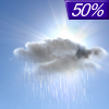 |
Friday Night... A 50 percent chance of showers, mainly after 7pm. Cloudy, then gradually becoming partly cloudy, with a low around 41. West wind 5 to 15 mph. New precipitation amounts between a tenth and quarter of an inch possible. |
|
|
Saturday... Mostly sunny, with a high near 60. West northwest wind 5 to 15 mph. |
|
|
Saturday Night... Mostly clear, with a low around 39. Northwest wind 5 to 10 mph becoming southeast after midnight. |
|
|
Sunday... Sunny, with a high near 68. South southeast wind 5 to 15 mph. |
|
 |
Sunday Night... A 20 percent chance of showers after 1am. Partly cloudy, with a low around 50. Southeast wind around 15 mph. |
|
|
Monday... A 50 percent chance of showers, mainly after 1pm. Mostly cloudy, with a high near 72. Breezy, with a southeast wind 15 to 25 mph, with gusts as high as 40 mph. |
|
 |
Monday Night... Showers likely and possibly a thunderstorm before 1am, then a chance of showers and thunderstorms after 1am. Mostly cloudy, with a low around 52. Breezy, with a southeast wind 20 to 25 mph, with gusts as high as 40 mph. Chance of precipitation is 70%. |
|
|
Tuesday... A 30 percent chance of showers. Mostly sunny, with a high near 68. Breezy, with a south southwest wind 15 to 20 mph, with gusts as high as 30 mph. |
|
|
Tuesday Night... A 20 percent chance of showers. Partly cloudy, with a low around 47. Southwest wind around 15 mph, with gusts as high as 25 mph. |
|
|
Wednesday... A 30 percent chance of showers. Partly sunny, with a high near 63. West wind 10 to 15 mph. |
|
 |
Wednesday Night... A 20 percent chance of showers. Mostly cloudy, with a low around 44. North wind 10 to 15 mph. |
|
|
Thursday... A 30 percent chance of showers. Partly sunny, with a high near 59. North northwest wind around 15 mph. |
|
Current Radar Image
Sun Almanac for Hancock, Minnesota
Sunrise: 06:07 AM
Sunset: 8:33 PM
Civil Sunrise:05:34 AM
Civil Sunset: 9:06 PM
Nautical Sunrise: 04:53 AM
Nautical Sunset: 9:47 PM
Astro Sunrise: 04:06 AM
Astro Sunset: 10:34 PM
Minnesota's Current Temperatures
 Minnesota's Satellite Image
 Minnesota's Current Wind Direction
| National Summary |
of upper and lower values of current conditions amongst 6985 locations
in the contiguous United States |
|
High
Temp |
82° |
Corpus Christi NAS, Texas
|
|
Low
Temp |
30° |
Dubois Municipal, Wyoming
and 14 other locations
|
|
Wind
Speed |
25mph |
Berthoud Pass, Colorado
|
|
Wind
Gust |
33mph |
Berthoud Pass, Colorado
|
|
Wind
Chill |
16° |
Charlie, Montana
|
|
High
Pressure |
30.26Hg |
Salida Mountain, Colorado
|
|
Low
Pressure |
29.56Hg |
Roseau, Minnesota
|
|
| # Locations Reporting Snow |
13 |
|
| # Locations Reporting Rain |
131 |
|
| # Locations Reporting Thunderstorms / Lightning |
9 |
|
| # Locations Reporting Fog |
44 |
|
| Average Temperature in the Contiguous USA |
57° |
|
Any use of the information on this page is at your own risk. This information should not be relied upon in life-threatening situations, potential financial loss situations or in lieu of any officially disseminated information. Visit the
National Weather Service for official information.


