Greenlodge, Massachusetts Weather
No Watches or Warnings for Greenlodge
Issued: 9:45 pm EDT Apr 28, 2024 Latitude: 42.2223209 Longitude: -71.159219 View on Google Maps
|
|
|
|
|
|
|
|
|
|
 |
 |
 |
 |
|
 |
 |
|
| Low: °F |
High: °F |
High: °F |
High: °F |
High: °F |
High: °F |
High: °F |
High: °F |
| Low: °F |
Low: °F |
Low: °F |
Low: °F |
Low: °F |
Low: °F |
|
| Rain |
Mostly Sunny |
Mostly Cloudy |
Rain |
Mostly Sunny |
Partly Sunny |
Rain |
Rain |
Current Conditions at
NORWOOD - (KOWD)
63°
Cloudy
as of 9:53 PM EDST
Rel. Humidity: 72%
Dew Point: 54°F
Visibility: 10 Miles
Pressure: 29.97 in.
Flight Rule: VFR
Wind Data
6 MPH
240° Southwest
Cloud Level(s): Few at 9000ft, Solid Overcast at 11000ft
Current Conditions at
BOSTON - (KBOS)
63°
Cloudy
as of 9:54 PM EDST
Rel. Humidity: 67%
Dew Point: 52°F
Visibility: 10 Miles
Pressure: 29.96 in.
Flight Rule: VFR
Cloud Level(s): Solid Overcast at 11000ft
Current Conditions at
BEDFORD - (KBED)
64°
Cloudy
as of 9:51 PM EDST
Rel. Humidity: 72%
Dew Point: 55°F
Visibility: 10 Miles
Pressure: 29.95 in.
Flight Rule: VFR
Cloud Level(s): Solid Overcast at 12000ft
|
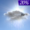
Tonight... A slight chance of showers before 11pm. Cloudy, then gradually becoming partly cloudy, with a low around 57. West wind around 6 mph. Chance of precipitation is 20%. |
|
|
Monday... Mostly sunny, with a high near 72. North wind 7 to 10 mph, with gusts as high as 22 mph. |
|
 |
Monday Night... Mostly cloudy, with a low around 49. South wind around 6 mph becoming calm. |
|
|
Tuesday... Mostly cloudy, with a high near 58. East wind 7 to 9 mph. |
|
 |
Tuesday Night... A chance of showers, mainly after 11pm. Mostly cloudy, with a low around 45. Southeast wind around 7 mph. Chance of precipitation is 50%. |
|
|
Wednesday... Showers likely, mainly before noon. Mostly cloudy, with a high near 55. Northeast wind 7 to 10 mph. Chance of precipitation is 60%. |
|
|
Wednesday Night... Mostly cloudy, with a low around 44. East wind 5 to 8 mph. |
|
|
Thursday... Mostly sunny, with a high near 69. Northwest wind 6 to 10 mph becoming southeast in the morning. |
|
|
Thursday Night... Mostly cloudy, with a low around 48. Southwest wind around 11 mph. |
|
|
Friday... Partly sunny, with a high near 72. Southwest wind 9 to 13 mph. |
|
 |
Friday Night... A chance of showers. Mostly cloudy, with a low around 50. South wind 10 to 13 mph. Chance of precipitation is 30%. |
|
|
Saturday... A chance of showers. Mostly cloudy, with a high near 64. Southeast wind 10 to 13 mph. Chance of precipitation is 30%. |
|
 |
Saturday Night... A chance of showers. Mostly cloudy, with a low around 49. Southeast wind 9 to 11 mph becoming east after midnight. Chance of precipitation is 40%. |
|
|
Sunday... A chance of showers. Mostly cloudy, with a high near 63. Northeast wind 9 to 13 mph becoming southeast in the afternoon. Chance of precipitation is 30%. |
|
Current Radar Image
Sun Almanac for Greenlodge, Massachusetts
Sunrise: 05:43 AM
Sunset: 7:41 PM
Civil Sunrise:05:13 AM
Civil Sunset: 8:11 PM
Nautical Sunrise: 04:36 AM
Nautical Sunset: 8:48 PM
Astro Sunrise: 03:55 AM
Astro Sunset: 9:29 PM
Massachusetts' Current Temperatures
 Massachusetts' Satellite Image
 Massachusetts' Current Wind Direction
| National Summary |
of upper and lower values of current conditions amongst 6117 locations
in the contiguous United States |
|
High
Temp |
90° |
Blythe, California
and 3 other locations
|
|
Low
Temp |
1° |
Imperial Beach NAS, California
|
|
Wind
Speed |
38mph |
Duluth Sky Harbor, Minnesota
|
|
Wind
Gust |
45mph |
Duluth Sky Harbor, Minnesota
and 1 other location
|
|
Wind
Chill |
0° |
Berthoud Pass, Colorado
|
|
Heat
Index |
97° |
Mcallen, Texas
|
|
High
Pressure |
30.26Hg |
Myrtle Beach AFB, South Carolina
and 5 other locations
|
|
Low
Pressure |
29.65Hg |
Maurice, Iowa
|
|
| # Locations Reporting Snow |
6 |
|
| # Locations Reporting Rain |
202 |
|
| # Locations Reporting Thunderstorms / Lightning |
8 |
|
| # Locations Reporting Fog |
5 |
|
| Average Temperature in the Contiguous USA |
63° |
|
Any use of the information on this page is at your own risk. This information should not be relied upon in life-threatening situations, potential financial loss situations or in lieu of any officially disseminated information. Visit the
National Weather Service for official information.


