
| your sport, your way | ||||
 |  |  |  |  |
|

| This Afternoon | Tonight | Monday | Tuesday | Wednesday | Thursday | Friday | Saturday |
 |
 |
 |
 |
 |
 |
|
|
| High: 43°F | Low: 33°F | High: 40°F | High: 60°F | High: 62°F | High: 59°F | High: 49°F | High: 51°F |
| Low: 33°F | Low: 41°F | Low: 38°F | Low: 37°F | Low: 35°F | |||
| Cloudy | Rain, Snow, & Sleet | Rain & Snow | Rain | Rain | Rain | Rain | Rain |


|
This Afternoon... Cloudy, with a high near 43. East wind around 10 mph, with gusts as high as 15 mph. |
|
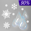
Tonight... Rain before 4am, then rain, possibly mixed with sleet between 4am and 5am, then rain, possibly mixed with snow and sleet after 5am. Low around 33. Breezy, with an east wind 10 to 15 mph, with gusts as high as 30 mph. Chance of precipitation is 90%. New snow and sleet accumulation of less than a half inch possible. |
|
Monday... Rain and snow before 11am, then rain between 11am and 5pm, then rain likely, possibly mixed with snow after 5pm. Patchy fog before 3pm. High near 40. East wind 5 to 10 mph, with gusts as high as 25 mph. Chance of precipitation is 80%. New snow accumulation of less than a half inch possible. |
 |
Monday Night... A chance of rain and snow, mainly before 8pm. Patchy fog after 9pm. Otherwise, cloudy, with a low around 33. Northeast wind around 5 mph becoming west after midnight. Chance of precipitation is 30%. |
|
Tuesday... A 20 percent chance of rain after 1pm. Patchy fog before 9am. Otherwise, partly sunny, with a high near 60. West wind 5 to 10 mph becoming south in the afternoon. |
 |
Tuesday Night... Rain, mainly before 1am. Low around 41. Breezy, with a southeast wind 10 to 15 mph becoming southwest after midnight. Winds could gust as high as 20 mph. Chance of precipitation is 90%. New precipitation amounts between three quarters and one inch possible. |
|
Wednesday... A slight chance of rain. Mostly sunny, with a high near 62. Windy, with a west wind 15 to 25 mph, with gusts as high as 40 mph. |
 |
Wednesday Night... A slight chance of rain before 1am. Mostly cloudy, with a low around 38. Breezy, with a west wind 5 to 15 mph becoming northeast after midnight. Winds could gust as high as 25 mph. |
|
Thursday... A chance of rain, mainly after 1pm. Partly sunny, with a high near 59. North wind 5 to 10 mph, with gusts as high as 15 mph. |
 |
Thursday Night... A chance of rain. Mostly cloudy, with a low around 37. North wind around 10 mph, with gusts as high as 15 mph. |
|
Friday... A chance of rain. Mostly cloudy, with a high near 49. Breezy, with a north wind around 15 mph, with gusts as high as 25 mph. |
|
Friday Night... A chance of rain. Mostly cloudy, with a low around 35. Breezy, with a north wind 10 to 15 mph, with gusts as high as 25 mph. |
|
Saturday... A chance of rain. Mostly cloudy, with a high near 51. Breezy, with a northwest wind around 15 mph, with gusts as high as 25 mph. |


