Gemmell, Minnesota Weather
Issued: 1:58 am CDT Apr 29, 2024 Latitude: 47.9732889 Longitude: -94.1238237 View on Google Maps
|
|
|
|
|
|
|
|
|
|
 |
 |
 |
 |
 |
|
|
 |
| Low: °F |
High: °F |
High: °F |
High: °F |
High: °F |
High: °F |
High: °F |
High: °F |
| Low: °F |
Low: °F |
Low: °F |
Low: °F |
Low: °F |
Low: °F |
|
| Rain & Snow |
Rain, Snow, & Sleet |
Partly Sunny |
Rain |
Rain |
Rain |
Rain |
Mostly Sunny |
Current Conditions at
WASKISH - (KVWU)
Cloudy
Light Drizzle
as of 1:55 AM CDST
Rel. Humidity: 93%
Dew Point: 36°F
Visibility: 10 Miles
Pressure: 29.87 in.
Flight Rule: MVFR
Wind Data
16 MPH
Gust: 23 MPH
070° East
Cloud Level(s): Broken at 1200ft, Solid Overcast at 7500ft
Current Conditions at
BIGFORK - (KFOZ)
Cloudy
as of 2:13 AM CDST
Rel. Humidity: 86%
Dew Point: 34°F
Visibility: 10 Miles
Pressure: 29.89 in.
Flight Rule: MVFR
Wind Data
13 MPH
Gust: 22 MPH
070° East
Cloud Level(s): Solid Overcast at 1500ft
Current Conditions at
BEMIDJI - (KBJI)
Cloudy
Light Rain
as of 2:15 AM CDST
Rel. Humidity: 100%
Dew Point: 36°F
Visibility: 10 Miles
Pressure: 29.87 in.
Flight Rule: MVFR
Wind Data
10 MPH
Gust: 18 MPH
130° Southeast
Cloud Level(s): Solid Overcast at 1000ft
Current Conditions at
INTERNATIONAL FALLS - (KINL)
Cloudy
Light Rain
as of 1:54 AM CDST
Rel. Humidity: 74%
Dew Point: 28°F
Visibility: 10 Miles
Pressure: 29.95 in.
Flight Rule: VFR
Cloud Level(s): Broken at 5500ft, Solid Overcast at 6500ft
|
Overnight... Rain showers before 4am, then rain and snow showers. Low around 33. East wind around 10 mph, with gusts as high as 25 mph. Chance of precipitation is 100%. Total nighttime snow accumulation of less than a half inch possible. |
|
|
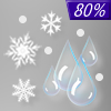
Monday... Rain and snow showers before noon, then a chance of rain showers between noon and 5pm, then a chance of rain showers and sleet after 5pm. High near 42. East wind 5 to 10 mph, with gusts as high as 20 mph. Chance of precipitation is 80%. New snow and sleet accumulation of less than a half inch possible. |
|
 |
Monday Night... A 20 percent chance of showers before 8pm. Cloudy, with a low around 33. North wind around 5 mph becoming calm in the evening. |
|
|
Tuesday... A 20 percent chance of showers after 1pm. Partly sunny, with a high near 60. Northwest wind 5 to 10 mph becoming southeast in the afternoon. |
|
 |
Tuesday Night... Showers, mainly before 1am. Low around 41. East wind 5 to 10 mph becoming southwest after midnight. Chance of precipitation is 90%. New precipitation amounts between a half and three quarters of an inch possible. |
|
|
Wednesday... A 20 percent chance of showers before 1pm. Mostly sunny, with a high near 62. Breezy, with a west wind 10 to 20 mph, with gusts as high as 30 mph. |
|
 |
Wednesday Night... Partly cloudy, with a low around 40. Breezy, with a west wind 5 to 15 mph becoming southeast after midnight. Winds could gust as high as 20 mph. |
|
|
Thursday... A chance of showers, mainly after 1pm. Mostly cloudy, with a high near 59. Breezy, with an east wind 10 to 15 mph, with gusts as high as 20 mph. |
|
 |
Thursday Night... A chance of showers. Mostly cloudy, with a low around 41. Breezy, with a northeast wind 10 to 15 mph, with gusts as high as 20 mph. |
|
|
Friday... A chance of showers. Mostly cloudy, with a high near 52. Breezy, with a north wind 10 to 15 mph becoming west in the afternoon. Winds could gust as high as 25 mph. |
|
|
Friday Night... A chance of showers. Mostly cloudy, with a low around 37. Breezy, with a west wind around 15 mph, with gusts as high as 25 mph. |
|
|
Saturday... A chance of showers. Mostly cloudy, with a high near 52. Breezy, with a west wind around 15 mph, with gusts as high as 25 mph. |
|
|
Saturday Night... A chance of showers. Mostly cloudy, with a low around 36. Breezy, with a west wind 10 to 15 mph, with gusts as high as 25 mph. |
|
|
Sunday... Mostly sunny, with a high near 60. Breezy, with a west wind 10 to 15 mph, with gusts as high as 20 mph. |
|
Current Radar Image
Sun Almanac for Gemmell, Minnesota
Sunrise: 06:00 AM
Sunset: 8:27 PM
Civil Sunrise:05:26 AM
Civil Sunset: 9:02 PM
Nautical Sunrise: 04:42 AM
Nautical Sunset: 9:45 PM
Astro Sunrise: 03:52 AM
Astro Sunset: 10:35 PM
Minnesota's Current Temperatures
 Minnesota's Satellite Image
 Minnesota's Current Wind Direction
| National Summary |
of upper and lower values of current conditions amongst 6863 locations
in the contiguous United States |
|
High
Temp |
81° |
Kingsville NAS, Texas
and 4 other locations
|
|
Low
Temp |
19° |
Berthoud Pass, Colorado
|
|
Wind
Speed |
36mph |
Duluth Sky Harbor, Minnesota
|
|
Wind
Gust |
46mph |
Duluth Sky Harbor, Minnesota
|
|
Wind
Chill |
0° |
Berthoud Pass, Colorado
|
|
High
Pressure |
30.25Hg |
Pagosa Springs, Colorado
and 1 other location
|
|
Low
Pressure |
29.65Hg |
Windom, Minnesota
|
|
| # Locations Reporting Snow |
7 |
|
| # Locations Reporting Rain |
130 |
|
| # Locations Reporting Thunderstorms / Lightning |
11 |
|
| # Locations Reporting Fog |
33 |
|
| Average Temperature in the Contiguous USA |
56° |
|
Any use of the information on this page is at your own risk. This information should not be relied upon in life-threatening situations, potential financial loss situations or in lieu of any officially disseminated information. Visit the
National Weather Service for official information.


