Fairmont, Oklahoma Weather
|
|
|
|
|
|
|
|
 |
 |
 |
|
|
|
 |
 |
| High: °F |
Low: °F |
High: °F |
High: °F |
High: °F |
High: °F |
High: °F |
High: °F |
| Low: °F |
Low: °F |
Low: °F |
Low: °F |
Low: °F |
|
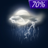
| Thunderstorms |
Thunderstorms |
Sunny |
Sunny |
Sunny |
Sunny |
Mostly Sunny |
Thunderstorms |
Current Conditions at
ENID - (KWDG)
61°
Cloudy
as of 3:55 AM CDST
Rel. Humidity: 100%
Dew Point: 61°F
Visibility: 10 Miles
Pressure: 29.78 in.
Flight Rule: LIFR
Wind Data
12 MPH
140° Southeast
Cloud Level(s): Solid Overcast at 400ft
Current Conditions at
STILLWATER - (KSWO)
63°
Cloudy
as of 3:53 AM CDST
Rel. Humidity: 93%
Dew Point: 61°F
Visibility: 10 Miles
Pressure: 29.81 in.
Flight Rule: IFR
Wind Data
12 MPH
130° Southeast
Cloud Level(s): Solid Overcast at 500ft
Current Conditions at
GUTHRIE - (KGOK)
63°
Cloudy
as of 3:53 AM CDST
Rel. Humidity: 93%
Dew Point: 61°F
Visibility: 10 Miles
Pressure: 29.79 in.
Flight Rule: IFR
Wind Data
7 MPH
130° Southeast
Cloud Level(s): Solid Overcast at 600ft
|
Today... Showers and thunderstorms likely, mainly after 4pm. Some of the storms could be severe. Mostly cloudy, with a high near 80. South wind 8 to 13 mph increasing to 17 to 22 mph in the afternoon. Winds could gust as high as 33 mph. Chance of precipitation is 60%. New rainfall amounts of less than a tenth of an inch, except higher amounts possible in thunderstorms. |
|
|
Tonight... Showers and thunderstorms likely, mainly before 10pm. Some of the storms could be severe. Mostly cloudy, then gradually becoming mostly clear, with a low around 50. South wind 16 to 21 mph becoming west 7 to 12 mph after midnight. Winds could gust as high as 31 mph. Chance of precipitation is 70%. New rainfall amounts between a tenth and quarter of an inch, except higher amounts possible in thunderstorms. |
|
|
Tuesday... Sunny, with a high near 81. West wind 7 to 14 mph becoming south southwest in the afternoon. Winds could gust as high as 21 mph. |
|
 |
Tuesday Night... Clear, with a low around 56. South wind 13 to 21 mph, with gusts as high as 31 mph. |
|
|
Wednesday... Sunny, with a high near 78. North northwest wind 10 to 15 mph, with gusts as high as 23 mph. |
|
 |
Wednesday Night... Mostly clear, with a low around 49. |
|
|
Thursday... Sunny, with a high near 76. |
|
|
Thursday Night... Mostly clear, with a low around 48. |
|
|
Friday... Sunny, with a high near 76. |
|
 |
Friday Night... Partly cloudy, with a low around 51. |
|
|
Saturday... Mostly sunny, with a high near 75. |
|
 |
Saturday Night... A 20 percent chance of showers and thunderstorms. Partly cloudy, with a low around 52. |
|
|
Sunday... A 20 percent chance of showers and thunderstorms. Mostly sunny, with a high near 78. |
|
Current Radar Image
Sun Almanac for Fairmont, Oklahoma
Sunrise: 06:31 AM
Sunset: 8:23 PM
Civil Sunrise:06:03 AM
Civil Sunset: 8:51 PM
Nautical Sunrise: 05:29 AM
Nautical Sunset: 9:25 PM
Astro Sunrise: 04:53 AM
Astro Sunset: 10:02 PM
Oklahoma's Current Temperatures
 Oklahoma's Satellite Image
 Oklahoma's Current Wind Direction
| National Summary |
of upper and lower values of current conditions amongst 6311 locations
in the contiguous United States |
|
High
Temp |
84° |
Key West NAS, Florida
|
|
Low
Temp |
30° |
Kemmerer, Wyoming
and 6 other locations
|
|
Wind
Speed |
59mph |
Salida Mountain, Colorado
|
|
Wind
Gust |
78mph |
Salida Mountain, Colorado
|
|
Wind
Chill |
18° |
Kemmerer, Wyoming
and 1 other location
|
|
High
Pressure |
30.82Hg |
Ottawa, Ohio
|
|
Low
Pressure |
29.35Hg |
Guernsey, Wyoming
and 1 other location
|
|
| # Locations Reporting Snow |
19 |
|
| # Locations Reporting Rain |
110 |
|
| # Locations Reporting Thunderstorms / Lightning |
4 |
|
| # Locations Reporting Fog |
83 |
|
| Average Temperature in the Contiguous USA |
57° |
|
Any use of the information on this page is at your own risk. This information should not be relied upon in life-threatening situations, potential financial loss situations or in lieu of any officially disseminated information. Visit the
National Weather Service for official information.


