Devenscrest, Massachusetts Weather
No Watches or Warnings for Devenscrest
Issued: 6:08 pm EDT Apr 28, 2024 Latitude: 42.5500912 Longitude: -71.5661779 View on Google Maps
|
|
|
|
|
|
|
|
|
|
 |
 |
 |
 |
 |
|
 |
 |
| Low: °F |
High: °F |
High: °F |
High: °F |
High: °F |
High: °F |
High: °F |
High: °F |
| Low: °F |
Low: °F |
Low: °F |
Low: °F |
Low: °F |
Low: °F |
|
| Rain |
Mostly Sunny |
Mostly Cloudy |
Rain |
Partly Sunny |
Partly Sunny |
Rain |
Rain |
Current Conditions at
FITCHBURG - (KFIT)
72°
Mostly Clear
as of 6:52 PM EDST
Rel. Humidity: 49%
Dew Point: 52°F
Visibility: 10 Miles
Pressure: 29.98 in.
Flight Rule: VFR
Wind Data
7 MPH
Gust: 17 MPH
260° West
Cloud Level(s): Few at 10000ft
Current Conditions at
BEDFORD - (KBED)
66°
Clear
as of 6:51 PM EDST
Rel. Humidity: 59%
Dew Point: 52°F
Visibility: 10 Miles
Pressure: 29.97 in.
Flight Rule: VFR
Wind Data
9 MPH
230° Southwest
Cloud Level(s): Clear
Current Conditions at
NASHUA/BOIRE FIELD - (KASH)
70°
Mostly Cloudy
as of 6:56 PM EDST
Rel. Humidity: 56%
Dew Point: 54°F
Visibility: 10 Miles
Pressure: 29.96 in.
Flight Rule: VFR
Wind Data
5 MPH
150° Southeast
Cloud Level(s): Broken at 6500ft
Current Conditions at
WORCESTER - (KORH)
66°
Mostly Cloudy
as of 6:54 PM EDST
Rel. Humidity: 59%
Dew Point: 52°F
Visibility: 10 Miles
Pressure: 30.01 in.
Flight Rule: VFR
Wind Data
14 MPH
Gust: 21 MPH
240° Southwest
Cloud Level(s): Broken at 11000ft
|
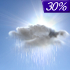
Tonight... A chance of showers, mainly before 9pm. Cloudy, then gradually becoming partly cloudy, with a low around 56. Light and variable wind. Chance of precipitation is 30%. New precipitation amounts of less than a tenth of an inch possible. |
|
|
Monday... Mostly sunny, with a high near 75. North wind 8 to 10 mph, with gusts as high as 21 mph. |
|
 |
Monday Night... Mostly cloudy, with a low around 47. North wind 3 to 6 mph. |
|
|
Tuesday... Mostly cloudy, with a high near 63. Southeast wind 6 to 8 mph. |
|
 |
Tuesday Night... Showers likely, mainly between 11pm and 2am. Mostly cloudy, with a low around 45. Southeast wind around 7 mph. Chance of precipitation is 70%. |
|
|
Wednesday... A chance of showers, mainly before 11am. Mostly cloudy, with a high near 57. East wind 6 to 8 mph. Chance of precipitation is 50%. |
|
|
Wednesday Night... Mostly cloudy, with a low around 44. East wind around 6 mph becoming southwest after midnight. |
|
|
Thursday... Partly sunny, with a high near 72. South wind 5 to 10 mph. |
|
|
Thursday Night... Mostly cloudy, with a low around 49. Southwest wind around 10 mph. |
|
|
Friday... Partly sunny, with a high near 75. Southwest wind 9 to 11 mph. |
|
 |
Friday Night... A chance of showers. Mostly cloudy, with a low around 50. Southeast wind 9 to 11 mph. Chance of precipitation is 30%. |
|
|
Saturday... A chance of showers. Mostly cloudy, with a high near 66. East wind around 11 mph, with gusts as high as 21 mph. Chance of precipitation is 40%. |
|
 |
Saturday Night... A chance of showers. Mostly cloudy, with a low around 48. Southeast wind around 10 mph becoming northeast after midnight. Chance of precipitation is 40%. |
|
|
Sunday... A chance of showers. Mostly cloudy, with a high near 65. Northeast wind 9 to 11 mph becoming south in the afternoon. Winds could gust as high as 21 mph. Chance of precipitation is 30%. |
|
Current Radar Image
Sun Almanac for Devenscrest, Massachusetts
Sunrise: 05:44 AM
Sunset: 7:43 PM
Civil Sunrise:05:14 AM
Civil Sunset: 8:14 PM
Nautical Sunrise: 04:36 AM
Nautical Sunset: 8:51 PM
Astro Sunrise: 03:55 AM
Astro Sunset: 9:32 PM
Massachusetts' Current Temperatures
 Massachusetts' Satellite Image
 Massachusetts' Current Wind Direction
| National Summary |
of upper and lower values of current conditions amongst 6896 locations
in the contiguous United States |
|
High
Temp |
97° |
Mcallen, Texas
|
|
Low
Temp |
1° |
Imperial Beach NAS, California
|
|
Wind
Speed |
37mph |
Duluth Sky Harbor, Minnesota
|
|
Wind
Gust |
46mph |
Duluth Sky Harbor, Minnesota
|
|
Wind
Chill |
4° |
Berthoud Pass, Colorado
|
|
Heat
Index |
105° |
Mcallen, Texas
|
|
High
Pressure |
30.27Hg |
Sylva, North Carolina
and 1 other location
|
|
Low
Pressure |
29.65Hg |
Sioux City, Iowa
|
|
| # Locations Reporting Snow |
4 |
|
| # Locations Reporting Rain |
207 |
|
| # Locations Reporting Thunderstorms / Lightning |
6 |
|
| # Locations Reporting Fog |
4 |
|
| Average Temperature in the Contiguous USA |
67° |
|
Any use of the information on this page is at your own risk. This information should not be relied upon in life-threatening situations, potential financial loss situations or in lieu of any officially disseminated information. Visit the
National Weather Service for official information.


