No Watches or Warnings for Denmark
Issued: 7:06 pm EDT Apr 28, 2024 Latitude: 43.9703491 Longitude: -70.8033966 View on Google Maps
|
|
|
|
|
|
|
|
|
|
 |
 |
 |
 |
 |
|
 |
|
| Low: °F |
High: °F |
High: °F |
High: °F |
High: °F |
High: °F |
High: °F |
High: °F |
| Low: °F |
Low: °F |
Low: °F |
Low: °F |
Low: °F |
Low: °F |
|
| Rain |
Sunny |
Rain |
Rain |
Partly Sunny |
Partly Sunny |
Rain |
Partly Sunny |
Current Conditions at
FRYEBURG - (KIZG)
52°
Cloudy
Light Rain Mist
as of 8:23 PM EDST
Rel. Humidity: 93%
Dew Point: 50°F
Visibility: 6 Miles
Pressure: 29.99 in.
Flight Rule: VFR
Cloud Level(s): Scattered at 600ft, Scattered at 5500ft, Solid Overcast at 10000ft
Current Conditions at
AUBURN/LWSTN - (KLEW)
48°
Cloudy
Light Rain
as of 7:56 PM EDST
Rel. Humidity: 93%
Dew Point: 46°F
Visibility: 10 Miles
Pressure: 29.99 in.
Flight Rule: IFR
Cloud Level(s): Solid Overcast at 600ft
Current Conditions at
MT WASHINGTON - (KMWN)
Cloudy
Light Shower(S) Rain Fog
as of 7:47 PM EDST
Rel. Humidity: 100%
Dew Point: 45°F
Visibility: 0 Miles
Flight Rule: LIFR
Wind Data
46 MPH
Gust: 54 MPH
290° West
Current Conditions at
PORTLAND - (KPWM)
48°
Mostly Cloudy
as of 7:51 PM EDST
Rel. Humidity: 93%
Dew Point: 46°F
Visibility: 10 Miles
Pressure: 30.00 in.
Flight Rule: VFR
Cloud Level(s): Broken at 10000ft, Broken at 12000ft
|
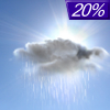
Tonight... Isolated showers before 11pm. Cloudy, then gradually becoming partly cloudy, with a low around 47. Calm wind becoming northwest around 5 mph after midnight. Chance of precipitation is 20%. |
|
|
Monday... Sunny, with a high near 68. North wind around 10 mph, with gusts as high as 20 mph. |
|
 |
Monday Night... Partly cloudy, with a low around 40. Northeast wind around 5 mph. |
|
|
Tuesday... A 30 percent chance of showers after 2pm. Mostly cloudy, with a high near 58. East wind around 5 mph. |
|
 |
Tuesday Night... Showers likely, mainly between 8pm and 2am. Patchy fog after 5am. Otherwise, mostly cloudy, with a low around 40. Southeast wind around 5 mph becoming calm in the evening. Chance of precipitation is 60%. |
|
|
Wednesday... A 30 percent chance of showers before 2pm. Patchy fog before 9am. Otherwise, mostly cloudy, with a high near 57. |
|
 |
Wednesday Night... Patchy fog after 4am. Otherwise, mostly cloudy, with a low around 41. |
|
|
Thursday... Partly sunny, with a high near 68. |
|
 |
Thursday Night... Mostly cloudy, with a low around 45. |
|
|
Friday... A 30 percent chance of showers after 2pm. Partly sunny, with a high near 68. |
|
 |
Friday Night... A 30 percent chance of showers. Mostly cloudy, with a low around 46. |
|
|
Saturday... A 40 percent chance of showers. Mostly cloudy, with a high near 60. |
|
|
Saturday Night... A 30 percent chance of showers. Mostly cloudy, with a low around 44. |
|
|
Sunday... A 30 percent chance of showers. Partly sunny, with a high near 61. |
|
Current Radar Image
Sun Almanac for Denmark, Maine
Sunrise: 05:38 AM
Sunset: 7:43 PM
Civil Sunrise:05:07 AM
Civil Sunset: 8:15 PM
Nautical Sunrise: 04:28 AM
Nautical Sunset: 8:53 PM
Astro Sunrise: 03:45 AM
Astro Sunset: 9:36 PM
Maine's Current Temperatures
 Maine's Satellite Image
 Maine's Current Wind Direction
| National Summary |
of upper and lower values of current conditions amongst 6117 locations
in the contiguous United States |
|
High
Temp |
95° |
Mcallen, Texas
|
|
Low
Temp |
1° |
Imperial Beach NAS, California
|
|
Wind
Speed |
39mph |
Duluth Sky Harbor, Minnesota
|
|
Wind
Gust |
47mph |
Duluth Sky Harbor, Minnesota
|
|
Wind
Chill |
4° |
Berthoud Pass, Colorado
|
|
Heat
Index |
101° |
Mcallen, Texas
|
|
High
Pressure |
30.27Hg |
Sylva, North Carolina
|
|
Low
Pressure |
29.64Hg |
Le Mars, Iowa
|
|
| # Locations Reporting Snow |
7 |
|
| # Locations Reporting Rain |
215 |
|
| # Locations Reporting Thunderstorms / Lightning |
11 |
|
| # Locations Reporting Fog |
3 |
|
| Average Temperature in the Contiguous USA |
65° |
|
Any use of the information on this page is at your own risk. This information should not be relied upon in life-threatening situations, potential financial loss situations or in lieu of any officially disseminated information. Visit the
National Weather Service for official information.


