Cleaveland, Arizona Weather
No Watches or Warnings for Cleaveland
Issued: 2:02 am MST Apr 26, 2024 Latitude: 33.7217196 Longitude: -109.2811902 View on Google Maps
|
|
|
|
|
|
|
|
|
|
 |
 |
 |
 |
|
|
|
|
| Low: °F |
High: °F |
High: °F |
High: °F |
High: °F |
High: °F |
High: °F |
High: °F |
| Low: °F |
Low: °F |
Low: °F |
Low: °F |
Low: °F |
Low: °F |
|
| Clear |
Increasing Clouds |
Rain & Snow |
Sunny |
Sunny |
Sunny |
Sunny |
Sunny |
Current Conditions at
SHOW LOW - (KSOW)
Clear
as of 3:15 AM MDST
Rel. Humidity: 60%
Dew Point: 28°F
Visibility: 10 Miles
Pressure: 29.97 in.
Flight Rule: VFR
Wind Data
10 MPH
180° South
Cloud Level(s): Clear
Current Conditions at
SAFFORD - (KSAD)
59°
Clear
as of 2:51 AM MDST
Rel. Humidity: 30%
Dew Point: 28°F
Visibility: 10 Miles
Pressure: 29.87 in.
Flight Rule: VFR
Wind Data
9 MPH
320° Northwest
Cloud Level(s): Clear
Current Conditions at
SILVER CITY - (KSVC)
43°
Clear
as of 2:55 AM MDST
Rel. Humidity: 52%
Dew Point: 27°F
Visibility: 10 Miles
Pressure: 29.95 in.
Flight Rule: VFR
Wind Data
6 MPH
330° Northwest
Cloud Level(s): Clear
|
Overnight... Clear, with a low around 30. West wind around 7 mph. |
|
|
Friday... Increasing clouds, with a high near 57. Breezy, with a southwest wind 6 to 16 mph increasing to 16 to 26 mph in the afternoon. Winds could gust as high as 37 mph. |
|
 |
Friday Night... A chance of rain showers before 10pm, then a chance of rain and snow showers between 10pm and 2am, then a chance of snow showers after 2am. Snow level 9000 feet lowering to 7800 feet after midnight . Mostly cloudy, with a low around 30. Breezy, with a west southwest wind 16 to 22 mph, with gusts as high as 32 mph. Chance of precipitation is 50%. New snow accumulation of less than a half inch possible. |
|
|
Saturday... A chance of snow showers before 3pm, then a slight chance of rain showers. Some thunder is also possible. Mostly cloudy, with a high near 46. Breezy, with a west southwest wind 14 to 22 mph, with gusts as high as 32 mph. Chance of precipitation is 40%. New snow accumulation of less than a half inch possible. |
|
 |
Saturday Night... Widespread frost after 4am. Otherwise, mostly clear, with a low around 28. West wind 8 to 16 mph, with gusts as high as 25 mph. |
|
|
Sunday... Widespread frost before 7am. Otherwise, sunny, with a high near 58. |
|
|
Sunday Night... Mostly clear, with a low around 31. |
|
|
Monday... Sunny, with a high near 66. |
|
|
Monday Night... Clear, with a low around 35. |
|
|
Tuesday... Sunny, with a high near 70. |
|
|
Tuesday Night... Mostly clear, with a low around 38. |
|
|
Wednesday... Sunny, with a high near 70. |
|
|
Wednesday Night... Clear, with a low around 38. |
|
|
Thursday... Sunny, with a high near 72. |
|
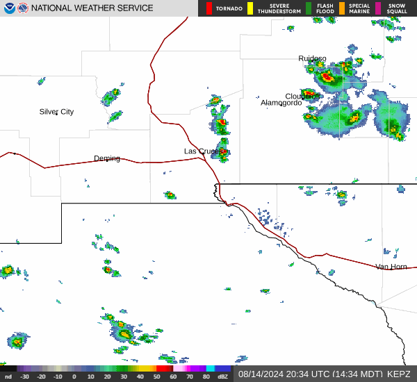
Current Radar Image
Sun Almanac for Cleaveland, Arizona
Sunrise: 06:33 AM
Sunset: 7:57 PM
Civil Sunrise:06:06 AM
Civil Sunset: 8:23 PM
Nautical Sunrise: 05:35 AM
Nautical Sunset: 8:55 PM
Astro Sunrise: 05:02 AM
Astro Sunset: 9:28 PM
Arizona's Current Temperatures
 Arizona's Satellite Image
 Arizona's Current Wind Direction
| National Summary |
of upper and lower values of current conditions amongst 6920 locations
in the contiguous United States |
|
High
Temp |
81° |
Corpus Christi NAS, Texas
|
|
Low
Temp |
1° |
Imperial Beach NAS, California
|
|
Wind
Speed |
36mph |
Berthoud Pass, Colorado
|
|
Wind
Gust |
52mph |
Berthoud Pass, Colorado
|
|
Wind
Chill |
1° |
Berthoud Pass, Colorado
|
|
High
Pressure |
30.47Hg |
Montpelier, Vermont
and 1 other location
|
|
Low
Pressure |
29.43Hg |
Thedford, Nebraska
and 1 other location
|
|
| # Locations Reporting Snow |
7 |
|
| # Locations Reporting Rain |
121 |
|
| # Locations Reporting Thunderstorms / Lightning |
10 |
|
| # Locations Reporting Fog |
12 |
|
| Average Temperature in the Contiguous USA |
51° |
|
Any use of the information on this page is at your own risk. This information should not be relied upon in life-threatening situations, potential financial loss situations or in lieu of any officially disseminated information. Visit the
National Weather Service for official information.