Burlington, California Weather
No Watches or Warnings for Burlington
Issued: 2:15 pm PDT Apr 25, 2024 Latitude: 40.3084738 Longitude: -123.9092056 View on Google Maps
|
|
|
|
|
|
|
|
|
|
 |
 |
 |
 |
 |
|
|
 |
| Low: °F |
High: °F |
High: °F |
High: °F |
High: °F |
High: °F |
High: °F |
High: °F |
| Low: °F |
Low: °F |
Low: °F |
Low: °F |
Low: °F |
Low: °F |
|
| Rain |
Rain |
Partly Sunny |
Mostly Sunny |
Sunny |
Sunny |
Mostly Sunny |
Rain |
Current Conditions at
ARCATA - (KACV)
50°
Cloudy
Light Rain Mist
as of 7:39 PM PDST
Rel. Humidity: 100%
Dew Point: 50°F
Visibility: 2 Miles
Pressure: 30.04 in.
Flight Rule: IFR
Wind Data
6 MPH
140° Southeast
Cloud Level(s): Few at 800ft, Scattered at 1300ft, Solid Overcast at 2000ft
Current Conditions at
REDDING - (KRDD)
63°
Cloudy
as of 6:53 PM PDST
Rel. Humidity: 77%
Dew Point: 55°F
Visibility: 10 Miles
Pressure: 29.93 in.
Flight Rule: VFR
Cloud Level(s): Solid Overcast at 7000ft
Current Conditions at
RED BLUFF - (KRBL)
63°
Cloudy
Light Rain
as of 6:54 PM PDST
Rel. Humidity: 72%
Dew Point: 54°F
Visibility: 10 Miles
Pressure: 29.95 in.
Flight Rule: VFR
Wind Data
5 MPH
040° Northeast
Cloud Level(s): Broken at 3400ft, Broken at 4100ft, Solid Overcast at 4900ft
Current Conditions at
CRESCENT CITY - (KCEC)
52°
Cloudy
Light Rain Mist
as of 7:20 PM PDST
Rel. Humidity: 100%
Dew Point: 52°F
Visibility: 3 Miles
Pressure: 30.03 in.
Flight Rule: LIFR
Wind Data
22 MPH
Gust: 28 MPH
170° South
Cloud Level(s): Broken at 400ft, Solid Overcast at 1400ft
|
Tonight... Rain likely. Cloudy, with a low around 47. Southeast wind around 6 mph becoming calm. Chance of precipitation is 70%. New precipitation amounts between a tenth and quarter of an inch possible. |
|
|
Friday... Showers likely, mainly before 11am. Cloudy, then gradually becoming mostly sunny, with a high near 58. Northwest wind 6 to 13 mph. Chance of precipitation is 60%. New precipitation amounts between a tenth and quarter of an inch possible. |
|
 |
Friday Night... Mostly cloudy, with a low around 42. North northwest wind 8 to 14 mph. |
|
|
Saturday... Partly sunny, with a high near 60. North northwest wind 7 to 9 mph. |
|
|
Saturday Night... Mostly cloudy, with a low around 45. Northwest wind 5 to 9 mph becoming calm in the evening. |
|
|
Sunday... Mostly sunny, with a high near 63. Light north northwest wind becoming northwest 8 to 13 mph in the morning. Winds could gust as high as 18 mph. |
|
 |
Sunday Night... Partly cloudy, with a low around 42. |
|
|
Monday... Sunny, with a high near 62. Breezy. |
|
 |
Monday Night... Mostly clear, with a low around 40. Breezy. |
|
|
Tuesday... Sunny, with a high near 68. |
|
|
Tuesday Night... Mostly clear, with a low around 42. |
|
|
Wednesday... Mostly sunny, with a high near 68. |
|
 |
Wednesday Night... A slight chance of rain. Mostly cloudy, with a low around 43. |
|
|
Thursday... A chance of rain. Partly sunny, with a high near 65. |
|
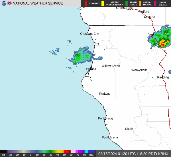
Current Radar Image
Sun Almanac for Burlington, California
Sunrise: 06:22 AM
Sunset: 8:05 PM
Civil Sunrise:05:53 AM
Civil Sunset: 8:34 PM
Nautical Sunrise: 05:17 AM
Nautical Sunset: 9:10 PM
Astro Sunrise: 04:40 AM
Astro Sunset: 9:47 PM
California's Current Temperatures
 California's Satellite Image
 California's Current Wind Direction
| National Summary |
of upper and lower values of current conditions amongst 6899 locations
in the contiguous United States |
|
High
Temp |
88° |
Pecos, Texas
|
|
Low
Temp |
23° |
Berthoud Pass, Colorado
|
|
Wind
Speed |
36mph |
Oscar Madis, Colorado
|
|
Wind
Gust |
47mph |
Salina, Kansas
|
|
Wind
Chill |
11° |
Dakota Hill, Colorado
|
|
High
Pressure |
30.40Hg |
Massena, New York
and 1 other location
|
|
Low
Pressure |
29.44Hg |
Goodland, Kansas
|
|
| # Locations Reporting Snow |
3 |
|
| # Locations Reporting Rain |
109 |
|
| # Locations Reporting Thunderstorms / Lightning |
7 |
|
| # Locations Reporting Fog |
1 |
|
| Average Temperature in the Contiguous USA |
57° |
|
Any use of the information on this page is at your own risk. This information should not be relied upon in life-threatening situations, potential financial loss situations or in lieu of any officially disseminated information. Visit the
National Weather Service for official information.