Bayonne, Nebraska Weather
Issued: 9:15 pm MDT Apr 25, 2024 Latitude: 42.7855546 Longitude: -101.9776601 View on Google Maps
|
|
|
|
|
|
|
|
|
|
 |
 |
 |
 |
 |
 |
|
|
| Low: °F |
High: °F |
High: °F |
High: °F |
High: °F |
High: °F |
High: °F |
High: °F |
| Low: °F |
Low: °F |
Low: °F |
Low: °F |
Low: °F |
Low: °F |
|
| Thunderstorms |
Thunderstorms |
Rain |
Rain |
Sunny |
Rain |
Rain |
Rain |
Current Conditions at
PINE RIDGE - (KIEN)
52°
Cloudy
Light Rain
as of 10:52 PM MDST
Rel. Humidity: 93%
Dew Point: 50°F
Visibility: 10 Miles
Pressure: 29.55 in.
Flight Rule: VFR
Wind Data
12 MPH
Gust: 22 MPH
110° East
Cloud Level(s): Solid Overcast at 9000ft
Current Conditions at
CHADRON - (KCDR)
54°
Clear
as of 10:53 PM MDST
Rel. Humidity: 87%
Dew Point: 50°F
Visibility: 10 Miles
Pressure: 29.55 in.
Flight Rule: VFR
Cloud Level(s): Clear
Current Conditions at
ALLIANCE - (KAIA)
52°
Mostly Cloudy
as of 10:53 PM MDST
Rel. Humidity: 100%
Dew Point: 52°F
Visibility: 10 Miles
Pressure: 29.57 in.
Flight Rule: VFR
Cloud Level(s): Scattered at 8500ft, Broken at 11000ft
Current Conditions at
VALENTINE - (KVTN)
54°
Cloudy
Mist
as of 11:52 PM CDST
Rel. Humidity: 93%
Dew Point: 52°F
Visibility: 5 Miles
Pressure: 29.60 in.
Flight Rule: IFR
Cloud Level(s): Solid Overcast at 700ft
|
Tonight... Showers and possibly a thunderstorm. Low around 49. East wind around 10 mph becoming north northwest after midnight. Chance of precipitation is 90%. |
|
|
Friday... Showers and possibly a thunderstorm. High near 57. Breezy, with a north northwest wind 10 to 15 mph increasing to 15 to 20 mph in the afternoon. Winds could gust as high as 30 mph. Chance of precipitation is 90%. |
|
 |
Friday Night... Showers likely and possibly a thunderstorm. Mostly cloudy, with a low around 42. Breezy, with a north northwest wind 15 to 20 mph, with gusts as high as 25 mph. Chance of precipitation is 70%. |
|
|
Saturday... Showers. High near 50. North northeast wind around 15 mph, with gusts as high as 25 mph. Chance of precipitation is 90%. |
|
 |
Saturday Night... Showers. Low around 34. North northeast wind around 15 mph, with gusts as high as 25 mph. Chance of precipitation is 90%. |
|
|
Sunday... Showers, mainly before noon. High near 46. Chance of precipitation is 80%. |
|
 |
Sunday Night... Partly cloudy, with a low around 31. |
|
|
Monday... Sunny, with a high near 68. |
|
 |
Monday Night... A slight chance of showers and thunderstorms before midnight. Partly cloudy, with a low around 41. |
|
|
Tuesday... A slight chance of showers after noon. Sunny, with a high near 67. |
|
 |
Tuesday Night... A slight chance of showers. Partly cloudy, with a low around 40. |
|
|
Wednesday... A slight chance of showers. Sunny, with a high near 69. |
|
|
Wednesday Night... A slight chance of showers. Partly cloudy, with a low around 45. |
|
|
Thursday... A slight chance of showers. Mostly sunny, with a high near 72. Breezy. |
|
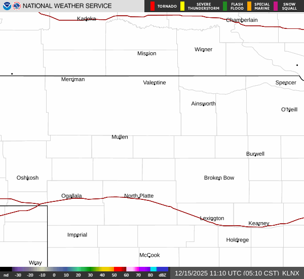
Current Radar Image
Sun Almanac for Bayonne, Nebraska
Sunrise: 05:48 AM
Sunset: 7:43 PM
Civil Sunrise:05:17 AM
Civil Sunset: 8:14 PM
Nautical Sunrise: 04:40 AM
Nautical Sunset: 8:51 PM
Astro Sunrise: 04:00 AM
Astro Sunset: 9:31 PM
Nebraska's Current Temperatures
 Nebraska's Satellite Image
 Nebraska's Current Wind Direction
| National Summary |
of upper and lower values of current conditions amongst 6111 locations
in the contiguous United States |
|
High
Temp |
88° |
Mesa Williams Gateway, Arizona
|
|
Low
Temp |
21° |
Saranac Lake, New York
and 1 other location
|
|
Wind
Speed |
35mph |
Sandburg, California
|
|
Wind
Gust |
55mph |
Sandburg, California
|
|
Wind
Chill |
7° |
Salida Mountain, Colorado
|
|
High
Pressure |
30.41Hg |
Franklin Cnty Airpor, Vermont
and 6 other locations
|
|
Low
Pressure |
29.49Hg |
Goodland, Kansas
|
|
| # Locations Reporting Snow |
2 |
|
| # Locations Reporting Rain |
102 |
|
| # Locations Reporting Thunderstorms / Lightning |
2 |
|
| # Locations Reporting Fog |
2 |
|
| Average Temperature in the Contiguous USA |
54° |
|
Any use of the information on this page is at your own risk. This information should not be relied upon in life-threatening situations, potential financial loss situations or in lieu of any officially disseminated information. Visit the
National Weather Service for official information.