Aspen Valley, California Weather
No Watches or Warnings for Aspen Valley
Issued: 2:57 pm PDT Apr 26, 2024 Latitude: 37.8274238 Longitude: -119.7712866 View on Google Maps
|
|
|
|
|
|
|
|
|
|
|
 |
 |
 |
 |
|
|
|
|
|
| High: °F |
Low: °F |
High: °F |
High: °F |
High: °F |
High: °F |
High: °F |
High: °F |
High: °F |
| Low: °F |
Low: °F |
Low: °F |
Low: °F |
Low: °F |
Low: °F |
|
| Thunderstorms |
Rain & Snow |
Increasing Clouds |
Sunny |
Sunny |
Sunny |
Sunny |
Sunny |
Sunny |
Current Conditions at
MERCED - (KMCE)
72°
Partly Cloudy
as of 2:53 PM PDST
Rel. Humidity: 35%
Dew Point: 43°F
Visibility: 10 Miles
Pressure: 29.92 in.
Flight Rule: VFR
Wind Data
12 MPH
Gust: 22 MPH
290° West
Cloud Level(s): Scattered at 6000ft
Current Conditions at
MADERA - (KMAE)
73°
Partly Cloudy
as of 2:53 PM PDST
Rel. Humidity: 33%
Dew Point: 43°F
Visibility: 10 Miles
Pressure: 29.93 in.
Flight Rule: VFR
Wind Data
17 MPH
Gust: 29 MPH
300° Northwest
Cloud Level(s): Scattered at 6500ft
Current Conditions at
FRESNO - (KFAT)
70°
Mostly Cloudy
as of 2:53 PM PDST
Rel. Humidity: 37%
Dew Point: 43°F
Visibility: 10 Miles
Pressure: 29.92 in.
Flight Rule: VFR
Wind Data
16 MPH
310° Northwest
Cloud Level(s): Broken at 6000ft, Broken at 7000ft, Broken at 8000ft
|
This Afternoon... Showers and possibly a thunderstorm. Snow level 6400 feet. High near 39. Wind chill values as low as 29. West northwest wind around 10 mph, with gusts as high as 15 mph. Chance of precipitation is 90%. New rainfall amounts of less than a tenth of an inch, except higher amounts possible in thunderstorms. |
|
|
Tonight... A chance of rain and snow showers before 11pm. Some thunder is also possible. Mostly cloudy during the early evening, then gradual clearing, with a low around 32. North northwest wind 5 to 15 mph becoming east northeast after midnight. Chance of precipitation is 40%. Little or no snow accumulation expected. |
|
|
Saturday... Increasing clouds, with a high near 48. Wind chill values as low as 30 early. East wind 5 to 10 mph becoming west in the afternoon. Winds could gust as high as 15 mph. |
|
 |
Saturday Night... Partly cloudy, with a low around 38. West northwest wind around 5 mph becoming east northeast after midnight. |
|
|
Sunday... Sunny, with a high near 53. East wind 5 to 10 mph becoming west in the afternoon. |
|
 |
Sunday Night... Mostly clear, with a low around 38. West wind 5 to 10 mph becoming east northeast after midnight. |
|
|
Monday... Sunny, with a high near 57. East northeast wind 5 to 10 mph becoming west southwest in the morning. Winds could gust as high as 15 mph. |
|
 |
Monday Night... Clear, with a low around 42. West northwest wind around 10 mph becoming northeast in the evening. Winds could gust as high as 15 mph. |
|
|
Tuesday... Sunny, with a high near 59. East wind 5 to 10 mph becoming west in the morning. Winds could gust as high as 15 mph. |
|
|
Tuesday Night... Clear, with a low around 43. West northwest wind around 10 mph becoming east northeast in the evening. Winds could gust as high as 15 mph. |
|
|
Wednesday... Sunny, with a high near 61. East northeast wind around 10 mph becoming west southwest in the morning. Winds could gust as high as 15 mph. |
|
|
Wednesday Night... Mostly clear, with a low around 43. West wind around 10 mph becoming east northeast in the evening. Winds could gust as high as 15 mph. |
|
|
Thursday... Sunny, with a high near 59. South southeast wind around 10 mph becoming west southwest in the morning. Winds could gust as high as 15 mph. |
|
|
Thursday Night... Mostly clear, with a low around 41. West wind around 10 mph becoming northeast in the evening. Winds could gust as high as 15 mph. |
|
|
Friday... Sunny, with a high near 59. Northeast wind around 10 mph becoming west southwest in the morning. Winds could gust as high as 15 mph. |
|
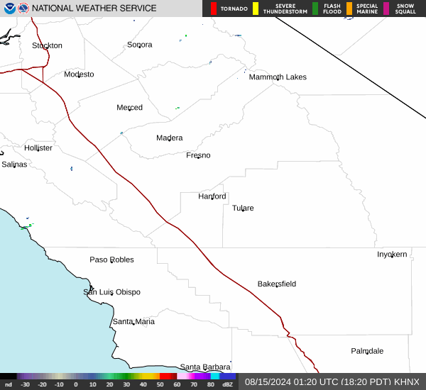
Current Radar Image
Sun Almanac for Aspen Valley, California
Sunrise: 06:08 AM
Sunset: 7:45 PM
Civil Sunrise:05:40 AM
Civil Sunset: 8:13 PM
Nautical Sunrise: 05:06 AM
Nautical Sunset: 8:47 PM
Astro Sunrise: 04:31 AM
Astro Sunset: 9:23 PM
California's Current Temperatures
 California's Satellite Image
 California's Current Wind Direction
| National Summary |
of upper and lower values of current conditions amongst 6876 locations
in the contiguous United States |
|
High
Temp |
97° |
Del Rio, Texas
|
|
Low
Temp |
27° |
Pagosa Springs, Colorado
and 1 other location
|
|
Wind
Speed |
39mph |
Omaha, Nebraska
|
|
Wind
Gust |
60mph |
29 Palms, California
|
|
Wind
Chill |
12° |
Pagosa Springs, Colorado
|
|
Heat
Index |
98° |
Mcallen, Texas
|
|
High
Pressure |
30.50Hg |
Block Isl, Rhode Island
and 2 other locations
|
|
Low
Pressure |
29.26Hg |
Omaha, Nebraska
|
|
| # Locations Reporting Snow |
3 |
|
| # Locations Reporting Rain |
204 |
|
| # Locations Reporting Thunderstorms / Lightning |
24 |
|
| Average Temperature in the Contiguous USA |
66° |
|
Any use of the information on this page is at your own risk. This information should not be relied upon in life-threatening situations, potential financial loss situations or in lieu of any officially disseminated information. Visit the
National Weather Service for official information.