
| your sport, your way | ||||
 |  |  |  |  |
|

| Overnight | Friday | Saturday | Sunday | Monday | Tuesday | Wednesday | Thursday |
 |
 |
 |
 |
 |
 |
 |
|
| Low: 50°F | High: 68°F | High: 76°F | High: 71°F | High: 66°F | High: 76°F | High: 74°F | High: 72°F |
| Low: 52°F | Low: 57°F | Low: 44°F | Low: 47°F | Low: 50°F | Low: 48°F | ||
| Thunderstorms | Thunderstorms | Thunderstorms | Thunderstorms | Mostly Sunny | Rain | Rain | Rain |


|
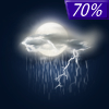
Overnight... Showers and thunderstorms, mainly after 3am. Low around 50. Windy, with a southeast wind around 21 mph, with gusts as high as 29 mph. Chance of precipitation is 90%. New rainfall amounts between a quarter and half of an inch possible. |
|
Friday... Showers and thunderstorms. High near 68. Windy, with a southeast wind 21 to 23 mph, with gusts as high as 37 mph. Chance of precipitation is 90%. New rainfall amounts between a quarter and half of an inch possible. |
 |
Friday Night... Showers and thunderstorms likely before 1am. Mostly cloudy, then gradually becoming mostly clear, with a low around 52. Windy, with a south southeast wind 15 to 21 mph, with gusts as high as 33 mph. Chance of precipitation is 70%. New rainfall amounts between a quarter and half of an inch possible. |
|
Saturday... A 50 percent chance of showers and thunderstorms, mainly after 1pm. Increasing clouds, with a high near 76. Southwest wind 11 to 14 mph, with gusts as high as 22 mph. New rainfall amounts between a tenth and quarter of an inch, except higher amounts possible in thunderstorms. |
 |
Saturday Night... Showers and thunderstorms. Low around 57. Breezy, with a south southeast wind 11 to 17 mph, with gusts as high as 25 mph. Chance of precipitation is 100%. New rainfall amounts between three quarters and one inch possible. |
|
Sunday... Showers and thunderstorms. High near 71. Windy. Chance of precipitation is 100%. New rainfall amounts between a quarter and half of an inch possible. |
 |
Sunday Night... Showers and thunderstorms likely, mainly before 1am. Mostly cloudy, with a low around 44. Breezy. Chance of precipitation is 60%. |
|
Monday... Mostly sunny, with a high near 66. |
 |
Monday Night... Mostly clear, with a low around 47. |
|
Tuesday... A 30 percent chance of showers after 1pm. Sunny, with a high near 76. Breezy. |
 |
Tuesday Night... A 40 percent chance of showers and thunderstorms. Partly cloudy, with a low around 50. |
|
Wednesday... A 40 percent chance of showers. Mostly sunny, with a high near 74. Breezy. |
 |
Wednesday Night... A 40 percent chance of showers. Partly cloudy, with a low around 48. |
|
Thursday... A 30 percent chance of showers. Mostly sunny, with a high near 72. |


