Shallowater, Texas Weather
Issued: 12:18 am CDT Apr 26, 2024 Latitude: 33.6889728 Longitude: -101.9982275 View on Google Maps
|
|
|
|
|
|
|
|
|
|
 |
 |
 |
|
|
|
 |
|
| Low: °F |
High: °F |
High: °F |
High: °F |
High: °F |
High: °F |
High: °F |
High: °F |
| Low: °F |
Low: °F |
Low: °F |
Low: °F |
Low: °F |
Low: °F |
|
| Thunderstorms |
Sunny |
Dust |
Sunny |
Sunny |
Sunny |
Thunderstorms |
Thunderstorms |
Current Conditions at
LUBBOCK - (KLBB)
72°
Mostly Cloudy
as of 11:53 PM CDST
Rel. Humidity: 53%
Dew Point: 54°F
Visibility: 10 Miles
Pressure: 29.70 in.
Flight Rule: VFR
Wind Data
17 MPH
Gust: 30 MPH
200° South
Cloud Level(s): Few at 6000ft, Scattered at 9000ft, Broken at 25000ft
Current Conditions at
PLAINVIEW - (KPVW)
68°
Partly Cloudy
as of 12:10 AM CDST
Rel. Humidity: 68%
Dew Point: 57°F
Visibility: 10 Miles
Pressure: 29.71 in.
Flight Rule: VFR
Wind Data
9 MPH
210° Southwest
Cloud Level(s): Scattered at 6000ft
Current Conditions at
CLOVIS - (KCVN)
63°
Clear
as of 10:56 PM MDST
Rel. Humidity: 25%
Dew Point: 27°F
Visibility: 10 Miles
Pressure: 29.75 in.
Flight Rule: VFR
Wind Data
17 MPH
Gust: 24 MPH
280° West
Cloud Level(s): Clear
Current Conditions at
GAINES COUNTY - (KGNC)
73°
Mostly Cloudy
as of 12:15 AM CDST
Rel. Humidity: 69%
Dew Point: 63°F
Visibility: 10 Miles
Pressure: 29.81 in.
Flight Rule: VFR
Wind Data
12 MPH
200° South
Cloud Level(s): Broken at 7500ft, Broken at 8500ft
|
Overnight... A 50 percent chance of showers and thunderstorms before 1am. Some of the storms could be severe. Mostly cloudy, then gradually becoming clear, with a low around 53. West southwest wind around 15 mph. New rainfall amounts of less than a tenth of an inch, except higher amounts possible in thunderstorms. |
|
|
Friday... Sunny, with a high near 81. Breezy, with a west wind 15 to 25 mph. |
|
 |
Friday Night... Clear, with a low around 52. Southwest wind 10 to 20 mph. |
|
|
Saturday... Patchy blowing dust after 1pm. Sunny, with a high near 80. Windy, with a southwest wind 10 to 20 mph increasing to 20 to 30 mph. Winds could gust as high as 45 mph. |
|
 |
Saturday Night... Partly cloudy, with a low around 49. Windy, with a west wind 20 to 30 mph decreasing to 10 to 20 mph after midnight. Winds could gust as high as 40 mph. |
|
|
Sunday... Sunny, with a high near 80. West wind 15 to 20 mph. |
|
 |
Sunday Night... Mostly clear, with a low around 49. West southwest wind 10 to 15 mph becoming south after midnight. |
|
|
Monday... Sunny, with a high near 84. West southwest wind 10 to 15 mph. |
|
|
Monday Night... Clear, with a low around 52. West southwest wind around 10 mph becoming south after midnight. |
|
|
Tuesday... Sunny, with a high near 89. |
|
|
Tuesday Night... Partly cloudy, with a low around 60. |
|
|
Wednesday... A chance of showers and thunderstorms. Partly sunny, with a high near 83. |
|
 |
Wednesday Night... A chance of showers and thunderstorms. Mostly cloudy, with a low around 55. |
|
|
Thursday... A chance of showers and thunderstorms. Partly sunny, with a high near 77. |
|
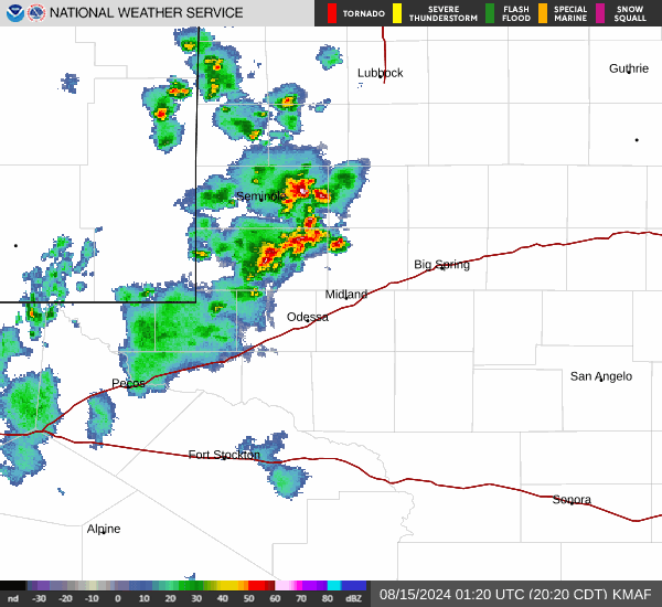
Current Radar Image
Sun Almanac for Shallowater, Texas
Sunrise: 07:04 AM
Sunset: 8:28 PM
Civil Sunrise:06:37 AM
Civil Sunset: 8:54 PM
Nautical Sunrise: 06:06 AM
Nautical Sunset: 9:25 PM
Astro Sunrise: 05:33 AM
Astro Sunset: 9:58 PM
Texas' Current Temperatures
 Texas' Satellite Image
 Texas' Current Wind Direction
| National Summary |
of upper and lower values of current conditions amongst 6964 locations
in the contiguous United States |
|
High
Temp |
82° |
Del Rio, Texas
and 1 other location
|
|
Low
Temp |
19° |
Saranac Lake, New York
|
|
Wind
Speed |
32mph |
Salina, Kansas
|
|
Wind
Gust |
58mph |
Sandburg, California
|
|
Wind
Chill |
4° |
Berthoud Pass, Colorado
|
|
High
Pressure |
30.43Hg |
Montpelier, Vermont
|
|
Low
Pressure |
29.52Hg |
Colby-Shaltz Field A/P, Kansas
and 2 other locations
|
|
| # Locations Reporting Snow |
4 |
|
| # Locations Reporting Rain |
98 |
|
| # Locations Reporting Thunderstorms / Lightning |
6 |
|
| # Locations Reporting Fog |
5 |
|
| Average Temperature in the Contiguous USA |
54° |
|
Any use of the information on this page is at your own risk. This information should not be relied upon in life-threatening situations, potential financial loss situations or in lieu of any officially disseminated information. Visit the
National Weather Service for official information.