No Watches or Warnings for Sedona
Issued: 4:12 pm MST Apr 25, 2024 Latitude: 34.8697395 Longitude: -111.7609896 View on Google Maps
|
|
|
|
|
|
|
|
|
|
|
 |
 |
 |
 |
 |
|
|
|
|
| High: °F |
Low: °F |
High: °F |
High: °F |
High: °F |
High: °F |
High: °F |
High: °F |
High: °F |
| Low: °F |
Low: °F |
Low: °F |
Low: °F |
Low: °F |
Low: °F |
|
| Thunderstorms |
Thunderstorms |
Thunderstorms |
Thunderstorms |
Sunny |
Sunny |
Sunny |
Sunny |
Sunny |
Current Conditions at
FLAGSTAFF - (KFLG)
Mostly Cloudy
as of 5:57 PM MDST
Rel. Humidity: 65%
Dew Point: 36°F
Visibility: 10 Miles
Pressure: 29.99 in.
Flight Rule: VFR
Wind Data
9 MPH
210° Southwest
Cloud Level(s): Few at 3800ft, Broken at 8000ft, Broken at 9000ft
Current Conditions at
PRESCOTT - (KPRC)
63°
Clear
as of 5:53 PM MDST
Rel. Humidity: 27%
Dew Point: 28°F
Visibility: 10 Miles
Pressure: 29.93 in.
Flight Rule: VFR
Wind Data
23 MPH
Gust: 29 MPH
230° Southwest
Cloud Level(s): Clear
Current Conditions at
WINSLOW - (KINW)
61°
Partly Cloudy
as of 5:56 PM MDST
Rel. Humidity: 36%
Dew Point: 34°F
Visibility: 10 Miles
Pressure: 29.92 in.
Flight Rule: VFR
Wind Data
23 MPH
Gust: 32 MPH
230° Southwest
Cloud Level(s): Scattered at 11000ft
Current Conditions at
DEER VLY/PHOENIX - (KDVT)
77°
Clear
as of 5:53 PM MDST
Rel. Humidity: 22%
Dew Point: 36°F
Visibility: 10 Miles
Pressure: 29.82 in.
Flight Rule: VFR
Cloud Level(s): Clear
|
This Afternoon... A 20 percent chance of showers and thunderstorms. Mostly sunny, with a steady temperature around 58. Southwest wind around 11 mph, with gusts as high as 17 mph. |
|
|
Tonight... A 20 percent chance of showers and thunderstorms before 8pm. Mostly clear, with a low around 45. South wind around 8 mph becoming east after midnight. |
|
|
Friday... A slight chance of showers, then a chance of showers and thunderstorms after 2pm. Increasing clouds, with a high near 66. South wind 8 to 13 mph increasing to 16 to 21 mph in the afternoon. Winds could gust as high as 31 mph. Chance of precipitation is 30%. |
|
 |
Friday Night... Showers likely and possibly a thunderstorm before 11pm, then a chance of showers and thunderstorms after 11pm. Mostly cloudy, with a low around 44. South wind 7 to 17 mph, with gusts as high as 26 mph. Chance of precipitation is 70%. |
|
|
Saturday... A chance of showers, with thunderstorms also possible after 11am. Mostly cloudy, with a high near 62. Southwest wind 10 to 13 mph, with gusts as high as 20 mph. Chance of precipitation is 40%. |
|
 |
Saturday Night... Mostly clear, with a low around 44. West wind 6 to 9 mph becoming northeast after midnight. |
|
|
Sunday... Sunny, with a high near 74. Southwest wind 6 to 14 mph, with gusts as high as 21 mph. |
|
|
Sunday Night... Mostly clear, with a low around 48. West wind 6 to 11 mph becoming northeast after midnight. Winds could gust as high as 17 mph. |
|
|
Monday... Sunny, with a high near 79. East wind 7 to 13 mph becoming southwest in the afternoon. Winds could gust as high as 20 mph. |
|
 |
Monday Night... Clear, with a low around 53. South wind 6 to 9 mph becoming northeast after midnight. |
|
|
Tuesday... Sunny, with a high near 83. East wind 8 to 14 mph becoming southwest in the afternoon. Winds could gust as high as 21 mph. |
|
|
Tuesday Night... Mostly clear, with a low around 54. South wind 7 to 10 mph becoming northeast after midnight. Winds could gust as high as 16 mph. |
|
|
Wednesday... Sunny, with a high near 85. East wind 8 to 15 mph becoming southwest in the afternoon. Winds could gust as high as 23 mph. |
|
|
Wednesday Night... Mostly clear, with a low around 55. South wind 7 to 10 mph becoming northeast after midnight. Winds could gust as high as 17 mph. |
|
|
Thursday... Sunny, with a high near 85. |
|
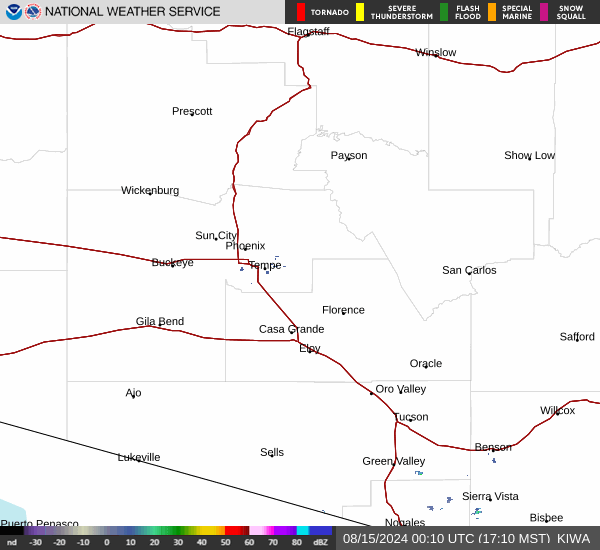
Current Radar Image
Sun Almanac for Sedona, Arizona
Sunrise: 06:42 AM
Sunset: 8:08 PM
Civil Sunrise:06:15 AM
Civil Sunset: 8:34 PM
Nautical Sunrise: 05:43 AM
Nautical Sunset: 9:06 PM
Astro Sunrise: 05:10 AM
Astro Sunset: 9:40 PM
Arizona's Current Temperatures
 Arizona's Satellite Image
 Arizona's Current Wind Direction
| National Summary |
of upper and lower values of current conditions amongst 6976 locations
in the contiguous United States |
|
High
Temp |
91° |
Ft Stockton, Texas
and 2 other locations
|
|
Low
Temp |
25° |
Berthoud Pass, Colorado
|
|
Wind
Speed |
39mph |
Tucumcari, New Mexico
|
|
Wind
Gust |
56mph |
Sedalia, Missouri
|
|
Wind
Chill |
12° |
Berthoud Pass, Colorado
|
|
Heat
Index |
94° |
Laredo AFB, Texas
|
|
High
Pressure |
30.39Hg |
Williamson/Sodus, New York
|
|
Low
Pressure |
29.42Hg |
Lamar, Colorado
|
|
| # Locations Reporting Snow |
4 |
|
| # Locations Reporting Rain |
94 |
|
| # Locations Reporting Thunderstorms / Lightning |
10 |
|
| # Locations Reporting Fog |
3 |
|
| Average Temperature in the Contiguous USA |
62° |
|
Any use of the information on this page is at your own risk. This information should not be relied upon in life-threatening situations, potential financial loss situations or in lieu of any officially disseminated information. Visit the
National Weather Service for official information.