Woodlawn, Tennessee Weather
No Watches or Warnings for Woodlawn
Issued: 1:18 pm EDT Apr 26, 2024 Latitude: 36.2731616 Longitude: -82.4590334 View on Google Maps
|
|
|
|
|
|
|
|
|
|
 |
 |
 |
 |
|
 |
 |
|
| High: °F |
Low: °F |
High: °F |
High: °F |
High: °F |
High: °F |
High: °F |
High: °F |
| Low: °F |
Low: °F |
Low: °F |
Low: °F |
Low: °F |
|
| Rain |
Rain |
Partly Sunny |
Sunny |
Sunny |
Thunderstorms |
Thunderstorms |
Thunderstorms |
Current Conditions at
BRISTOL - (KTRI)
66°
Mostly Cloudy
as of 1:53 PM EDST
Rel. Humidity: 59%
Dew Point: 52°F
Visibility: 10 Miles
Pressure: 30.26 in.
Flight Rule: VFR
Cloud Level(s): Scattered at 4100ft, Broken at 10000ft
Current Conditions at
ABINGDON - (KVJI)
66°
Partly Cloudy
as of 2:15 PM EDST
Rel. Humidity: 48%
Dew Point: 46°F
Visibility: 10 Miles
Pressure: 30.26 in.
Flight Rule: VFR
Wind Data
12 MPH
Gust: 20 MPH
280° West
Cloud Level(s): Scattered at 5500ft, Scattered at 6500ft, Scattered at 12000ft
Current Conditions at
BOONE - (KTNB)
48°
Cloudy
Mist
as of 1:55 PM EDST
Rel. Humidity: 100%
Dew Point: 48°F
Visibility: 4 Miles
Pressure: 30.17 in.
Flight Rule: LIFR
Wind Data
6 MPH
120° Southeast
Cloud Level(s): Solid Overcast at 300ft
Current Conditions at
WISE/LONESOME PINE - (KLNP)
63°
Cloudy
as of 2:15 PM EDST
Rel. Humidity: 55%
Dew Point: 46°F
Visibility: 10 Miles
Pressure: 30.28 in.
Flight Rule: VFR
Wind Data
12 MPH
Gust: 22 MPH
190° South
Cloud Level(s): Scattered at 4500ft, Solid Overcast at 11000ft
|
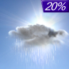
This Afternoon... A 20 percent chance of showers. Mostly cloudy, with a high near 66. South wind around 10 mph. |
|
|
Tonight... A 20 percent chance of showers before 11pm. Cloudy, then gradually becoming partly cloudy, with a low around 57. South wind around 15 mph, with gusts as high as 30 mph. |
|
|
Saturday... Partly sunny, with a high near 74. South wind around 15 mph, with gusts as high as 25 mph. |
|
 |
Saturday Night... Partly cloudy, with a low around 56. South wind around 10 mph, with gusts as high as 20 mph. |
|
|
Sunday... Sunny, with a high near 79. Southeast wind around 5 mph becoming southwest in the afternoon. |
|
 |
Sunday Night... Mostly clear, with a low around 55. South wind 5 to 10 mph. |
|
|
Monday... Sunny, with a high near 81. Southeast wind 5 to 10 mph becoming west in the afternoon. |
|
 |
Monday Night... A 20 percent chance of showers and thunderstorms after 2am. Partly cloudy, with a low around 58. |
|
|
Tuesday... A chance of showers and thunderstorms, then showers likely and possibly a thunderstorm after 2pm. Partly sunny, with a high near 76. Chance of precipitation is 60%. |
|
 |
Tuesday Night... Showers likely and possibly a thunderstorm before 8pm, then a slight chance of showers and thunderstorms between 8pm and 2am. Partly cloudy, with a low around 57. Chance of precipitation is 60%. |
|
|
Wednesday... A 40 percent chance of showers and thunderstorms. Mostly sunny, with a high near 79. |
|
 |
Wednesday Night... A 30 percent chance of showers and thunderstorms. Partly cloudy, with a low around 58. |
|
|
Thursday... A 40 percent chance of showers and thunderstorms. Mostly sunny, with a high near 79. |
|
Current Radar Image
Sun Almanac for Woodlawn, Tennessee
Sunrise: 06:42 AM
Sunset: 8:14 PM
Civil Sunrise:06:14 AM
Civil Sunset: 8:41 PM
Nautical Sunrise: 05:41 AM
Nautical Sunset: 9:14 PM
Astro Sunrise: 05:07 AM
Astro Sunset: 9:48 PM
Tennessee's Current Temperatures
 Tennessee's Satellite Image
 Tennessee's Current Wind Direction
| National Summary |
of upper and lower values of current conditions amongst 6950 locations
in the contiguous United States |
|
High
Temp |
88° |
Naples, Florida
and 11 other locations
|
|
Low
Temp |
21° |
Berthoud Pass, Colorado
|
|
Wind
Speed |
45mph |
29 Palms, California
|
|
Wind
Gust |
66mph |
29 Palms, California
|
|
Wind
Chill |
3° |
Berthoud Pass, Colorado
|
|
Heat
Index |
95° |
Mcallen, Texas
|
|
High
Pressure |
30.50Hg |
Westhampton Beach, New York
and 3 other locations
|
|
Low
Pressure |
29.29Hg |
Grand Island, Nebraska
|
|
| # Locations Reporting Snow |
1 |
|
| # Locations Reporting Rain |
158 |
|
| # Locations Reporting Thunderstorms / Lightning |
11 |
|
| # Locations Reporting Fog |
3 |
|
| Average Temperature in the Contiguous USA |
64° |
|
Any use of the information on this page is at your own risk. This information should not be relied upon in life-threatening situations, potential financial loss situations or in lieu of any officially disseminated information. Visit the
National Weather Service for official information.


