Syracuse, New York Weather
No Watches or Warnings for Syracuse
Issued: 6:10 am EDT Apr 26, 2024 Latitude: 43.0481221 Longitude: -76.1474244 View on Google Maps
|
|
|
|
|
|
|
|
|
|
 |
 |
 |
 |
 |
 |
 |
|
| High: °F |
Low: °F |
High: °F |
High: °F |
High: °F |
High: °F |
High: °F |
High: °F |
| Low: °F |
Low: °F |
Low: °F |
Low: °F |
Low: °F |
|
| Sunny |
Mostly Clear |
Rain |
Thunderstorms |
Partly Sunny |
Thunderstorms |
Mostly Sunny |
Thunderstorms |
Current Conditions at
SYRACUSE - (KSYR)
43°
Mostly Clear
as of 8:54 AM EDST
Rel. Humidity: 52%
Dew Point: 27°F
Visibility: 10 Miles
Pressure: 30.48 in.
Flight Rule: VFR
Cloud Level(s): Few at 22000ft
Current Conditions at
FULTON - (KFZY)
43°
Clear
as of 8:54 AM EDST
Rel. Humidity: 56%
Dew Point: 28°F
Visibility: 10 Miles
Pressure: 30.48 in.
Flight Rule: VFR
Cloud Level(s): Clear
Current Conditions at
GRIFFISS AFB - (KRME)
41°
Clear
as of 7:53 AM CDST
Rel. Humidity: 52%
Dew Point: 25°F
Visibility: 10 Miles
Pressure: 30.50 in.
Flight Rule: VFR
Cloud Level(s): Clear
|
Today... Sunny, with a high near 62. East wind around 6 mph. |
|
|
Tonight... Mostly clear, with a low around 43. East wind 6 to 10 mph becoming south after midnight. |
|
|
Saturday... A chance of showers, mainly after noon. Increasing clouds, with a high near 63. South wind 16 to 18 mph, with gusts as high as 29 mph. Chance of precipitation is 40%. New precipitation amounts of less than a tenth of an inch possible. |
|
 |
Saturday Night... A chance of showers, with thunderstorms also possible after 2am. Mostly cloudy, with a low around 51. South wind around 14 mph. Chance of precipitation is 50%. New rainfall amounts between a tenth and quarter of an inch, except higher amounts possible in thunderstorms. |
|
|
Sunday... A chance of showers and thunderstorms. Partly sunny, with a high near 77. South wind around 10 mph. Chance of precipitation is 30%. |
|
 |
Sunday Night... A chance of showers and thunderstorms, mainly before 8pm. Mostly cloudy, with a low around 58. Chance of precipitation is 30%. |
|
|
Monday... Partly sunny, with a high near 82. |
|
|
Monday Night... A chance of showers and thunderstorms between 8pm and 2am, then a chance of showers after 2am. Mostly cloudy, with a low around 63. Chance of precipitation is 30%. |
|
|
Tuesday... A chance of showers, then showers and thunderstorms likely after 2pm. Mostly cloudy, with a high near 77. Chance of precipitation is 60%. |
|
 |
Tuesday Night... Showers and thunderstorms likely, mainly before 8pm. Mostly cloudy, with a low around 55. Chance of precipitation is 60%. |
|
|
Wednesday... Mostly sunny, with a high near 76. |
|
 |
Wednesday Night... Partly cloudy, with a low around 53. |
|
|
Thursday... A chance of showers and thunderstorms. Partly sunny, with a high near 66. Chance of precipitation is 30%. |
|
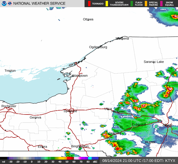
Current Radar Image
Sun Almanac for Syracuse, New York
Sunrise: 06:04 AM
Sunset: 8:00 PM
Civil Sunrise:05:34 AM
Civil Sunset: 8:31 PM
Nautical Sunrise: 04:56 AM
Nautical Sunset: 9:08 PM
Astro Sunrise: 04:15 AM
Astro Sunset: 9:49 PM
New York's Current Temperatures
 New York's Satellite Image
 New York's Current Wind Direction
| National Summary |
of upper and lower values of current conditions amongst 5925 locations
in the contiguous United States |
|
High
Temp |
79° |
Lantana/Palm Bea, Florida
and 4 other locations
|
|
Low
Temp |
1° |
Imperial Beach NAS, California
|
|
Wind
Speed |
36mph |
Berthoud Pass, Colorado
|
|
Wind
Gust |
53mph |
Tracy, Minnesota
and 1 other location
|
|
Wind
Chill |
1° |
Berthoud Pass, Colorado
|
|
High
Pressure |
30.52Hg |
Franklin Cnty Airpor, Vermont
and 2 other locations
|
|
Low
Pressure |
29.35Hg |
Hill City, Kansas
|
|
| # Locations Reporting Snow |
5 |
|
| # Locations Reporting Rain |
168 |
|
| # Locations Reporting Thunderstorms / Lightning |
9 |
|
| # Locations Reporting Fog |
16 |
|
| Average Temperature in the Contiguous USA |
53° |
|
Any use of the information on this page is at your own risk. This information should not be relied upon in life-threatening situations, potential financial loss situations or in lieu of any officially disseminated information. Visit the
National Weather Service for official information.