No Watches or Warnings for Andover
Issued: 11:16 pm EDT Jun 30, 2025 Latitude: 25.9684255 Longitude: -80.2128256 View on Google Maps
|
|
|
|
|
|
|
|
|
|
 |
 |
 |
|
 |
 |
|
 |
| Low: °F |
High: °F |
High: °F |
High: °F |
High: °F |
High: °F |
High: °F |
High: °F |
| Low: °F |
Low: °F |
Low: °F |
Low: °F |
Low: °F |
Low: °F |
|
| Thunderstorms |
Thunderstorms |
Thunderstorms |
Thunderstorms |
Thunderstorms |
Thunderstorms |
Thunderstorms |
Thunderstorms |
Current Conditions at
NORTH PERRY ARPT - (KHWO)
82°
Mostly Cloudy
as of 11:53 PM EDST
Rel. Humidity: 61%
Dew Point: 68°F
Visibility: 10 Miles
Pressure: 30.15 in.
Flight Rule: VFR
Wind Data
7 MPH
050° Northeast
Cloud Level(s): Broken at 3100ft, Broken at 3500ft
Current Conditions at
OPA LOCKA ARPT - (KOPF)
81°
Partly Cloudy
as of 11:53 PM EDST
Rel. Humidity: 61%
Dew Point: 66°F
Visibility: 10 Miles
Pressure: 30.15 in.
Flight Rule: VFR
Wind Data
9 MPH
030° Northeast
Cloud Level(s): Few at 2900ft, Scattered at 3800ft
Current Conditions at
FORT LAUDERDALE INTL - (KFLL)
77°
Mostly Cloudy
as of 11:53 PM EDST
Rel. Humidity: 83%
Dew Point: 72°F
Visibility: 8 Miles
Pressure: 30.15 in.
Flight Rule: VFR
Cloud Level(s): Scattered at 3200ft, Broken at 4500ft, Broken at 7000ft
Current Conditions at
FORT LAUDERDALE EXEC - (KFXE)
77°
Partly Cloudy
Thunderstorm In Vicinity
as of 11:53 PM EDST
Rel. Humidity: 88%
Dew Point: 73°F
Visibility: 10 Miles
Pressure: 30.15 in.
Flight Rule: VFR
Wind Data
7 MPH
060° Northeast
Cloud Level(s): Scattered at 3300ft
|
Overnight... A 30 percent chance of showers and thunderstorms, mainly before 3am. Mostly cloudy, with a low around 78. Light east wind. |
|
|
Tuesday... A chance of showers and thunderstorms before 2pm, then showers likely and possibly a thunderstorm between 2pm and 3pm, then showers and thunderstorms likely after 3pm. Mostly sunny, with a high near 89. Southeast wind 5 to 10 mph. Chance of precipitation is 60%. New rainfall amounts of less than a tenth of an inch, except higher amounts possible in thunderstorms. |
|
|
Tuesday Night... A 30 percent chance of showers and thunderstorms, mainly before 2am. Mostly cloudy, with a low around 79. South wind around 6 mph becoming calm in the evening. |
|
|
Wednesday... A 40 percent chance of showers and thunderstorms, mainly after 8am. Partly sunny, with a high near 89. Heat index values as high as 100. South wind 6 to 10 mph. |
|
 |
Wednesday Night... Mostly cloudy, with a low around 79. South wind 3 to 6 mph. |
|
|
Thursday... A 40 percent chance of showers and thunderstorms. Partly sunny, with a high near 89. South wind 5 to 10 mph. |
|
|
Thursday Night... A 30 percent chance of showers and thunderstorms after 2am. Mostly cloudy, with a low around 79. South wind around 6 mph becoming calm in the evening. |
|
|
Independence Day... A 50 percent chance of showers and thunderstorms. Partly sunny, with a high near 89. South wind 3 to 8 mph. |
|
 |
Friday Night... A 50 percent chance of showers and thunderstorms. Mostly cloudy, with a low around 78. South wind around 5 mph becoming calm in the evening. |
|
|
Saturday... Showers and thunderstorms likely, mainly before 2pm. Partly sunny, with a high near 88. Chance of precipitation is 60%. |
|
 |
Saturday Night... A 40 percent chance of showers and thunderstorms. Mostly cloudy, with a low around 78. |
|
|
Sunday... Showers and thunderstorms likely. Partly sunny, with a high near 88. Chance of precipitation is 60%. |
|
|
Sunday Night... A 30 percent chance of showers and thunderstorms. Mostly cloudy, with a low around 78. |
|
|
Monday... A 40 percent chance of showers and thunderstorms. Mostly sunny, with a high near 89. |
|
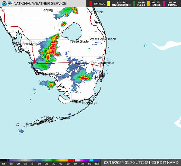
Current Radar Image
Sun Almanac for Andover, Florida
Sunrise: 06:33 AM
Sunset: 8:17 PM
Civil Sunrise:06:07 AM
Civil Sunset: 8:43 PM
Nautical Sunrise: 05:36 AM
Nautical Sunset: 9:14 PM
Astro Sunrise: 05:03 AM
Astro Sunset: 9:47 PM
Florida's Current Temperatures
 Florida's Satellite Image
 Florida's Current Wind Direction
| National Summary |
of upper and lower values of current conditions amongst 6890 locations
in the contiguous United States |
|
High
Temp |
108° |
Phoenix, Arizona
|
|
Low
Temp |
43° |
Salida Mountain, Colorado
|
|
Wind
Speed |
30mph |
Lordsburg, New Mexico
|
|
Wind
Gust |
39mph |
Lordsburg, New Mexico
|
|
Wind
Chill |
35° |
Salida Mountain, Colorado
|
|
High
Pressure |
30.84Hg |
Salida Mountain, Colorado
|
|
Low
Pressure |
29.61Hg |
Thermal, California
|
|
| # Locations Reporting Rain |
76 |
|
| # Locations Reporting Thunderstorms / Lightning |
17 |
|
| # Locations Reporting Fog |
9 |
|
| Average Temperature in the Contiguous USA |
73° |
|
Any use of the information on this page is at your own risk. This information should not be relied upon in life-threatening situations, potential financial loss situations or in lieu of any officially disseminated information. Visit the
National Weather Service for official information.