No Watches or Warnings for Carrizo
Issued: 4:12 pm MST Apr 25, 2024 Latitude: 33.9939364 Longitude: -110.2887199 View on Google Maps
|
|
|
|
|
|
|
|
|
|
 |
 |
 |
 |
|
|
|
|
| Low: °F |
High: °F |
High: °F |
High: °F |
High: °F |
High: °F |
High: °F |
High: °F |
| Low: °F |
Low: °F |
Low: °F |
Low: °F |
Low: °F |
Low: °F |
|
| Mostly Cloudy |
Increasing Clouds |
Thunderstorms |
Sunny |
Sunny |
Sunny |
Sunny |
Sunny |
Current Conditions at
SHOW LOW - (KSOW)
54°
Partly Cloudy
as of 7:15 PM MDST
Rel. Humidity: 37%
Dew Point: 28°F
Visibility: 10 Miles
Pressure: 29.98 in.
Flight Rule: VFR
Wind Data
20 MPH
Gust: 25 MPH
250° West
Cloud Level(s): Few at 8000ft, Scattered at 9000ft
Current Conditions at
WINSLOW - (KINW)
59°
Cloudy
as of 6:56 PM MDST
Rel. Humidity: 38%
Dew Point: 34°F
Visibility: 10 Miles
Pressure: 29.93 in.
Flight Rule: VFR
Cloud Level(s): Broken at 7500ft, Solid Overcast at 9000ft
Current Conditions at
SAFFORD - (KSAD)
73°
Partly Cloudy
as of 6:51 PM MDST
Rel. Humidity: 18%
Dew Point: 28°F
Visibility: 10 Miles
Pressure: 29.84 in.
Flight Rule: VFR
Wind Data
21 MPH
Gust: 28 MPH
270° West
Cloud Level(s): Scattered at 9500ft
|
Tonight... Mostly cloudy, then gradually becoming clear, with a low around 40. Southwest wind 9 to 14 mph becoming light and variable after midnight. Winds could gust as high as 21 mph. |
|
|
Friday... Increasing clouds, with a high near 67. Breezy, with a southwest wind 7 to 12 mph increasing to 17 to 22 mph in the afternoon. Winds could gust as high as 33 mph. |
|
 |
Friday Night... A 50 percent chance of showers. Mostly cloudy, with a low around 40. Southwest wind 11 to 16 mph, with gusts as high as 23 mph. |
|
|
Saturday... A chance of showers, with thunderstorms also possible after 11am. Partly sunny, with a high near 60. Southwest wind 10 to 17 mph, with gusts as high as 25 mph. Chance of precipitation is 40%. |
|
 |
Saturday Night... Mostly clear, with a low around 38. West wind 5 to 8 mph becoming calm in the evening. |
|
|
Sunday... Sunny, with a high near 72. Light south wind becoming west 8 to 13 mph in the morning. Winds could gust as high as 18 mph. |
|
 |
Sunday Night... Clear, with a low around 41. West wind 5 to 11 mph becoming east after midnight. Winds could gust as high as 16 mph. |
|
|
Monday... Sunny, with a high near 79. East wind 5 to 13 mph becoming southwest in the afternoon. Winds could gust as high as 20 mph. |
|
|
Monday Night... Clear, with a low around 45. Southwest wind 5 to 9 mph becoming northeast in the evening. Winds could gust as high as 15 mph. |
|
|
Tuesday... Sunny, with a high near 82. East wind 6 to 14 mph becoming southwest in the afternoon. Winds could gust as high as 22 mph. |
|
|
Tuesday Night... Mostly clear, with a low around 48. West wind 6 to 10 mph becoming northeast after midnight. Winds could gust as high as 15 mph. |
|
|
Wednesday... Sunny, with a high near 85. Southeast wind 6 to 14 mph becoming southwest in the afternoon. Winds could gust as high as 22 mph. |
|
|
Wednesday Night... Mostly clear, with a low around 49. Southwest wind 6 to 10 mph becoming northeast in the evening. Winds could gust as high as 16 mph. |
|
|
Thursday... Sunny, with a high near 85. Southeast wind 8 to 17 mph becoming southwest in the afternoon. Winds could gust as high as 26 mph. |
|
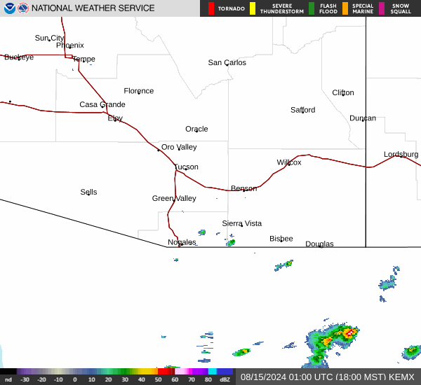
Current Radar Image
Sun Almanac for Carrizo, Arizona
Sunrise: 06:37 AM
Sunset: 8:01 PM
Civil Sunrise:06:11 AM
Civil Sunset: 8:27 PM
Nautical Sunrise: 05:40 AM
Nautical Sunset: 8:58 PM
Astro Sunrise: 05:07 AM
Astro Sunset: 9:31 PM
Arizona's Current Temperatures
 Arizona's Satellite Image
 Arizona's Current Wind Direction
| National Summary |
of upper and lower values of current conditions amongst 6866 locations
in the contiguous United States |
|
High
Temp |
90° |
Presidio, Texas
and 1 other location
|
|
Low
Temp |
25° |
Salida Mountain, Colorado
and 1 other location
|
|
Wind
Speed |
39mph |
Ruidoso, New Mexico
|
|
Wind
Gust |
58mph |
Sedalia, Missouri
|
|
Wind
Chill |
10° |
Berthoud Pass, Colorado
|
|
High
Pressure |
30.40Hg |
Williamson/Sodus, New York
|
|
Low
Pressure |
29.41Hg |
Lamar, Colorado
|
|
| # Locations Reporting Snow |
5 |
|
| # Locations Reporting Rain |
106 |
|
| # Locations Reporting Thunderstorms / Lightning |
10 |
|
| # Locations Reporting Fog |
2 |
|
| Average Temperature in the Contiguous USA |
60° |
|
Any use of the information on this page is at your own risk. This information should not be relied upon in life-threatening situations, potential financial loss situations or in lieu of any officially disseminated information. Visit the
National Weather Service for official information.