Broylesville, Tennessee Weather
No Watches or Warnings for Broylesville
Issued: 2:39 pm EDT Apr 26, 2024 Latitude: 36.2139938 Longitude: -82.6026484 View on Google Maps
|
|
|
|
|
|
|
|
|
|
|
 |
 |
 |
 |
|
 |
 |
 |
 |
| High: °F |
Low: °F |
High: °F |
High: °F |
High: °F |
High: °F |
High: °F |
High: °F |
High: °F |
| Low: °F |
Low: °F |
Low: °F |
Low: °F |
Low: °F |
Low: °F |
|
| Rain |
Rain |
Partly Sunny |
Sunny |
Sunny |
Thunderstorms |
Thunderstorms |
Thunderstorms |
Thunderstorms |
Current Conditions at
BRISTOL - (KTRI)
61°
Cloudy
Light Rain
as of 3:53 PM EDST
Rel. Humidity: 82%
Dew Point: 55°F
Visibility: 6 Miles
Pressure: 30.27 in.
Flight Rule: VFR
Cloud Level(s): Broken at 6000ft, Solid Overcast at 7000ft
Current Conditions at
ABINGDON - (KVJI)
63°
Cloudy
as of 4:35 PM EDST
Rel. Humidity: 63%
Dew Point: 50°F
Visibility: 10 Miles
Pressure: 30.27 in.
Flight Rule: VFR
Cloud Level(s): Solid Overcast at 7500ft
Current Conditions at
WISE/LONESOME PINE - (KLNP)
55°
Cloudy
as of 4:35 PM EDST
Rel. Humidity: 76%
Dew Point: 48°F
Visibility: 10 Miles
Pressure: 30.28 in.
Flight Rule: VFR
Wind Data
9 MPH
Gust: 16 MPH
170° South
Cloud Level(s): Solid Overcast at 4700ft
|
This Afternoon... A 20 percent chance of showers. Cloudy, with a high near 66. Southeast wind around 10 mph. |
|
|
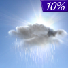
Tonight... A slight chance of showers before 8pm, then a slight chance of sprinkles between 8pm and 9pm. Cloudy, then gradually becoming partly cloudy, with a low around 57. Southeast wind 10 to 15 mph, with gusts as high as 25 mph. Chance of precipitation is 10%. |
|
|
Saturday... Partly sunny, with a high near 75. South wind 10 to 15 mph, with gusts as high as 20 mph. |
|
 |
Saturday Night... Partly cloudy, with a low around 57. South wind 5 to 10 mph, with gusts as high as 20 mph. |
|
|
Sunday... Sunny, with a high near 80. South wind 5 to 10 mph. |
|
 |
Sunday Night... Mostly clear, with a low around 56. South wind 5 to 10 mph. |
|
|
Monday... Sunny, with a high near 82. Southeast wind 5 to 10 mph becoming southwest in the afternoon. |
|
|
Monday Night... Partly cloudy, with a low around 59. |
|
|
Tuesday... Showers likely, with thunderstorms also possible after 2pm. Partly sunny, with a high near 76. Chance of precipitation is 60%. |
|
 |
Tuesday Night... A slight chance of thunderstorms before 8pm. Mostly clear, with a low around 57. Chance of precipitation is 10%. |
|
|
Wednesday... A 30 percent chance of showers and thunderstorms. Sunny, with a high near 81. |
|
 |
Wednesday Night... A 30 percent chance of showers and thunderstorms. Partly cloudy, with a low around 58. |
|
|
Thursday... A 40 percent chance of showers and thunderstorms. Mostly sunny, with a high near 81. |
|
|
Thursday Night... A 30 percent chance of showers and thunderstorms. Partly cloudy, with a low around 58. |
|
|
Friday... A chance of showers and thunderstorms. Partly sunny, with a high near 77. |
|
Current Radar Image
Sun Almanac for Broylesville, Tennessee
Sunrise: 06:42 AM
Sunset: 8:14 PM
Civil Sunrise:06:15 AM
Civil Sunset: 8:41 PM
Nautical Sunrise: 05:42 AM
Nautical Sunset: 9:14 PM
Astro Sunrise: 05:08 AM
Astro Sunset: 9:48 PM
Tennessee's Current Temperatures
 Tennessee's Satellite Image
 Tennessee's Current Wind Direction
| National Summary |
of upper and lower values of current conditions amongst 7064 locations
in the contiguous United States |
|
High
Temp |
93° |
Junction, Texas
and 2 other locations
|
|
Low
Temp |
27° |
Berthoud Pass, Colorado
|
|
Wind
Speed |
46mph |
Mojave, California
|
|
Wind
Gust |
63mph |
Mojave, California
|
|
Wind
Chill |
17° |
Salida Mountain, Colorado
|
|
Heat
Index |
98° |
Laredo AFB, Texas
|
|
High
Pressure |
30.90Hg |
Ottawa, Ohio
|
|
Low
Pressure |
29.28Hg |
Aurora, Nebraska
and 2 other locations
|
|
| # Locations Reporting Snow |
1 |
|
| # Locations Reporting Rain |
197 |
|
| # Locations Reporting Thunderstorms / Lightning |
14 |
|
| Average Temperature in the Contiguous USA |
66° |
|
Any use of the information on this page is at your own risk. This information should not be relied upon in life-threatening situations, potential financial loss situations or in lieu of any officially disseminated information. Visit the
National Weather Service for official information.


