No Watches or Warnings for Atwood
Issued: 4:06 pm PDT Apr 26, 2024 Latitude: 38.7479799 Longitude: -117.8562235 View on Google Maps
|
|
|
|
|
|
|
|
|
|
 |
 |
 |
|
|
|
|
|
| Low: °F |
High: °F |
High: °F |
High: °F |
High: °F |
High: °F |
High: °F |
High: °F |
| Low: °F |
Low: °F |
Low: °F |
Low: °F |
Low: °F |
Low: °F |
|
| Rain & Snow |
Mostly Cloudy |
Sunny |
Sunny |
Sunny |
Sunny |
Sunny |
Sunny |
Current Conditions at
TONOPAH - (KTPH)
Mostly Clear
as of 7:56 PM PDST
Rel. Humidity: 56%
Dew Point: 30°F
Visibility: 10 Miles
Pressure: 29.82 in.
Flight Rule: VFR
Wind Data
16 MPH
320° Northwest
Cloud Level(s): Few at 6500ft, Few at 8000ft
Current Conditions at
FALLON NAS - (KNFL)
48°
Clear
as of 7:56 PM PDST
Rel. Humidity: 61%
Dew Point: 36°F
Visibility: 10 Miles
Pressure: 29.88 in.
Flight Rule: VFR
Cloud Level(s): Few at 3000ft, Scattered at 5000ft, Scattered at 10000ft, Broken at 25000ft
Current Conditions at
LOVELOCK - (KLOL)
46°
Cloudy
as of 7:53 PM PDST
Rel. Humidity: 14%
Visibility: 10 Miles
Pressure: 29.88 in.
Flight Rule: VFR
Wind Data
6 MPH
300° Northwest
Cloud Level(s): Few at 7000ft, Few at 9000ft, Solid Overcast at 11000ft
Current Conditions at
BISHOP - (KBIH)
52°
Cloudy
Light Rain
as of 7:56 PM PDST
Rel. Humidity: 46%
Dew Point: 32°F
Visibility: 9 Miles
Pressure: 29.80 in.
Flight Rule: VFR
Wind Data
16 MPH
320° Northwest
Cloud Level(s): Scattered at 4600ft, Broken at 7500ft, Solid Overcast at 11000ft
|
Tonight... Scattered rain and snow showers before 11pm. Snow level 6700 feet lowering to 6100 feet after midnight . Mostly cloudy, with a low around 34. Northwest wind 15 to 20 mph. Chance of precipitation is 30%. Little or no snow accumulation expected. |
|
|
Saturday... Mostly cloudy, then gradually becoming sunny, with a high near 56. Northwest wind 10 to 15 mph. |
|
 |
Saturday Night... Partly cloudy, with a low around 39. North northwest wind 10 to 15 mph. |
|
|
Sunday... Sunny, with a high near 62. West northwest wind 5 to 15 mph. |
|
 |
Sunday Night... Mostly clear, with a low around 40. Northwest wind 5 to 15 mph. |
|
|
Monday... Sunny, with a high near 65. |
|
|
Monday Night... Mostly clear, with a low around 42. |
|
|
Tuesday... Sunny, with a high near 65. |
|
|
Tuesday Night... Mostly clear, with a low around 40. |
|
|
Wednesday... Sunny, with a high near 66. |
|
|
Wednesday Night... Mostly clear, with a low around 45. |
|
|
Thursday... Sunny, with a high near 69. |
|
|
Thursday Night... Mostly clear, with a low around 45. |
|
|
Friday... Sunny, with a high near 69. |
|
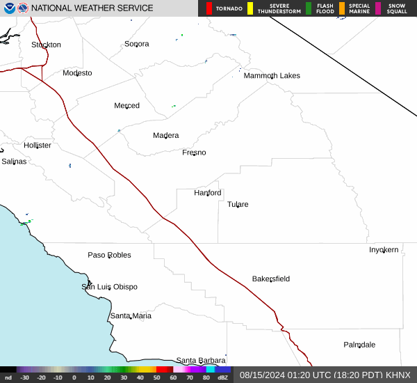
Current Radar Image
Sun Almanac for Atwood, Nevada
Sunrise: 05:58 AM
Sunset: 7:40 PM
Civil Sunrise:05:29 AM
Civil Sunset: 8:09 PM
Nautical Sunrise: 04:55 AM
Nautical Sunset: 8:43 PM
Astro Sunrise: 04:18 AM
Astro Sunset: 9:20 PM
Nevada's Current Temperatures
 Nevada's Satellite Image
 Nevada's Current Wind Direction
| National Summary |
of upper and lower values of current conditions amongst 6967 locations
in the contiguous United States |
|
High
Temp |
90° |
Del Rio, Texas
|
|
Low
Temp |
1° |
Imperial Beach NAS, California
|
|
Wind
Speed |
32mph |
El Centro, California
and 1 other location
|
|
Wind
Gust |
51mph |
29 Palms, California
|
|
Wind
Chill |
-16° |
Imperial BeachNAS, California
|
|
High
Pressure |
30.53Hg |
Montauk, New York
and 1 other location
|
|
Low
Pressure |
29.33Hg |
Sheldon, Iowa
and 1 other location
|
|
| # Locations Reporting Snow |
5 |
|
| # Locations Reporting Rain |
171 |
|
| # Locations Reporting Thunderstorms / Lightning |
11 |
|
| # Locations Reporting Fog |
2 |
|
| Average Temperature in the Contiguous USA |
58° |
|
Any use of the information on this page is at your own risk. This information should not be relied upon in life-threatening situations, potential financial loss situations or in lieu of any officially disseminated information. Visit the
National Weather Service for official information.