No Watches or Warnings for Albert
Issued: 8:44 pm CDT Apr 26, 2024 Latitude: 38.4527906 Longitude: -99.0114836 View on Google Maps
|
|
|
|
|
|
|
|
|
|
 |
 |
 |
 |
 |
|
 |
|
| Low: °F |
High: °F |
High: °F |
High: °F |
High: °F |
High: °F |
High: °F |
High: °F |
| Low: °F |
Low: °F |
Low: °F |
Low: °F |
Low: °F |
Low: °F |
|
| Mostly Clear |
Thunderstorms |
Thunderstorms |
Mostly Sunny |
Sunny |
Thunderstorms |
Rain |
Mostly Sunny |
Current Conditions at
GREAT BEND - (KGBD)
75°
Clear
as of 7:56 PM CDST
Rel. Humidity: 33%
Dew Point: 45°F
Visibility: 10 Miles
Pressure: 29.53 in.
Flight Rule: VFR
Cloud Level(s): Clear
Current Conditions at
RUSSELL - (KRSL)
72°
Clear
as of 7:53 PM CDST
Rel. Humidity: 40%
Dew Point: 46°F
Visibility: 10 Miles
Pressure: 29.51 in.
Flight Rule: VFR
Cloud Level(s): Clear
Current Conditions at
HAYS - (KHYS)
72°
Clear
as of 7:56 PM CDST
Rel. Humidity: 37%
Dew Point: 45°F
Visibility: 10 Miles
Pressure: 29.53 in.
Flight Rule: VFR
Cloud Level(s): Clear
Current Conditions at
PRATT - (KPTT)
72°
Clear
as of 8:30 PM CDST
Rel. Humidity: 35%
Dew Point: 43°F
Visibility: 10 Miles
Pressure: 29.56 in.
Flight Rule: VFR
Cloud Level(s): Clear
|
Tonight... Mostly clear, with a low around 49. North northwest wind 7 to 9 mph becoming east in the evening. |
|
|
Saturday... A 50 percent chance of showers and thunderstorms after 1pm. Some of the storms could be severe. Mostly sunny, with a high near 82. Breezy, with an east wind 9 to 14 mph becoming south 19 to 29 mph in the afternoon. Winds could gust as high as 39 mph. |
|
 |
Saturday Night... A 50 percent chance of showers and thunderstorms, mainly before 1am. Some of the storms could be severe. Partly cloudy, with a low around 52. Breezy, with a south southeast wind 20 to 25 mph decreasing to 9 to 14 mph after midnight. Winds could gust as high as 34 mph. |
|
|
Sunday... A chance of showers and thunderstorms. Mostly sunny, with a high near 71. West southwest wind 10 to 16 mph, with gusts as high as 22 mph. Chance of precipitation is 30%. |
|
|
Sunday Night... Mostly clear, with a low around 40. North northwest wind 8 to 18 mph, with gusts as high as 21 mph. |
|
|
Monday... Mostly sunny, with a high near 76. |
|
|
Monday Night... Mostly clear, with a low around 51. |
|
|
Tuesday... Sunny, with a high near 84. |
|
|
Tuesday Night... Mostly clear, with a low around 53. |
|
|
Wednesday... A 30 percent chance of showers and thunderstorms after 1pm. Mostly sunny, with a high near 81. |
|
 |
Wednesday Night... A 30 percent chance of showers and thunderstorms. Mostly cloudy, with a low around 50. |
|
|
Thursday... A 20 percent chance of showers. Mostly sunny, with a high near 71. |
|
 |
Thursday Night... A 20 percent chance of showers. Partly cloudy, with a low around 46. |
|
|
Friday... Mostly sunny, with a high near 74. |
|
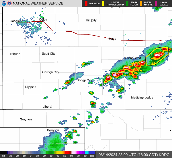
Current Radar Image
Sun Almanac for Albert, Kansas
Sunrise: 06:44 AM
Sunset: 8:23 PM
Civil Sunrise:06:16 AM
Civil Sunset: 8:52 PM
Nautical Sunrise: 05:42 AM
Nautical Sunset: 9:26 PM
Astro Sunrise: 05:06 AM
Astro Sunset: 10:02 PM
Kansas' Current Temperatures
 Kansas' Satellite Image
 Kansas' Current Wind Direction
| National Summary |
of upper and lower values of current conditions amongst 6211 locations
in the contiguous United States |
|
High
Temp |
93° |
Del Rio, Texas
|
|
Low
Temp |
23° |
Berthoud Pass, Colorado
|
|
Wind
Speed |
38mph |
Mojave, California
|
|
Wind
Gust |
59mph |
Mojave, California
|
|
Wind
Chill |
10° |
Berthoud Pass, Colorado
|
|
High
Pressure |
30.51Hg |
Nantucket, Massachusetts
|
|
Low
Pressure |
29.29Hg |
Sheldon, Iowa
|
|
| # Locations Reporting Snow |
7 |
|
| # Locations Reporting Rain |
182 |
|
| # Locations Reporting Thunderstorms / Lightning |
14 |
|
| # Locations Reporting Fog |
1 |
|
| Average Temperature in the Contiguous USA |
61° |
|
Any use of the information on this page is at your own risk. This information should not be relied upon in life-threatening situations, potential financial loss situations or in lieu of any officially disseminated information. Visit the
National Weather Service for official information.