Adobe Crossing, Texas Weather
Issued: 8:51 pm CDT Apr 26, 2024 Latitude: 31.0529279 Longitude: -102.3073604 View on Google Maps
|
|
|
|
|
|
|
|
|
|
 |
 |
|
|
|
 |
 |
|
| Low: °F |
High: °F |
High: °F |
High: °F |
High: °F |
High: °F |
High: °F |
High: °F |
| Low: °F |
Low: °F |
Low: °F |
Low: °F |
Low: °F |
Low: °F |
|
| Clear |
Sunny |
Sunny |
Sunny |
Sunny |
Thunderstorms |
Thunderstorms |
Thunderstorms |
Current Conditions at
FT STOCKTON - (KFST)
73°
Clear
as of 9:53 PM CDST
Rel. Humidity: 11%
Dew Point: 16°F
Visibility: 10 Miles
Pressure: 29.70 in.
Flight Rule: VFR
Wind Data
8 MPH
210° Southwest
Cloud Level(s): Clear
Current Conditions at
TERREL COUNTY ARPT - (K6R6)
79°
Clear
as of 9:51 PM CDST
Rel. Humidity: 36%
Dew Point: 50°F
Pressure: 29.70 in.
Wind Data
8 MPH
140° Southeast
Current Conditions at
ODESSA - (KODO)
75°
Clear
as of 9:53 PM CDST
Rel. Humidity: 13%
Dew Point: 21°F
Visibility: 10 Miles
Pressure: 29.71 in.
Flight Rule: VFR
Wind Data
5 MPH
240° Southwest
Cloud Level(s): Clear
Current Conditions at
MIDLAND - (KMDD)
75°
Clear
as of 10:15 AM PDST
Rel. Humidity: 13%
Dew Point: 21°F
Visibility: 10 Miles
Pressure: 29.71 in.
Flight Rule: VFR
Wind Data
5 MPH
210° Southwest
Cloud Level(s): Clear
|
Tonight... Clear, with a low around 60. South southeast wind 5 to 10 mph. |
|
|
Saturday... Sunny, with a high near 91. Southwest wind 5 to 10 mph becoming west northwest in the morning. |
|
 |
Saturday Night... A 20 percent chance of showers before 1am. Partly cloudy, with a low around 57. West southwest wind 5 to 15 mph becoming northwest in the evening. |
|
|
Sunday... Sunny, with a high near 87. West wind 10 to 15 mph. |
|
|
Sunday Night... Clear, with a low around 55. West wind 5 to 10 mph becoming south southwest after midnight. |
|
|
Monday... Sunny, with a high near 91. South southwest wind 5 to 10 mph becoming west in the afternoon. Winds could gust as high as 20 mph. |
|
 |
Monday Night... Mostly clear, with a low around 66. East wind 10 to 15 mph becoming south southeast after midnight. Winds could gust as high as 25 mph. |
|
|
Tuesday... Sunny, with a high near 93. Breezy, with a south southeast wind 15 to 20 mph, with gusts as high as 30 mph. |
|
 |
Tuesday Night... Partly cloudy, with a low around 69. Windy, with a south southeast wind 20 to 25 mph, with gusts as high as 35 mph. |
|
|
Wednesday... A 30 percent chance of showers and thunderstorms after 1pm. Partly sunny, with a high near 90. South southeast wind around 15 mph, with gusts as high as 25 mph. |
|
 |
Wednesday Night... A 20 percent chance of showers and thunderstorms. Partly cloudy, with a low around 65. |
|
|
Thursday... A 30 percent chance of showers and thunderstorms. Mostly sunny, with a high near 88. |
|
|
Thursday Night... A 20 percent chance of showers and thunderstorms. Partly cloudy, with a low around 61. Breezy. |
|
|
Friday... A 30 percent chance of showers and thunderstorms. Mostly sunny, with a high near 87. |
|
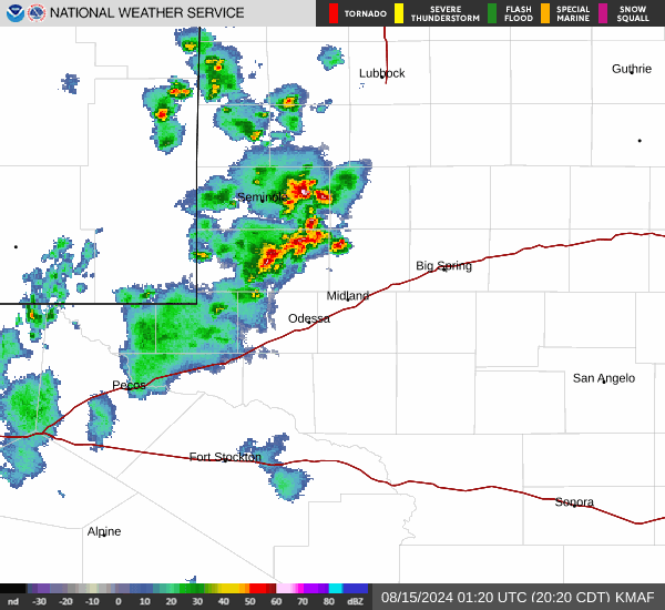
Current Radar Image
Sun Almanac for Adobe Crossing, Texas
Sunrise: 07:09 AM
Sunset: 8:25 PM
Civil Sunrise:06:43 AM
Civil Sunset: 8:51 PM
Nautical Sunrise: 06:13 AM
Nautical Sunset: 9:21 PM
Astro Sunrise: 05:42 AM
Astro Sunset: 9:52 PM
Texas' Current Temperatures
 Texas' Satellite Image
 Texas' Current Wind Direction
| National Summary |
of upper and lower values of current conditions amongst 6912 locations
in the contiguous United States |
|
High
Temp |
90° |
Del Rio, Texas
|
|
Low
Temp |
1° |
Imperial Beach NAS, California
|
|
Wind
Speed |
32mph |
El Centro, California
|
|
Wind
Gust |
51mph |
29 Palms, California
|
|
Wind
Chill |
-16° |
Imperial BeachNAS, California
|
|
High
Pressure |
30.53Hg |
Montauk, New York
and 1 other location
|
|
Low
Pressure |
29.32Hg |
Maurice, Iowa
and 1 other location
|
|
| # Locations Reporting Snow |
3 |
|
| # Locations Reporting Rain |
183 |
|
| # Locations Reporting Thunderstorms / Lightning |
8 |
|
| Average Temperature in the Contiguous USA |
58° |
|
Any use of the information on this page is at your own risk. This information should not be relied upon in life-threatening situations, potential financial loss situations or in lieu of any officially disseminated information. Visit the
National Weather Service for official information.