Venango, Nebraska Weather
Issued: 1:45 am MDT Apr 18, 2024 Latitude: 40.7636078 Longitude: -102.0407383 View on Google Maps
|
|
|
|
|
|
|
|
|
|
 |
 |
 |
 |
 |
 |
 |
|
| Low: °F |
High: °F |
High: °F |
High: °F |
High: °F |
High: °F |
High: °F |
High: °F |
| Low: °F |
Low: °F |
Low: °F |
Low: °F |
Low: °F |
Low: °F |
|
| Rain & Snow |
Snow |
Rain |
Rain & Snow |
Mostly Sunny |
Partly Sunny |
Rain |
Partly Sunny |
Current Conditions at
OGALALLA - (KOGA)
Cloudy
as of 5:35 AM CDST
Rel. Humidity: 86%
Dew Point: 34°F
Visibility: 10 Miles
Pressure: 30.18 in.
Flight Rule: VFR
Cloud Level(s): Solid Overcast at 8000ft
Current Conditions at
IMPERIAL - (KIML)
Cloudy
as of 3:53 AM MDST
Rel. Humidity: 86%
Dew Point: 32°F
Visibility: 10 Miles
Pressure: 30.17 in.
Flight Rule: MVFR
Cloud Level(s): Broken at 1100ft, Solid Overcast at 6500ft
Current Conditions at
SIDNEY - (KSNY)
Cloudy
as of 4:15 AM MDST
Rel. Humidity: 86%
Dew Point: 30°F
Visibility: 10 Miles
Pressure: 30.17 in.
Flight Rule: MVFR
Wind Data
10 MPH
350° North
Cloud Level(s): Few at 600ft, Broken at 2000ft, Solid Overcast at 2400ft
Current Conditions at
NORTH PLATTE - (KLBF)
Cloudy
as of 5:00 AM CDST
Rel. Humidity: 93%
Dew Point: 34°F
Visibility: 10 Miles
Pressure: 30.15 in.
Flight Rule: VFR
Wind Data
12 MPH
Gust: 22 MPH
0° North
Cloud Level(s): Scattered at 800ft, Broken at 5000ft, Solid Overcast at 8500ft
|
Overnight... A chance of rain and snow showers. Mostly cloudy, with a low around 32. Breezy, with a north wind around 20 mph, with gusts as high as 25 mph. Chance of precipitation is 30%. |
|
|
Thursday... A 20 percent chance of snow showers before 7am. Partly sunny, with a high near 52. North wind 10 to 15 mph, with gusts as high as 25 mph. |
|
 |
Thursday Night... A 30 percent chance of showers, mainly after 4am. Mostly cloudy, with a low around 33. North wind 5 to 10 mph becoming east after midnight. |
|
|
Friday... A 50 percent chance of showers. Cloudy, with a high near 50. Southeast wind 5 to 10 mph. |
|
|
Friday Night... Rain showers likely before 1am, then rain and snow showers between 1am and 4am, then snow showers after 4am. Low around 28. Northeast wind 10 to 15 mph. Chance of precipitation is 80%. |
|
|
Saturday... Snow showers before 10am, then rain and snow showers likely between 10am and 4pm, then a chance of rain showers after 4pm. High near 44. Chance of precipitation is 80%. |
|
|
Saturday Night... A 30 percent chance of showers, mainly before 7pm. Mostly cloudy, with a low around 28. |
|
|
Sunday... Mostly sunny, with a high near 66. |
|
 |
Sunday Night... A chance of showers after 7pm. Mostly cloudy, with a low around 42. |
|
|
Monday... A chance of showers before 7am, then a slight chance of showers after 1pm. Partly sunny, with a high near 67. |
|
 |
Monday Night... A chance of showers. Partly cloudy, with a low around 37. |
|
|
Tuesday... A slight chance of showers. Mostly sunny, with a high near 65. |
|
|
Tuesday Night... A chance of showers. Partly cloudy, with a low around 41. |
|
|
Wednesday... A chance of showers. Partly sunny, with a high near 71. |
|
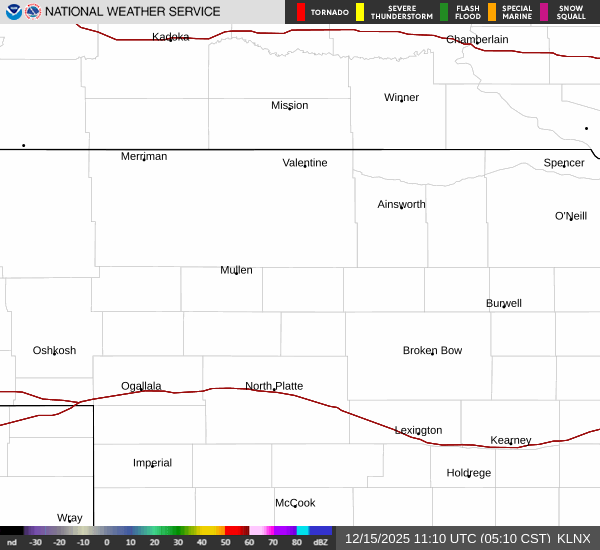
Current Radar Image
Sun Almanac for Venango, Nebraska
Sunrise: 06:03 AM
Sunset: 7:31 PM
Civil Sunrise:05:35 AM
Civil Sunset: 8:00 PM
Nautical Sunrise: 05:00 AM
Nautical Sunset: 8:34 PM
Astro Sunrise: 04:24 AM
Astro Sunset: 9:11 PM
Nebraska's Current Temperatures
 Nebraska's Satellite Image
 Nebraska's Current Wind Direction
| National Summary |
of upper and lower values of current conditions amongst 6568 locations
in the contiguous United States |
|
High
Temp |
79° |
Mcallen, Texas
and 1 other location
|
|
Low
Temp |
1° |
Imperial Beach NAS, California
|
|
Wind
Speed |
43mph |
Dodge City, Kansas
|
|
Wind
Gust |
56mph |
Garden City, Kansas
|
|
Wind
Chill |
-15° |
Perryton, Texas
|
|
High
Pressure |
30.80Hg |
Ottawa, Ohio
|
|
Low
Pressure |
29.71Hg |
Medicine Lake, Kansas
|
|
| # Locations Reporting Snow |
10 |
|
| # Locations Reporting Rain |
99 |
|
| # Locations Reporting Thunderstorms / Lightning |
3 |
|
| # Locations Reporting Fog |
33 |
|
| Average Temperature in the Contiguous USA |
52° |
|
Any use of the information on this page is at your own risk. This information should not be relied upon in life-threatening situations, potential financial loss situations or in lieu of any officially disseminated information. Visit the
National Weather Service for official information.