Tenmile, California Weather
No Watches or Warnings for Tenmile
Issued: 12:42 am PDT Apr 25, 2024 Latitude: 40.0709916 Longitude: -121.9505415 View on Google Maps
|
|
|
|
|
|
|
|
|
|
 |
 |
 |
 |
|
|
|
 |
| Low: °F |
High: °F |
High: °F |
High: °F |
High: °F |
High: °F |
High: °F |
High: °F |
| Low: °F |
Low: °F |
Low: °F |
Low: °F |
Low: °F |
Low: °F |
|
| Mostly Cloudy |
Thunderstorms |
Thunderstorms |
Sunny |
Sunny |
Sunny |
Sunny |
Mostly Sunny |
Current Conditions at
RED BLUFF - (KRBL)
57°
Cloudy
as of 1:54 AM PDST
Rel. Humidity: 76%
Dew Point: 50°F
Visibility: 10 Miles
Pressure: 30.01 in.
Flight Rule: VFR
Cloud Level(s): Broken at 6000ft, Solid Overcast at 7500ft
Current Conditions at
REDDING - (KRDD)
63°
Cloudy
as of 1:53 AM PDST
Rel. Humidity: 59%
Dew Point: 48°F
Visibility: 10 Miles
Pressure: 30.00 in.
Flight Rule: VFR
Cloud Level(s): Solid Overcast at 5500ft
Current Conditions at
OROVILLE - (KOVE)
57°
Clear
as of 1:53 AM PDST
Rel. Humidity: 67%
Dew Point: 46°F
Visibility: 10 Miles
Pressure: 30.04 in.
Flight Rule: VFR
Wind Data
5 MPH
120° Southeast
Cloud Level(s): Clear
Current Conditions at
MARYSVILLE - (KMYV)
54°
Clear
as of 1:53 AM PDST
Rel. Humidity: 76%
Dew Point: 46°F
Visibility: 10 Miles
Pressure: 30.03 in.
Flight Rule: VFR
Cloud Level(s): Clear
|
Overnight... Mostly cloudy, with a steady temperature around 55. South southeast wind around 7 mph. |
|
|
Thursday... A chance of showers, with thunderstorms also possible after 5pm. Mostly cloudy, with a high near 64. Light south wind increasing to 6 to 11 mph in the morning. Chance of precipitation is 30%. New rainfall amounts of less than a tenth of an inch, except higher amounts possible in thunderstorms. |
|
 |
Thursday Night... A chance of showers and thunderstorms before midnight, then a slight chance of showers after 4am. Mostly cloudy, with a low around 50. Southeast wind 5 to 8 mph becoming north in the evening. Chance of precipitation is 50%. New precipitation amounts of less than a tenth of an inch, except higher amounts possible in thunderstorms. |
|
|
Friday... A chance of showers, with thunderstorms also possible after 11am. Partly sunny, with a high near 64. South wind 5 to 10 mph becoming northwest in the afternoon. Chance of precipitation is 40%. New rainfall amounts of less than a tenth of an inch, except higher amounts possible in thunderstorms. |
|
 |
Friday Night... Mostly clear, with a low around 47. North wind 7 to 11 mph. |
|
|
Saturday... Sunny, with a high near 69. |
|
 |
Saturday Night... Partly cloudy, with a low around 50. |
|
|
Sunday... Sunny, with a high near 71. |
|
|
Sunday Night... Mostly clear, with a low around 51. |
|
|
Monday... Sunny, with a high near 72. |
|
 |
Monday Night... Clear, with a low around 52. |
|
|
Tuesday... Sunny, with a high near 74. |
|
|
Tuesday Night... Mostly clear, with a low around 51. |
|
|
Wednesday... Mostly sunny, with a high near 71. |
|
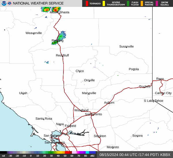
Current Radar Image
Sun Almanac for Tenmile, California
Sunrise: 06:14 AM
Sunset: 7:57 PM
Civil Sunrise:05:45 AM
Civil Sunset: 8:26 PM
Nautical Sunrise: 05:10 AM
Nautical Sunset: 9:01 PM
Astro Sunrise: 04:33 AM
Astro Sunset: 9:38 PM
California's Current Temperatures
 California's Satellite Image
 California's Current Wind Direction
| National Summary |
of upper and lower values of current conditions amongst 7066 locations
in the contiguous United States |
|
High
Temp |
79° |
Corpus Christi NAS, Texas
|
|
Low
Temp |
-36° |
Front Royal, Virginia
|
|
Wind
Speed |
28mph |
El Centro, California
and 1 other location
|
|
Wind
Gust |
38mph |
Daggett, California
|
|
Wind
Chill |
0° |
Frenchville, Maine
|
|
High
Pressure |
30.38Hg |
Rogers City, Michigan
|
|
Low
Pressure |
29.67Hg |
Forsyth, Montana
|
|
| # Locations Reporting Snow |
1 |
|
| # Locations Reporting Rain |
34 |
|
| # Locations Reporting Thunderstorms / Lightning |
8 |
|
| # Locations Reporting Fog |
16 |
|
| Average Temperature in the Contiguous USA |
50° |
|
Any use of the information on this page is at your own risk. This information should not be relied upon in life-threatening situations, potential financial loss situations or in lieu of any officially disseminated information. Visit the
National Weather Service for official information.