Tankersley, Texas Weather
Issued: 4:31 pm CDT Apr 19, 2024 Latitude: 31.3496077 Longitude: -100.6434325 View on Google Maps
|
|
|
|
|
|
|
|
|
|
 |
 |
 |
 |
 |
 |
|
|
| Low: °F |
High: °F |
High: °F |
High: °F |
High: °F |
High: °F |
High: °F |
High: °F |
| Low: °F |
Low: °F |
Low: °F |
Low: °F |
Low: °F |
Low: °F |
|
| Thunderstorms |
Thunderstorms |
Mostly Cloudy |
Mostly Sunny |
Sunny |
Partly Sunny |
Partly Sunny |
Mostly Sunny |
Current Conditions at
SAN ANGELO - (KSJT)
66°
Cloudy
as of 4:51 PM CDST
Rel. Humidity: 55%
Dew Point: 50°F
Visibility: 10 Miles
Pressure: 30.04 in.
Flight Rule: VFR
Wind Data
12 MPH
020° North
Cloud Level(s): Solid Overcast at 3400ft
Current Conditions at
SONORA - (KSOA)
75°
Clear
as of 5:35 PM CDST
Rel. Humidity: 50%
Dew Point: 55°F
Visibility: 10 Miles
Pressure: 30.03 in.
Flight Rule: VFR
Wind Data
13 MPH
040° Northeast
Cloud Level(s): Clear
Current Conditions at
SWEETWATER - (KSWW)
64°
Cloudy
as of 5:35 PM CDST
Rel. Humidity: 52%
Dew Point: 46°F
Visibility: 10 Miles
Pressure: 30.10 in.
Flight Rule: VFR
Current Conditions at
JUNCTION - (KJCT)
81°
Cloudy
as of 4:51 PM CDST
Rel. Humidity: 44%
Dew Point: 57°F
Visibility: 10 Miles
Pressure: 30.00 in.
Flight Rule: VFR
Cloud Level(s): Solid Overcast at 3100ft
|
Tonight... A chance of showers and thunderstorms between 1am and 4am, then showers likely and possibly a thunderstorm after 4am. Mostly cloudy, with a low around 55. East wind 5 to 10 mph. Chance of precipitation is 70%. New rainfall amounts between a tenth and quarter of an inch, except higher amounts possible in thunderstorms. |
|
|
Saturday... Showers and possibly a thunderstorm. High near 63. Northeast wind 10 to 15 mph, with gusts as high as 25 mph. Chance of precipitation is 90%. New rainfall amounts between a half and three quarters of an inch possible. |
|
 |
Saturday Night... Showers and thunderstorms likely before 4am, then a slight chance of showers. Cloudy, with a low around 45. North northeast wind 10 to 15 mph. Chance of precipitation is 60%. New rainfall amounts between a tenth and quarter of an inch, except higher amounts possible in thunderstorms. |
|
|
Sunday... Mostly cloudy, with a high near 63. Northeast wind around 10 mph. |
|
 |
Sunday Night... Partly cloudy, with a low around 43. East southeast wind 5 to 10 mph. |
|
|
Monday... Mostly sunny, with a high near 75. South southeast wind 5 to 15 mph. |
|
 |
Monday Night... Mostly clear, with a low around 53. Breezy, with a south wind 15 to 20 mph. |
|
|
Tuesday... Sunny, with a high near 86. Breezy, with a south southwest wind 15 to 20 mph, with gusts as high as 30 mph. |
|
|
Tuesday Night... Mostly clear, with a low around 59. South wind around 15 mph, with gusts as high as 25 mph. |
|
|
Wednesday... Partly sunny, with a high near 86. South southeast wind around 15 mph, with gusts as high as 20 mph. |
|
|
Wednesday Night... Partly cloudy, with a low around 63. |
|
|
Thursday... Partly sunny, with a high near 87. Breezy. |
|
 |
Thursday Night... A 20 percent chance of showers and thunderstorms. Mostly cloudy, with a low around 64. Breezy. |
|
|
Friday... Mostly sunny, with a high near 91. Breezy. |
|
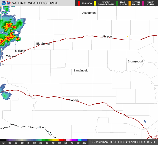
Current Radar Image
Sun Almanac for Tankersley, Texas
Sunrise: 07:09 AM
Sunset: 8:14 PM
Civil Sunrise:06:44 AM
Civil Sunset: 8:39 PM
Nautical Sunrise: 06:14 AM
Nautical Sunset: 9:09 PM
Astro Sunrise: 05:43 AM
Astro Sunset: 9:40 PM
Texas' Current Temperatures
 Texas' Satellite Image
 Texas' Current Wind Direction
| National Summary |
of upper and lower values of current conditions amongst 6993 locations
in the contiguous United States |
|
High
Temp |
95° |
Gila Bend (Aaf), Arizona
|
|
Low
Temp |
19° |
Perryton, Texas
and 1 other location
|
|
Wind
Speed |
36mph |
Rapid City, South Dakota
and 2 other locations
|
|
Wind
Gust |
47mph |
Rapid City, South Dakota
|
|
Wind
Chill |
14° |
Robertson Field, North Dakota
and 1 other location
|
|
Heat
Index |
101° |
Falfurrias, Texas
|
|
High
Pressure |
30.86Hg |
Ottawa, Ohio
|
|
Low
Pressure |
29.71Hg |
Thermal, California
|
|
| # Locations Reporting Snow |
34 |
|
| # Locations Reporting Rain |
35 |
|
| # Locations Reporting Thunderstorms / Lightning |
4 |
|
| # Locations Reporting Fog |
1 |
|
| Average Temperature in the Contiguous USA |
62° |
|
Any use of the information on this page is at your own risk. This information should not be relied upon in life-threatening situations, potential financial loss situations or in lieu of any officially disseminated information. Visit the
National Weather Service for official information.