Tamarack, Pennsylvania Weather
No Watches or Warnings for Tamarack
Issued: 7:00 pm EDT Apr 18, 2024 Latitude: 41.4245101 Longitude: -77.8483258 View on Google Maps
|
|
|
|
|
|
|
|
|
|
 |
 |
 |
|
 |
|
|
|
| Low: °F |
High: °F |
High: °F |
High: °F |
High: °F |
High: °F |
High: °F |
High: °F |
| Low: °F |
Low: °F |
Low: °F |
Low: °F |
Low: °F |
Low: °F |
|
| Morning Fog |
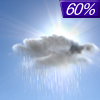
Rain |
Partly Sunny |
Partly Sunny |
Sunny |
Partly Sunny |
Partly Sunny |
Sunny |
Current Conditions at
CLEARFIELD - (KFIG)
61°
Clear
as of 7:54 PM EDST
Rel. Humidity: 55%
Dew Point: 45°F
Visibility: 10 Miles
Pressure: 30.06 in.
Flight Rule: VFR
Cloud Level(s): Clear
Current Conditions at
UNIVERSITY PARK - (KUNV)
63°
Clear
as of 7:53 PM EDST
Rel. Humidity: 51%
Dew Point: 45°F
Visibility: 10 Miles
Pressure: 30.06 in.
Flight Rule: VFR
Wind Data
5 MPH
300° Northwest
Cloud Level(s): Clear
Current Conditions at
WELLSVILLE MUNI - (KELZ)
52°
Clear
as of 7:56 PM EDST
Rel. Humidity: 76%
Dew Point: 45°F
Visibility: 10 Miles
Pressure: 30.08 in.
Flight Rule: VFR
Cloud Level(s): Clear
Current Conditions at
JOHNSTOWN - (KJST)
57°
Clear
as of 7:54 PM EDST
Rel. Humidity: 62%
Dew Point: 45°F
Visibility: 10 Miles
Pressure: 30.07 in.
Flight Rule: VFR
Cloud Level(s): Clear
|
Tonight... Patchy fog between 2am and 3am. Otherwise, mostly cloudy, with a low around 47. Calm wind becoming southeast 5 to 8 mph after midnight. |
|
|
Friday... Showers, mainly after 2pm. High near 59. South wind 11 to 16 mph, with gusts as high as 24 mph. Chance of precipitation is 80%. New precipitation amounts of less than a tenth of an inch possible. |
|
 |
Friday Night... Showers likely, mainly before 10pm. Cloudy, then gradually becoming partly cloudy, with a low around 41. West wind around 9 mph. Chance of precipitation is 60%. New precipitation amounts of less than a tenth of an inch possible. |
|
|
Saturday... A slight chance of showers after 11am. Partly sunny, with a high near 55. Breezy, with a west wind 10 to 20 mph, with gusts as high as 33 mph. Chance of precipitation is 20%. |
|
 |
Saturday Night... Widespread frost after 3am. Otherwise, mostly clear, with a low around 33. Northwest wind 11 to 16 mph becoming light west after midnight. Winds could gust as high as 25 mph. |
|
|
Sunday... Widespread frost before 7am. Otherwise, partly sunny, with a high near 53. |
|
|
Sunday Night... Widespread frost, mainly after 3am. Otherwise, mostly clear, with a low around 33. |
|
|
Monday... Widespread frost, mainly before 7am. Otherwise, sunny, with a high near 61. |
|
|
Monday Night... Mostly clear, with a low around 38. |
|
|
Tuesday... A chance of showers after 2pm. Partly sunny, with a high near 63. Chance of precipitation is 40%. |
|
 |
Tuesday Night... Showers. Low around 43. Chance of precipitation is 80%. |
|
|
Wednesday... Showers likely. Partly sunny, with a high near 54. Chance of precipitation is 60%. |
|
|
Wednesday Night... Mostly clear, with a low around 32. |
|
|
Thursday... Sunny, with a high near 57. |
|
Current Radar Image
Sun Almanac for Tamarack, Pennsylvania
Sunrise: 06:26 AM
Sunset: 7:55 PM
Civil Sunrise:05:57 AM
Civil Sunset: 8:24 PM
Nautical Sunrise: 05:22 AM
Nautical Sunset: 8:59 PM
Astro Sunrise: 04:45 AM
Astro Sunset: 9:36 PM
Pennsylvania's Current Temperatures
 Pennsylvania's Satellite Image
 Pennsylvania's Current Wind Direction
| National Summary |
of upper and lower values of current conditions amongst 6366 locations
in the contiguous United States |
|
High
Temp |
99° |
Junction, Texas
|
|
Low
Temp |
21° |
Perryton, Texas
|
|
Wind
Speed |
33mph |
Hettinger, North Dakota
and 1 other location
|
|
Wind
Gust |
47mph |
Springfield, Illinois
|
|
Wind
Chill |
7° |
Perryton, Texas
|
|
Heat
Index |
100° |
Del Rio, Texas
|
|
High
Pressure |
30.34Hg |
Cutbank, Montana
and 1 other location
|
|
Low
Pressure |
29.75Hg |
Bullhead City, Arizona
|
|
| # Locations Reporting Snow |
11 |
|
| # Locations Reporting Rain |
75 |
|
| # Locations Reporting Thunderstorms / Lightning |
13 |
|
| Average Temperature in the Contiguous USA |
62° |
|
Any use of the information on this page is at your own risk. This information should not be relied upon in life-threatening situations, potential financial loss situations or in lieu of any officially disseminated information. Visit the
National Weather Service for official information.


