No Watches or Warnings for Swansea
Issued: 1:20 am MST Apr 19, 2024 Latitude: 34.1700198 Longitude: -113.846049 View on Google Maps
|
|
|
|
|
|
|
|
|
|
 |
 |
|
|
|
|
|
|
| Low: °F |
High: °F |
High: °F |
High: °F |
High: °F |
High: °F |
High: °F |
High: °F |
| Low: °F |
Low: °F |
Low: °F |
Low: °F |
Low: °F |
Low: °F |
|
| Mostly Clear |
Sunny |
Sunny |
Sunny |
Sunny |
Sunny |
Sunny |
Sunny |
Current Conditions at
NEEDLES - (KEED)
73°
Clear
as of 1:56 AM PDST
Rel. Humidity: 17%
Dew Point: 27°F
Visibility: 10 Miles
Pressure: 29.80 in.
Flight Rule: VFR
Wind Data
6 MPH
240° Southwest
Cloud Level(s): Clear
Current Conditions at
BLYTHE - (KBLH)
72°
Clear
as of 1:52 AM PDST
Rel. Humidity: 26%
Dew Point: 36°F
Visibility: 10 Miles
Pressure: 29.79 in.
Flight Rule: VFR
Wind Data
10 MPH
190° South
Cloud Level(s): Clear
Current Conditions at
BULLHEAD CITY - (KIFP)
70°
Clear
as of 3:30 AM MDST
Rel. Humidity: 15%
Dew Point: 21°F
Visibility: 10 Miles
Pressure: 29.79 in.
Flight Rule: VFR
Cloud Level(s): Clear
Current Conditions at
KINGMAN - (KIGM)
57°
Clear
as of 2:51 AM MDST
Rel. Humidity: 26%
Dew Point: 23°F
Visibility: 10 Miles
Pressure: 29.93 in.
Flight Rule: VFR
Wind Data
7 MPH
120° Southeast
Cloud Level(s): Clear
|
Overnight... Mostly clear, with a low around 61. East southeast wind around 5 mph. |
|
|
Friday... Sunny, with a high near 89. East wind 5 to 10 mph becoming southwest in the afternoon. |
|
|
Friday Night... Mostly clear, with a low around 62. West southwest wind 5 to 10 mph becoming southeast after midnight. |
|
|
Saturday... Sunny, with a high near 90. East southeast wind 5 to 10 mph. |
|
|
Saturday Night... Mostly clear, with a low around 65. Southwest wind around 5 mph becoming east after midnight. |
|
|
Sunday... Sunny, with a high near 94. East wind 5 to 10 mph becoming west southwest in the afternoon. |
|
|
Sunday Night... Mostly clear, with a low around 66. West southwest wind 5 to 10 mph becoming east after midnight. |
|
|
Monday... Sunny, with a high near 94. Breezy, with an east wind 5 to 15 mph becoming south southwest in the afternoon. Winds could gust as high as 20 mph. |
|
 |
Monday Night... Clear, with a low around 64. Breezy, with a south southwest wind 5 to 15 mph becoming east southeast after midnight. Winds could gust as high as 20 mph. |
|
|
Tuesday... Sunny, with a high near 89. Breezy, with a southeast wind 10 to 15 mph becoming south southwest in the afternoon. Winds could gust as high as 25 mph. |
|
|
Tuesday Night... Clear, with a low around 61. Breezy, with a south southwest wind 5 to 15 mph becoming southeast after midnight. Winds could gust as high as 25 mph. |
|
|
Wednesday... Sunny, with a high near 86. Breezy, with a southeast wind 10 to 15 mph, with gusts as high as 25 mph. |
|
|
Wednesday Night... Mostly clear, with a low around 58. Breezy, with a southwest wind 10 to 15 mph, with gusts as high as 25 mph. |
|
|
Thursday... Sunny, with a high near 80. Breezy, with a southwest wind 10 to 15 mph, with gusts as high as 25 mph. |
|
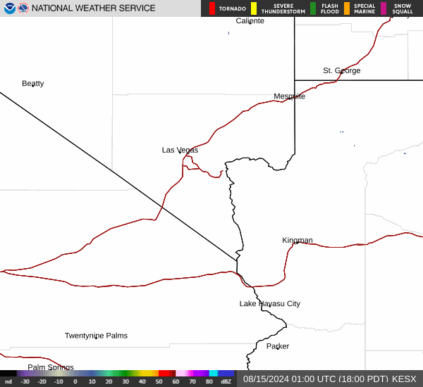
Current Radar Image
Sun Almanac for Swansea, Arizona
Sunrise: 06:58 AM
Sunset: 8:10 PM
Civil Sunrise:06:32 AM
Civil Sunset: 8:36 PM
Nautical Sunrise: 06:01 AM
Nautical Sunset: 9:07 PM
Astro Sunrise: 05:29 AM
Astro Sunset: 9:40 PM
Arizona's Current Temperatures
 Arizona's Satellite Image
 Arizona's Current Wind Direction
| National Summary |
of upper and lower values of current conditions amongst 6565 locations
in the contiguous United States |
|
High
Temp |
77° |
Port Isabel, Texas
and 2 other locations
|
|
Low
Temp |
-35° |
Front Royal, Virginia
|
|
Wind
Speed |
26mph |
Stanley Municipal A/P, North Dakota
|
|
Wind
Gust |
35mph |
Minot AFB, North Dakota
and 3 other locations
|
|
Wind
Chill |
3° |
Garrison, North Dakota
and 2 other locations
|
|
High
Pressure |
30.40Hg |
Cutbank, Montana
and 1 other location
|
|
Low
Pressure |
29.76Hg |
Monroe, Michigan
|
|
| # Locations Reporting Snow |
15 |
|
| # Locations Reporting Rain |
67 |
|
| # Locations Reporting Thunderstorms / Lightning |
4 |
|
| # Locations Reporting Fog |
8 |
|
| Average Temperature in the Contiguous USA |
49° |
|
Any use of the information on this page is at your own risk. This information should not be relied upon in life-threatening situations, potential financial loss situations or in lieu of any officially disseminated information. Visit the
National Weather Service for official information.