Smithfield, Nebraska Weather
Issued: 6:45 am CDT Apr 20, 2024 Latitude: 40.5725064 Longitude: -99.7423391 View on Google Maps
|
|
|
|
|
|
|
|
|
|
 |
 |
 |
|
 |
 |
 |
 |
| High: °F |
Low: °F |
High: °F |
High: °F |
High: °F |
High: °F |
High: °F |
High: °F |
| Low: °F |
Low: °F |
Low: °F |
Low: °F |
Low: °F |
|
| Rain & Snow |
Rain |
Mostly Sunny |
Mostly Sunny |
Sunny |
Partly Sunny |
Thunderstorms |
Thunderstorms |
Current Conditions at
LEXINGTON - (KLXN)
32°
Partly Cloudy
as of 7:55 AM CDST
Rel. Humidity: 68%
Dew Point: 23°F
Visibility: 10 Miles
Pressure: 30.44 in.
Flight Rule: VFR
Cloud Level(s): Scattered at 12000ft
Current Conditions at
BREWSTER FIELD - (KHDE)
32°
Partly Cloudy
as of 7:55 AM CDST
Rel. Humidity: 68%
Dew Point: 23°F
Visibility: 10 Miles
Pressure: 30.43 in.
Flight Rule: VFR
Cloud Level(s): Scattered at 11000ft
Current Conditions at
KEARNEY - (KEAR)
30°
Clear
as of 7:56 AM CDST
Rel. Humidity: 68%
Dew Point: 21°F
Visibility: 10 Miles
Pressure: 30.45 in.
Flight Rule: VFR
Wind Data
7 MPH
330° Northwest
Cloud Level(s): Clear
Current Conditions at
MCCOOK - (KMCK)
36°
Cloudy
as of 7:53 AM CDST
Rel. Humidity: 55%
Dew Point: 21°F
Visibility: 10 Miles
Pressure: 30.44 in.
Flight Rule: VFR
Cloud Level(s): Solid Overcast at 3100ft
|
Today... A chance of snow showers before 3pm, then a slight chance of rain and snow showers. Cloudy, with a high near 47. North northwest wind around 5 mph. Chance of precipitation is 30%. Little or no snow accumulation expected. |
|
|
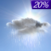
Tonight... A 20 percent chance of showers before 10pm. Widespread frost after 2am. Otherwise, cloudy, then gradually becoming partly cloudy, with a low around 28. West northwest wind 5 to 10 mph. |
|
|
Sunday... Widespread frost, mainly before 9am. Otherwise, mostly sunny, with a high near 61. West wind 5 to 10 mph becoming south southwest in the afternoon. |
|
 |
Sunday Night... Mostly clear, with a low around 38. Breezy, with a south wind 10 to 20 mph, with gusts as high as 30 mph. |
|
|
Monday... Mostly sunny, with a high near 75. Breezy, with a south wind 15 to 20 mph becoming northwest in the afternoon. Winds could gust as high as 30 mph. |
|
 |
Monday Night... A chance of showers before 10pm, then a chance of showers and thunderstorms between 10pm and 4am, then a chance of showers after 4am. Partly cloudy, with a low around 42. Chance of precipitation is 40%. New rainfall amounts of less than a tenth of an inch, except higher amounts possible in thunderstorms. |
|
|
Tuesday... Sunny, with a high near 66. |
|
 |
Tuesday Night... A 20 percent chance of showers after 1am. Partly cloudy, with a low around 38. |
|
|
Wednesday... A 20 percent chance of showers before 1pm. Partly sunny, with a high near 66. |
|
 |
Wednesday Night... A 40 percent chance of showers and thunderstorms after 1am. Mostly cloudy, with a low around 46. |
|
|
Thursday... A 50 percent chance of showers and thunderstorms. Partly sunny, with a high near 71. Breezy. |
|
 |
Thursday Night... Showers likely and possibly a thunderstorm. Mostly cloudy, with a low around 51. Breezy. Chance of precipitation is 60%. |
|
|
Friday... A 40 percent chance of showers and thunderstorms. Mostly sunny, with a high near 74. |
|
Current Radar Image
Sun Almanac for Smithfield, Nebraska
Sunrise: 06:52 AM
Sunset: 8:24 PM
Civil Sunrise:06:23 AM
Civil Sunset: 8:53 PM
Nautical Sunrise: 05:48 AM
Nautical Sunset: 9:27 PM
Astro Sunrise: 05:11 AM
Astro Sunset: 10:04 PM
Nebraska's Current Temperatures
 Nebraska's Satellite Image
 Nebraska's Current Wind Direction
| National Summary |
of upper and lower values of current conditions amongst 7088 locations
in the contiguous United States |
|
High
Temp |
81° |
Fort Lauderdale Intl, Florida
and 3 other locations
|
|
Low
Temp |
-18° |
Front Royal, Virginia
|
|
Wind
Speed |
29mph |
Hampton, Iowa
|
|
Wind
Gust |
38mph |
Big Spring, Texas
and 1 other location
|
|
Wind
Chill |
6° |
Stanley Municipal A/P, North Dakota
and 1 other location
|
|
High
Pressure |
30.46Hg |
Hebron, Nebraska
and 3 other locations
|
|
Low
Pressure |
29.77Hg |
Frenchville, Maine
|
|
| # Locations Reporting Snow |
35 |
|
| # Locations Reporting Rain |
117 |
|
| # Locations Reporting Thunderstorms / Lightning |
15 |
|
| # Locations Reporting Fog |
23 |
|
| Average Temperature in the Contiguous USA |
49° |
|
Any use of the information on this page is at your own risk. This information should not be relied upon in life-threatening situations, potential financial loss situations or in lieu of any officially disseminated information. Visit the
National Weather Service for official information.


