Seneca, California Weather
No Watches or Warnings for Seneca
Issued: 12:52 am PDT Apr 24, 2024 Latitude: 40.110444 Longitude: -121.084682 View on Google Maps
|
|
|
|
|
|
|
|
|
|
 |
 |
 |
 |
|
 |
|
|
| Low: °F |
High: °F |
High: °F |
High: °F |
High: °F |
High: °F |
High: °F |
High: °F |
| Low: °F |
Low: °F |
Low: °F |
Low: °F |
Low: °F |
Low: °F |
|
| Cloudy |
Mostly Sunny |
Partly Sunny |
Thunderstorms |
Mostly Sunny |
Sunny |
Sunny |
Sunny |
Current Conditions at
OROVILLE - (KOVE)
59°
Mostly Cloudy
as of 11:53 PM PDST
Rel. Humidity: 62%
Dew Point: 46°F
Visibility: 10 Miles
Pressure: 30.04 in.
Flight Rule: VFR
Wind Data
6 MPH
120° Southeast
Cloud Level(s): Broken at 5000ft
Current Conditions at
BLUE CANYON - (KBLU)
45°
Cloudy
Fog
as of 12:43 AM PDST
Rel. Humidity: 93%
Dew Point: 43°F
Visibility: 1/4 Miles
Pressure: 30.08 in.
Flight Rule: LIFR
Cloud Level(s): Broken at 400ft, Solid Overcast at 900ft
Current Conditions at
RED BLUFF - (KRBL)
63°
Cloudy
as of 11:54 PM PDST
Rel. Humidity: 59%
Dew Point: 48°F
Visibility: 10 Miles
Pressure: 30.01 in.
Flight Rule: VFR
Wind Data
6 MPH
150° Southeast
Cloud Level(s): Solid Overcast at 5000ft
Current Conditions at
REDDING - (KRDD)
64°
Cloudy
as of 11:53 PM PDST
Rel. Humidity: 55%
Dew Point: 48°F
Visibility: 10 Miles
Pressure: 29.99 in.
Flight Rule: VFR
Cloud Level(s): Solid Overcast at 4600ft
|
Overnight... Partly cloudy, with a low around 43. Light and variable wind. |
|
|
Wednesday... Mostly sunny, with a high near 58. Light and variable wind becoming west southwest 5 to 10 mph in the morning. |
|
|
Wednesday Night... Partly cloudy, with a low around 42. West southwest wind 5 to 9 mph becoming light after midnight. |
|
|
Thursday... A 30 percent chance of showers after 11am. Partly sunny, with a high near 51. Light west southwest wind becoming southwest 9 to 14 mph in the morning. Winds could gust as high as 21 mph. New precipitation amounts of less than a tenth of an inch possible. |
|
 |
Thursday Night... Showers likely, mainly before 11pm. Mostly cloudy, with a low around 41. Southwest wind 7 to 14 mph, with gusts as high as 20 mph. Chance of precipitation is 70%. |
|
|
Friday... Showers likely, with thunderstorms also possible after 11am. Mostly cloudy, with a high near 49. Chance of precipitation is 70%. |
|
|
Friday Night... Partly cloudy, with a low around 34. |
|
|
Saturday... Mostly sunny, with a high near 56. |
|
|
Saturday Night... Partly cloudy, with a low around 38. |
|
|
Sunday... Sunny, with a high near 59. |
|
 |
Sunday Night... Mostly clear, with a low around 40. |
|
|
Monday... Sunny, with a high near 60. |
|
|
Monday Night... Mostly clear, with a low around 37. |
|
|
Tuesday... Sunny, with a high near 60. |
|
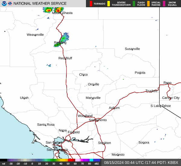
Current Radar Image
Sun Almanac for Seneca, California
Sunrise: 06:12 AM
Sunset: 7:53 PM
Civil Sunrise:05:43 AM
Civil Sunset: 8:21 PM
Nautical Sunrise: 05:08 AM
Nautical Sunset: 8:56 PM
Astro Sunrise: 04:31 AM
Astro Sunset: 9:34 PM
California's Current Temperatures
 California's Satellite Image
 California's Current Wind Direction
| National Summary |
of upper and lower values of current conditions amongst 7019 locations
in the contiguous United States |
|
High
Temp |
82° |
Phoenix, Arizona
|
|
Low
Temp |
-33° |
Front Royal, Virginia
|
|
Wind
Speed |
28mph |
Alpha, Wyoming
|
|
Wind
Gust |
37mph |
Alpha, Wyoming
|
|
Wind
Chill |
-16° |
Imperial BeachNAS, California
|
|
High
Pressure |
30.46Hg |
Salida Mountain, Colorado
|
|
Low
Pressure |
29.70Hg |
Ogdensburg Intl, New York
|
|
| # Locations Reporting Snow |
3 |
|
| # Locations Reporting Rain |
43 |
|
| # Locations Reporting Fog |
17 |
|
| Average Temperature in the Contiguous USA |
51° |
|
Any use of the information on this page is at your own risk. This information should not be relied upon in life-threatening situations, potential financial loss situations or in lieu of any officially disseminated information. Visit the
National Weather Service for official information.