Selwyn, California Weather
No Watches or Warnings for Selwyn
Issued: 1:05 pm PDT Apr 19, 2024 Latitude: 32.8636585 Longitude: -117.1917015 View on Google Maps
|
|
|
|
|
|
|
|
|
|
 |
 |
 |
|
|
|
|
 |
| Low: °F |
High: °F |
High: °F |
High: °F |
High: °F |
High: °F |
High: °F |
High: °F |
| Low: °F |
Low: °F |
Low: °F |
Low: °F |
Low: °F |
Low: °F |
|
| Mostly Cloudy |
Mostly Cloudy |
Morning Fog |
Morning Fog |
Morning Fog |
Morning Fog |
Patchy Fog |
Rain |
Current Conditions at
MIRAMAR MCAS - (KNKX)
61°
Clear
as of 5:55 PM PDST
Rel. Humidity: 72%
Dew Point: 52°F
Visibility: 10 Miles
Pressure: 29.94 in.
Flight Rule: VFR
Cloud Level(s): Clear
Current Conditions at
SAN DIEGO MONTGOMERY - (KMYF)
63°
Clear
as of 5:53 PM PDST
Rel. Humidity: 63%
Dew Point: 50°F
Visibility: 10 Miles
Pressure: 29.95 in.
Flight Rule: VFR
Cloud Level(s): Clear
Current Conditions at
SAN DIEGO INTL - (KSAN)
64°
Partly Cloudy
as of 5:51 PM PDST
Rel. Humidity: 63%
Dew Point: 52°F
Visibility: 10 Miles
Pressure: 29.96 in.
Flight Rule: VFR
Cloud Level(s): Scattered at 2500ft
Current Conditions at
NORTH ISLAND NAS - (KNZY)
63°
Partly Cloudy
as of 5:52 PM PDST
Rel. Humidity: 67%
Dew Point: 52°F
Visibility: 10 Miles
Pressure: 29.94 in.
Flight Rule: VFR
Cloud Level(s): Scattered at 2400ft
|
Tonight... Mostly cloudy, with a low around 53. West wind around 5 mph becoming calm in the evening. |
|
|
Saturday... Mostly cloudy, then gradually becoming sunny, with a high near 68. Light west wind increasing to 5 to 10 mph in the morning. |
|
 |
Saturday Night... Patchy fog after 11pm. Otherwise, mostly cloudy, with a low around 53. West wind around 5 mph becoming calm in the evening. |
|
|
Sunday... Patchy fog before 11am. Otherwise, mostly cloudy, then gradually becoming sunny, with a high near 72. North wind 5 to 10 mph becoming west in the afternoon. |
|
|
Sunday Night... Increasing clouds, with a low around 55. West wind around 5 mph becoming calm in the evening. |
|
|
Monday... Patchy fog before 11am. Otherwise, partly sunny, with a high near 70. |
|
|
Monday Night... Patchy fog after 11pm. Otherwise, mostly cloudy, with a low around 55. |
|
|
Tuesday... Patchy fog before 11am. Otherwise, cloudy through mid morning, then gradual clearing, with a high near 67. |
|
|
Tuesday Night... Patchy fog after 11pm. Otherwise, increasing clouds, with a low around 53. |
|
|
Wednesday... Patchy fog before 11am. Otherwise, partly sunny, with a high near 66. |
|
|
Wednesday Night... Patchy fog. Otherwise, mostly cloudy, with a low around 53. |
|
|
Thursday... Patchy fog. Otherwise, partly sunny, with a high near 65. |
|
 |
Thursday Night... A slight chance of showers. Patchy fog. Otherwise, mostly cloudy, with a low around 53. |
|
|
Friday... A slight chance of showers. Patchy fog. Otherwise, mostly cloudy, with a high near 65. |
|
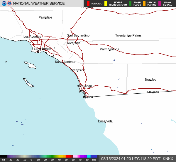
Current Radar Image
Sun Almanac for Selwyn, California
Sunrise: 06:13 AM
Sunset: 7:22 PM
Civil Sunrise:05:48 AM
Civil Sunset: 7:48 PM
Nautical Sunrise: 05:17 AM
Nautical Sunset: 8:18 PM
Astro Sunrise: 04:46 AM
Astro Sunset: 8:50 PM
California's Current Temperatures
 California's Satellite Image
 California's Current Wind Direction
| National Summary |
of upper and lower values of current conditions amongst 6887 locations
in the contiguous United States |
|
High
Temp |
93° |
Gila Bend (Aaf), Arizona
|
|
Low
Temp |
-33° |
Front Royal, Virginia
|
|
Wind
Speed |
28mph |
Rapid City, South Dakota
|
|
Wind
Gust |
40mph |
Waukesha, Wisconsin
and 2 other locations
|
|
Wind
Chill |
14° |
Bemidji, Minnesota
|
|
Heat
Index |
95° |
Laredo AFB, Texas
|
|
High
Pressure |
30.46Hg |
Havre, Montana
|
|
Low
Pressure |
29.68Hg |
Bullhead City, Arizona
|
|
| # Locations Reporting Snow |
35 |
|
| # Locations Reporting Rain |
26 |
|
| # Locations Reporting Thunderstorms / Lightning |
1 |
|
| # Locations Reporting Fog |
2 |
|
| Average Temperature in the Contiguous USA |
58° |
|
Any use of the information on this page is at your own risk. This information should not be relied upon in life-threatening situations, potential financial loss situations or in lieu of any officially disseminated information. Visit the
National Weather Service for official information.