Placerville, California Weather
No Watches or Warnings for Placerville
Issued: 12:41 pm PDT Apr 25, 2024 Latitude: 38.7296252 Longitude: -120.798546 View on Google Maps
|
|
|
|
|
|
|
|
|
|
 |
 |
 |
|
|
|
|
|
| Low: °F |
High: °F |
High: °F |
High: °F |
High: °F |
High: °F |
High: °F |
High: °F |
| Low: °F |
Low: °F |
Low: °F |
Low: °F |
Low: °F |
Low: °F |
|
| Rain |
Thunderstorms |
Sunny |
Sunny |
Sunny |
Sunny |
Sunny |
Sunny |
Current Conditions at
AUBURN - (KAUN)
63°
Mostly Cloudy
as of 2:35 PM PDST
Rel. Humidity: 59%
Dew Point: 48°F
Visibility: 9 Miles
Pressure: 30.06 in.
Flight Rule: VFR
Wind Data
12 MPH
190° South
Cloud Level(s): Scattered at 2800ft, Scattered at 3300ft, Broken at 3800ft
Current Conditions at
MATHER AFB - (KMHR)
68°
Mostly Clear
as of 2:35 PM PDST
Rel. Humidity: 49%
Dew Point: 48°F
Visibility: 10 Miles
Pressure: 30.03 in.
Flight Rule: VFR
Wind Data
14 MPH
220° Southwest
Cloud Level(s): Few at 4000ft
Current Conditions at
MCCLELLAN AFB - (KMCC)
68°
Clear
as of 2:35 PM PDST
Rel. Humidity: 45%
Dew Point: 46°F
Visibility: 10 Miles
Pressure: 30.03 in.
Flight Rule: VFR
Wind Data
15 MPH
220° Southwest
Cloud Level(s): Clear
Current Conditions at
BLUE CANYON - (KBLU)
46°
Cloudy
as of 2:34 PM PDST
Rel. Humidity: 75%
Dew Point: 39°F
Visibility: 10 Miles
Pressure: 30.09 in.
Flight Rule: MVFR
Wind Data
8 MPH
230° Southwest
Cloud Level(s): Broken at 1400ft, Solid Overcast at 4100ft
|
Tonight... A 50 percent chance of showers, mainly after 8pm. Increasing clouds, with a low around 46. South wind 6 to 9 mph. New precipitation amounts between a tenth and quarter of an inch possible. |
|
|
Friday... A chance of showers and thunderstorms before 1pm, then showers likely and possibly a thunderstorm between 1pm and 5pm, then a chance of showers and thunderstorms after 5pm. Mostly cloudy, with a high near 59. South wind 5 to 7 mph becoming west southwest in the afternoon. Chance of precipitation is 60%. New rainfall amounts between a quarter and half of an inch possible. |
|
 |
Friday Night... Partly cloudy, with a low around 42. West northwest wind around 6 mph becoming calm in the evening. |
|
|
Saturday... Sunny, with a high near 65. Calm wind becoming west 5 to 8 mph in the afternoon. |
|
|
Saturday Night... Partly cloudy, with a low around 46. West wind 5 to 7 mph becoming calm in the evening. |
|
|
Sunday... Sunny, with a high near 69. |
|
 |
Sunday Night... Clear, with a low around 46. |
|
|
Monday... Sunny, with a high near 71. |
|
|
Monday Night... Clear, with a low around 50. |
|
|
Tuesday... Sunny, with a high near 74. |
|
 |
Tuesday Night... Mostly clear, with a low around 51. |
|
|
Wednesday... Sunny, with a high near 74. |
|
|
Wednesday Night... Mostly clear, with a low around 48. |
|
|
Thursday... Sunny, with a high near 69. |
|
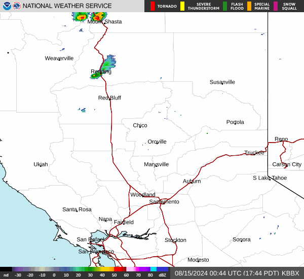
Current Radar Image
Sun Almanac for Placerville, California
Sunrise: 06:12 AM
Sunset: 7:50 PM
Civil Sunrise:05:44 AM
Civil Sunset: 8:18 PM
Nautical Sunrise: 05:10 AM
Nautical Sunset: 8:53 PM
Astro Sunrise: 04:33 AM
Astro Sunset: 9:29 PM
California's Current Temperatures
 California's Satellite Image
 California's Current Wind Direction
| National Summary |
of upper and lower values of current conditions amongst 7057 locations
in the contiguous United States |
|
High
Temp |
95° |
Pecos, Texas
|
|
Low
Temp |
30° |
Berthoud Pass, Colorado
|
|
Wind
Speed |
38mph |
Hallock, Minnesota
|
|
Wind
Gust |
61mph |
Kansas City, Missouri
|
|
Wind
Chill |
22° |
Pagosa Springs, Colorado
|
|
Heat
Index |
98° |
Falfurrias, Texas
and 1 other location
|
|
High
Pressure |
30.39Hg |
Williamson/Sodus, New York
|
|
Low
Pressure |
29.54Hg |
Lamar, Colorado
and 1 other location
|
|
| # Locations Reporting Rain |
93 |
|
| # Locations Reporting Thunderstorms / Lightning |
9 |
|
| Average Temperature in the Contiguous USA |
66° |
|
Any use of the information on this page is at your own risk. This information should not be relied upon in life-threatening situations, potential financial loss situations or in lieu of any officially disseminated information. Visit the
National Weather Service for official information.