Matternville, Pennsylvania Weather
No Watches or Warnings for Matternville
Issued: 5:47 pm EDT Apr 19, 2024 Latitude: 40.8306154 Longitude: -77.9658376 View on Google Maps
|
|
|
|
|
|
|
|
|
|
 |
 |
 |
 |
|
 |
|
|
| Low: °F |
High: °F |
High: °F |
High: °F |
High: °F |
High: °F |
High: °F |
High: °F |
| Low: °F |
Low: °F |
Low: °F |
Low: °F |
Low: °F |
Low: °F |
|
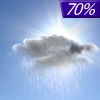
| Rain |
Increasing Clouds |
Mostly Sunny |
Sunny |
Mostly Sunny |
Partly Sunny |
Sunny |
Sunny |
Current Conditions at
UNIVERSITY PARK - (KUNV)
52°
Cloudy
as of 5:53 PM EDST
Rel. Humidity: 100%
Dew Point: 52°F
Visibility: 7 Miles
Pressure: 29.97 in.
Flight Rule: MVFR
Cloud Level(s): Solid Overcast at 1100ft
Current Conditions at
CLEARFIELD - (KFIG)
55°
Cloudy
Mist
as of 6:09 PM EDST
Rel. Humidity: 93%
Dew Point: 54°F
Visibility: 3 Miles
Pressure: 29.94 in.
Flight Rule: IFR
Cloud Level(s): Solid Overcast at 600ft
Current Conditions at
ALTOONA - (KAOO)
55°
Cloudy
as of 5:53 PM EDST
Rel. Humidity: 82%
Dew Point: 50°F
Visibility: 8 Miles
Pressure: 29.96 in.
Flight Rule: MVFR
Wind Data
10 MPH
150° Southeast
Cloud Level(s): Solid Overcast at 1100ft
Current Conditions at
DUBOIS - (KDUJ)
61°
Mostly Cloudy
as of 6:22 PM EDST
Rel. Humidity: 63%
Dew Point: 48°F
Visibility: 10 Miles
Pressure: 29.94 in.
Flight Rule: MVFR
Cloud Level(s): Scattered at 2400ft, Broken at 3000ft, Broken at 5500ft
|
Tonight... Showers likely, mainly before 10pm. Cloudy, then gradually becoming partly cloudy, with a low around 42. South wind 5 to 9 mph becoming west in the evening. Chance of precipitation is 70%. New precipitation amounts of less than a tenth of an inch possible. |
|
|
Saturday... Increasing clouds, with a high near 54. West wind 8 to 17 mph, with gusts as high as 32 mph. |
|
 |
Saturday Night... Widespread frost after 4am. Otherwise, mostly clear, with a low around 32. Northwest wind 5 to 11 mph, with gusts as high as 20 mph. |
|
|
Sunday... Widespread frost before 7am. Otherwise, mostly sunny, with a high near 52. West wind 6 to 10 mph. |
|
|
Sunday Night... Areas of frost after 5am. Otherwise, mostly clear, with a low around 34. West wind 6 to 8 mph. |
|
|
Monday... Areas of frost between 7am and 8am. Otherwise, sunny, with a high near 56. |
|
|
Monday Night... Areas of frost after 2am. Otherwise, mostly clear, with a low around 35. |
|
|
Tuesday... Areas of frost before 7am. Otherwise, mostly sunny, with a high near 62. |
|
 |
Tuesday Night... Showers likely, mainly after 2am. Mostly cloudy, with a low around 45. Chance of precipitation is 70%. |
|
|
Wednesday... Showers likely, mainly before 2pm. Partly sunny, with a high near 56. Chance of precipitation is 60%. |
|
 |
Wednesday Night... A chance of showers. Mostly clear, with a low around 32. Chance of precipitation is 30%. |
|
|
Thursday... Sunny, with a high near 55. |
|
|
Thursday Night... Widespread frost. Otherwise, mostly clear, with a low around 32. |
|
|
Friday... Areas of frost. Otherwise, sunny, with a high near 61. |
|
Current Radar Image
Sun Almanac for Matternville, Pennsylvania
Sunrise: 06:26 AM
Sunset: 7:56 PM
Civil Sunrise:05:57 AM
Civil Sunset: 8:25 PM
Nautical Sunrise: 05:22 AM
Nautical Sunset: 8:59 PM
Astro Sunrise: 04:45 AM
Astro Sunset: 9:36 PM
Pennsylvania's Current Temperatures
 Pennsylvania's Satellite Image
 Pennsylvania's Current Wind Direction
| National Summary |
of upper and lower values of current conditions amongst 6990 locations
in the contiguous United States |
|
High
Temp |
95° |
Gila Bend (Aaf), Arizona
|
|
Low
Temp |
19° |
Perryton, Texas
|
|
Wind
Speed |
37mph |
Salida Mountain, Colorado
|
|
Wind
Gust |
47mph |
Rapid City, South Dakota
and 1 other location
|
|
Wind
Chill |
13° |
Thief River Falls, Minnesota
|
|
Heat
Index |
104° |
Falfurrias, Texas
|
|
High
Pressure |
30.47Hg |
Havre, Montana
|
|
Low
Pressure |
29.71Hg |
Thermal, California
|
|
| # Locations Reporting Snow |
36 |
|
| # Locations Reporting Rain |
34 |
|
| # Locations Reporting Thunderstorms / Lightning |
4 |
|
| # Locations Reporting Fog |
2 |
|
| Average Temperature in the Contiguous USA |
62° |
|
Any use of the information on this page is at your own risk. This information should not be relied upon in life-threatening situations, potential financial loss situations or in lieu of any officially disseminated information. Visit the
National Weather Service for official information.


