No Watches or Warnings for Logan
Issued: 5:23 am PDT Apr 23, 2024 Latitude: 37.6096792 Longitude: -115.3928043 View on Google Maps
|
|
|
|
|
|
|
|
|
|
 |
 |
|
 |
 |
|
|
|
| High: °F |
Low: °F |
High: °F |
High: °F |
High: °F |
High: °F |
High: °F |
High: °F |
| Low: °F |
Low: °F |
Low: °F |
Low: °F |
Low: °F |
|
| Sunny |
Mostly Clear |
Sunny |
Thunderstorms |
Thunderstorms |
Sunny |
Sunny |
Sunny |
Current Conditions at
INDIAN SPRINGS - (KINS)
59°
Clear
as of 4:55 AM PDST
Rel. Humidity: 26%
Dew Point: 25°F
Visibility: 10 Miles
Pressure: 29.82 in.
Flight Rule: VFR
Cloud Level(s): Clear
Current Conditions at
MERCURY - (KDRA)
59°
Clear
as of 4:53 AM PDST
Rel. Humidity: 28%
Dew Point: 27°F
Visibility: 10 Miles
Pressure: 29.81 in.
Flight Rule: VFR
Wind Data
3 MPH
030° Northeast
Cloud Level(s): Clear
|
Today... Sunny, with a high near 70. Breezy, with a west southwest wind 8 to 13 mph becoming south 17 to 22 mph in the afternoon. |
|
|
Tonight... Mostly clear, with a low around 48. West southwest wind 15 to 20 mph decreasing to 7 to 12 mph after midnight. |
|
|
Wednesday... Sunny, with a high near 66. Breezy, with an east southeast wind 6 to 11 mph becoming south 18 to 23 mph in the afternoon. |
|
|
Wednesday Night... Mostly clear, with a low around 44. South southwest wind 15 to 20 mph decreasing to 8 to 13 mph after midnight. Winds could gust as high as 26 mph. |
|
|
Thursday... A 20 percent chance of showers and thunderstorms after 11am. Mostly sunny, with a high near 61. West southwest wind 7 to 12 mph increasing to 15 to 20 mph in the afternoon. Winds could gust as high as 26 mph. |
|
 |
Thursday Night... A 30 percent chance of showers and thunderstorms, mainly after 11pm. Mostly cloudy, with a low around 44. |
|
|
Friday... A chance of showers, then showers likely and possibly a thunderstorm after 11am. Mostly cloudy, with a high near 54. Chance of precipitation is 60%. |
|
 |
Friday Night... A chance of rain showers, mixing with snow after 9pm, then gradually ending. Partly cloudy, with a low around 39. |
|
|
Saturday... Sunny, with a high near 57. |
|
|
Saturday Night... Mostly clear, with a low around 42. |
|
|
Sunday... Sunny, with a high near 65. |
|
|
Sunday Night... Mostly clear, with a low around 47. |
|
|
Monday... Sunny, with a high near 70. |
|
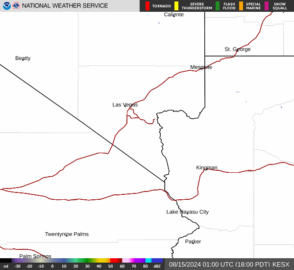
Current Radar Image
Sun Almanac for Logan, Nevada
Sunrise: 05:55 AM
Sunset: 7:25 PM
Civil Sunrise:05:27 AM
Civil Sunset: 7:52 PM
Nautical Sunrise: 04:54 AM
Nautical Sunset: 8:26 PM
Astro Sunrise: 04:19 AM
Astro Sunset: 9:01 PM
Nevada's Current Temperatures
 Nevada's Satellite Image
 Nevada's Current Wind Direction
| National Summary |
of upper and lower values of current conditions amongst 7231 locations
in the contiguous United States |
|
High
Temp |
79° |
Lake Havasu City, Arizona
|
|
Low
Temp |
-36° |
Front Royal, Virginia
|
|
Wind
Speed |
29mph |
Colorado Springs, Colorado
|
|
Wind
Gust |
43mph |
Colorado Springs, Colorado
|
|
Wind
Chill |
8° |
Perryton, Texas
|
|
High
Pressure |
30.36Hg |
Salida Mountain, Colorado
|
|
Low
Pressure |
29.47Hg |
Copper Harbor, Michigan
|
|
| # Locations Reporting Rain |
24 |
|
| # Locations Reporting Thunderstorms / Lightning |
4 |
|
| # Locations Reporting Fog |
3 |
|
| Average Temperature in the Contiguous USA |
48° |
|
Any use of the information on this page is at your own risk. This information should not be relied upon in life-threatening situations, potential financial loss situations or in lieu of any officially disseminated information. Visit the
National Weather Service for official information.