|

| Tonight | Saturday | Sunday | Monday | Tuesday | Wednesday | Thursday | Friday |
 |
 |
 |
 |
|
 |
|
|
| Low: 57°F | High: 53 °F | High: 61°F | High: 64°F | High: 67°F | High: 69°F | High: 69°F | High: 71°F |
| Low: 45°F | Low: 50°F | Low: 52°F | Low: 55°F | Low: 56°F | Low: 55°F | ||
| Rain | Rain | Partly Sunny | Rain | Partly Sunny | Rain | Partly Sunny | Partly Sunny |
Hourly forecast
Twin Creek, nc · Next 24 hours · Eastern time (EST/EDT)
Loading hourly forecast…
Current Conditions at
PITT-GREENVILLE - (KPGV)
PITT-GREENVILLE - (KPGV)
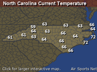
73°
Clear
as of 10:55 PM EDST
Rel. Humidity: 78%
Dew Point: 66°F
Visibility: 10 Miles
Pressure: 29.84 in.
Flight Rule: VFR
Dew Point: 66°F
Visibility: 10 Miles
Pressure: 29.84 in.
Flight Rule: VFR
Wind Data
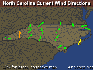
12 MPH
200° South
12 MPH
200° South
Cloud Level(s): Clear
Current Conditions at
WASH -WARREN FLD - (KOCW)
WASH -WARREN FLD - (KOCW)
73°
Cloudy
as of 10:55 PM EDST
Rel. Humidity: 73%
Dew Point: 64°F
Visibility: 10 Miles
Pressure: 29.87 in.
Flight Rule: VFR
Dew Point: 64°F
Visibility: 10 Miles
Pressure: 29.87 in.
Flight Rule: VFR
Wind Data
9 MPH
190° South
9 MPH
190° South
Cloud Level(s): Solid Overcast at 7000ft
Current Conditions at
KINSTON - (KISO)
KINSTON - (KISO)
73°
Partly Cloudy
as of 10:55 PM EDST
Rel. Humidity: 83%
Dew Point: 68°F
Visibility: 10 Miles
Pressure: 29.87 in.
Flight Rule: VFR
Dew Point: 68°F
Visibility: 10 Miles
Pressure: 29.87 in.
Flight Rule: VFR
Wind Data
8 MPH
190° South
8 MPH
190° South
Cloud Level(s): Scattered at 6000ft, Scattered at 7000ft
Current Conditions at
NEW BERN - (KEWN)
NEW BERN - (KEWN)
72°
Clear
as of 10:54 PM EDST
Rel. Humidity: 83%
Dew Point: 66°F
Visibility: 10 Miles
Pressure: 29.88 in.
Flight Rule: VFR
Dew Point: 66°F
Visibility: 10 Miles
Pressure: 29.88 in.
Flight Rule: VFR
Wind Data
9 MPH
210° Southwest
9 MPH
210° Southwest
Cloud Level(s): Clear
|
Tonight... A chance of showers, mainly after 5am. Mostly cloudy, with a low around 57. South wind around 11 mph becoming west after midnight. Winds could gust as high as 17 mph. Chance of precipitation is 30%. New precipitation amounts of less than a tenth of an inch possible. |
|
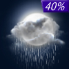
Saturday... Showers, mainly before 4pm. Temperature falling to around 53 by 5pm. North wind 15 to 18 mph, with gusts as high as 29 mph. Chance of precipitation is 100%. New precipitation amounts between a half and three quarters of an inch possible. |
 |
Saturday Night... A chance of showers after 1am. Mostly cloudy, with a low around 45. Breezy, with a north wind 17 to 20 mph, with gusts as high as 29 mph. Chance of precipitation is 40%. New precipitation amounts between a tenth and quarter of an inch possible. |
|
Sunday... A chance of showers, mainly after 2pm. Partly sunny, with a high near 61. Breezy, with a north wind 18 to 20 mph, with gusts as high as 30 mph. Chance of precipitation is 30%. New precipitation amounts between a tenth and quarter of an inch possible. |
|
Sunday Night... A chance of showers. Mostly cloudy, with a low around 50. Breezy, with a north wind 18 to 21 mph, with gusts as high as 30 mph. Chance of precipitation is 40%. New precipitation amounts between a tenth and quarter of an inch possible. |
|
Monday... A chance of showers. Mostly cloudy, with a high near 64. Breezy. Chance of precipitation is 50%. New precipitation amounts between a tenth and quarter of an inch possible. |
|
Monday Night... A chance of showers. Mostly cloudy, with a low around 52. Breezy. Chance of precipitation is 30%. |
|
Tuesday... A chance of showers before 2pm. Partly sunny, with a high near 67. Chance of precipitation is 30%. |
 |
Tuesday Night... Partly cloudy, with a low around 55. Breezy. |
|
Wednesday... A chance of showers after 2pm. Mostly sunny, with a high near 69. Chance of precipitation is 30%. |
|
Wednesday Night... A chance of showers. Mostly cloudy, with a low around 56. Breezy. Chance of precipitation is 30%. |
|
Thursday... Partly sunny, with a high near 69. |
 |
Thursday Night... Mostly cloudy, with a low around 55. |
|
Friday... Partly sunny, with a high near 71. |
North Carolina's Warnings, Watches, and Advisories
Civil Rise to Set: 0 Hours 7 Minutes
Nautical Rise to Set: 1 Hours 7 Minutes
Astro Rise to Set: 2 Hours 5 Minutes
Click for yearly Sun Almanac for Twin Creek
Sun Almanac for Twin Creek, North Carolina
Astronomical Sunrise 15:52 AMAstronomical sunrise occurs when the Sun is 18° below the horizon and the sky begins to brighten from a completly darkened state.
Nautical Sunrise 16:21 AMNautical sunrise (or nautical dawn) is the precise moment when the sun's center is 12° below the horizon in the morning. It marks the beginning of nautical twilight, allowing pilots/mariners to see the horizon.
Civil Sunrise 16:51 AMCivil sunrise is the moment in the morning when the sun's center is 6° below the horizon. It marks the start of morning civil twilight, providing enough natural light for most, outdoor activities without artificial lighting. It typically occurs roughly 20-30 minutes before actual sunrise.
Sunrise 17:17 AMSunrise (or sunup) is the moment when the upper rim of the Sun appears on the horizon in the morning. It marks the end of the twilight phase, often accompanied by distinct atmospheric colors.
Daylight: -1 Hours 16 MinutesDaylight hours are the period of time between local sunrise and sunset, representing the daily portion of sunlight. These hours change in length based on season, Earth's tilt, and latitude.
Sunset 04:33 PMThe sunset is defined in astronomy as the moment the upper limb of the Sun disappears below the horizon. It marks the end of daylight and is often accompanied by distinct atmospheric colors. It also signals the beginning of twilight.
Civil Sunset 04:58 PMCivil sunset (or evening civil twilight) occurs when the center of the sun is 6° below the horizon, marking the end of the brightest twilight phase. It typically occurs roughly 20-30 minutes after sunset, providing enough light for most outdoor activities to continue without artificial light.
Nautical Sunset 05:28 PMNautical sunset occurs when the sun's center is 12° below the horizon, marking the end of nautical twilight. This phase, following civil twilight, allows the horizon to remain visible, enabling mariners to take accurate star sights for navigation. The sky is dark, but some ambient light remains
Astronomical Sunset 05:57 PMAstronomical sunrise occurs when the Sun drops to 18° below the horizon. This causes the sky to enter a completly darkened state.
Civil Rise to Set: 0 Hours 7 Minutes
Nautical Rise to Set: 1 Hours 7 Minutes
Astro Rise to Set: 2 Hours 5 Minutes
Click for yearly Sun Almanac for Twin Creek
Moon Almanac for Twin Creek, North Carolina
Moon Phase: Waxing Crescent
Moon Illumination: 36%
Moon Age: 6.01 Days
Moon Illumination: 36%
Moon Age: 6.01 Days
Moon is currently below the horizon
Distance from Moon to Earth: 251,952 miles
Distance from Moon to Earth: 251,952 miles
| Upcoming Lunar Events for Twin Creek: | ||
| Next Event | Event Time | Illum |
| Moonrise: | 01:51 pm Sat | 41.2% |
| High Moon: | 06:37 pm Sat | 43.1% |
| Moonset: | 11:27 pm Sat | 45.0% |
| First Quarter: | 12:12 pm Sun | 50.0% |
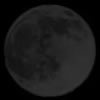 | New Moon: Sat Oct 10 |
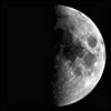 | First Quarter: Sun Oct 18 |
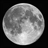 | Full Moon: Mon Oct 26 |
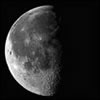 | Last Quarter: Sun Nov 1 |
| New Moon: Mon Nov 9 |
| Click for Monthly Moon Almanac |