Hazleton, Indiana Weather
No Watches or Warnings for Hazleton
Issued: 12:18 am CDT Apr 23, 2024 Latitude: 38.4889362 Longitude: -87.5416891 View on Google Maps
|
|
|
|
|
|
|
|
|
|
 |
 |
 |
|
 |
|
 |
|
| Low: °F |
High: °F |
High: °F |
High: °F |
High: °F |
High: °F |
High: °F |
High: °F |
| Low: °F |
Low: °F |
Low: °F |
Low: °F |
Low: °F |
Low: °F |
|
| Mostly Clear |
Rain |
Sunny |
Sunny |
Thunderstorms |
Thunderstorms |
Thunderstorms |
Thunderstorms |
Current Conditions at
MOUNT CARMEL MUNI - (KAJG)
52°
Clear
as of 1:15 AM CDST
Rel. Humidity: 62%
Dew Point: 39°F
Visibility: 10 Miles
Pressure: 30.04 in.
Flight Rule: VFR
Cloud Level(s): Clear
Current Conditions at
LAWRENCEVILLE - (KLWV)
48°
Clear
as of 12:53 AM CDST
Rel. Humidity: 66%
Dew Point: 37°F
Visibility: 10 Miles
Pressure: 30.04 in.
Flight Rule: VFR
Wind Data
8 MPH
210° Southwest
Cloud Level(s): Clear
Current Conditions at
EVANSVILLE - (KEVV)
54°
Clear
as of 12:54 AM CDST
Rel. Humidity: 50%
Dew Point: 36°F
Visibility: 10 Miles
Pressure: 30.08 in.
Flight Rule: VFR
Wind Data
8 MPH
210° Southwest
Cloud Level(s): Clear
Current Conditions at
HUNTINGBURG - (KHNB)
50°
Clear
as of 1:56 AM EDST
Rel. Humidity: 61%
Dew Point: 37°F
Visibility: 10 Miles
Pressure: 30.08 in.
Flight Rule: VFR
Cloud Level(s): Clear
|
Overnight... Mostly clear, with a low around 47. South southwest wind around 10 mph, with gusts as high as 18 mph. |
|
|
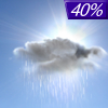
Tuesday... A 40 percent chance of showers after 1pm. Increasing clouds, with a high near 68. Breezy, with a southwest wind 13 to 20 mph, with gusts as high as 29 mph. |
|
 |
Tuesday Night... A 40 percent chance of showers before 1am. Cloudy, then gradually becoming partly cloudy, with a low around 47. North wind 6 to 9 mph becoming south southwest in the evening. |
|
|
Wednesday... Sunny, with a high near 67. North wind 7 to 10 mph. |
|
|
Wednesday Night... Mostly clear, with a low around 42. East northeast wind around 8 mph. |
|
|
Thursday... Sunny, with a high near 70. East southeast wind around 9 mph. |
|
 |
Thursday Night... A 30 percent chance of showers after 1am. Mostly cloudy, with a low around 53. East wind 7 to 11 mph, with gusts as high as 20 mph. |
|
|
Friday... A chance of showers and thunderstorms. Mostly cloudy, with a high near 76. Breezy, with a south wind 14 to 20 mph, with gusts as high as 30 mph. |
|
 |
Friday Night... A chance of showers and thunderstorms. Mostly cloudy, with a low around 66. Breezy, with a south wind 20 to 23 mph, with gusts as high as 34 mph. |
|
|
Saturday... A chance of showers and thunderstorms. Mostly cloudy, with a high near 79. Breezy, with a south wind 22 to 24 mph, with gusts as high as 37 mph. |
|
|
Saturday Night... A chance of showers and thunderstorms. Mostly cloudy, with a low around 67. Breezy, with a south wind 17 to 22 mph, with gusts as high as 30 mph. |
|
|
Sunday... A chance of showers and thunderstorms. Partly sunny, with a high near 82. Breezy, with a south wind 16 to 20 mph, with gusts as high as 32 mph. |
|
|
Sunday Night... A chance of showers and thunderstorms. Mostly cloudy, with a low around 64. South wind around 17 mph, with gusts as high as 29 mph. |
|
|
Monday... A chance of showers and thunderstorms. Partly sunny, with a high near 76. Breezy, with a south southwest wind 17 to 20 mph, with gusts as high as 29 mph. |
|
Current Radar Image
Sun Almanac for Hazleton, Indiana
Sunrise: 06:02 AM
Sunset: 7:35 PM
Civil Sunrise:05:34 AM
Civil Sunset: 8:03 PM
Nautical Sunrise: 05:00 AM
Nautical Sunset: 8:36 PM
Astro Sunrise: 04:25 AM
Astro Sunset: 9:12 PM
Indiana's Current Temperatures
 Indiana's Satellite Image
 Indiana's Current Wind Direction
| National Summary |
of upper and lower values of current conditions amongst 7028 locations
in the contiguous United States |
|
High
Temp |
86° |
Bullhead City, Arizona
|
|
Low
Temp |
-36° |
Front Royal, Virginia
|
|
Wind
Speed |
35mph |
Byron, California
|
|
Wind
Gust |
44mph |
Byron, California
|
|
Wind
Chill |
8° |
Perryton, Texas
|
|
High
Pressure |
30.79Hg |
Ottawa, Ohio
|
|
Low
Pressure |
29.48Hg |
Grand Marais, Minnesota
|
|
| # Locations Reporting Snow |
1 |
|
| # Locations Reporting Rain |
22 |
|
| # Locations Reporting Fog |
2 |
|
| Average Temperature in the Contiguous USA |
50° |
|
Any use of the information on this page is at your own risk. This information should not be relied upon in life-threatening situations, potential financial loss situations or in lieu of any officially disseminated information. Visit the
National Weather Service for official information.


