No Watches or Warnings for Egan
Issued: 3:26 am PDT Apr 19, 2024 Latitude: 33.7322431 Longitude: -117.0119697 View on Google Maps
|
|
|
|
|
|
|
|
|
|
 |
 |
|
 |
|
|
 |
 |
| High: °F |
Low: °F |
High: °F |
High: °F |
High: °F |
High: °F |
High: °F |
High: °F |
| Low: °F |
Low: °F |
Low: °F |
Low: °F |
Low: °F |
|
| Morning Fog |
Patchy Fog |
Morning Fog |
Sunny |
Sunny |
Morning Fog |
Mostly Cloudy |
Mostly Sunny |
Current Conditions at
MARCH AFB - (KRIV)
55°
Cloudy
Mist
as of 9:05 AM PDST
Rel. Humidity: 87%
Dew Point: 52°F
Visibility: 6 Miles
Pressure: 29.97 in.
Flight Rule: IFR
Cloud Level(s): Solid Overcast at 800ft
Current Conditions at
RIVERSIDE - (KRAL)
55°
Cloudy
Mist
as of 8:53 AM PDST
Rel. Humidity: 87%
Dew Point: 52°F
Visibility: 2 1/2 Miles
Pressure: 29.98 in.
Flight Rule: IFR
Cloud Level(s): Solid Overcast at 800ft
Current Conditions at
PALM SPRINGS - (KPSP)
75°
Clear
as of 8:53 AM PDST
Rel. Humidity: 29%
Dew Point: 41°F
Visibility: 10 Miles
Pressure: 29.83 in.
Flight Rule: VFR
Wind Data
3 MPH
220° Southwest
Cloud Level(s): Clear
Current Conditions at
CAMP PENDLETON - (KNFG)
61°
Cloudy
as of 8:55 AM PDST
Rel. Humidity: 77%
Dew Point: 54°F
Visibility: 10 Miles
Pressure: 29.99 in.
Flight Rule: MVFR
Cloud Level(s): Solid Overcast at 1500ft
|
Today... Patchy fog before 11am. Otherwise, sunny, with a high near 75. Light southwest wind increasing to 10 to 15 mph in the afternoon. Winds could gust as high as 20 mph. |
|
|
Tonight... Patchy fog after 11pm. Otherwise, increasing clouds, with a low around 50. Southwest wind 5 to 10 mph, with gusts as high as 20 mph. |
|
|
Saturday... Patchy fog before 11am. Otherwise, mostly cloudy through mid morning, then gradual clearing, with a high near 79. Light west wind becoming southwest 5 to 10 mph in the afternoon. |
|
 |
Saturday Night... Mostly clear, with a low around 55. Southwest wind 5 to 10 mph becoming light and variable in the evening. |
|
|
Sunday... Sunny, with a high near 88. Light and variable wind becoming southwest 10 to 15 mph in the afternoon. Winds could gust as high as 25 mph. |
|
|
Sunday Night... Mostly clear, with a low around 55. |
|
|
Monday... Sunny, with a high near 81. |
|
|
Monday Night... Patchy fog after 11pm. Otherwise, increasing clouds, with a low around 52. |
|
|
Tuesday... Patchy fog before 11am. Otherwise, mostly cloudy, then gradually becoming sunny, with a high near 73. |
|
 |
Tuesday Night... Increasing clouds, with a low around 48. |
|
|
Wednesday... Mostly cloudy, then gradually becoming sunny, with a high near 69. |
|
|
Wednesday Night... Mostly cloudy, with a low around 48. |
|
|
Thursday... Mostly sunny, with a high near 65. |
|
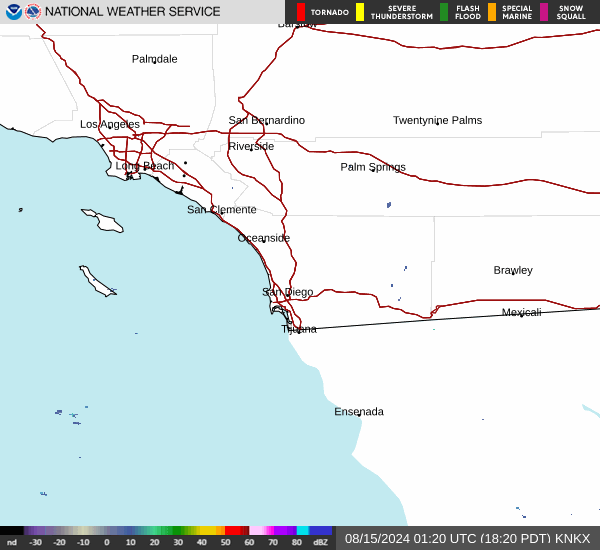
Current Radar Image
Sun Almanac for Egan, California
Sunrise: 06:11 AM
Sunset: 7:23 PM
Civil Sunrise:05:46 AM
Civil Sunset: 7:48 PM
Nautical Sunrise: 05:15 AM
Nautical Sunset: 8:19 PM
Astro Sunrise: 04:43 AM
Astro Sunset: 8:51 PM
California's Current Temperatures
 California's Satellite Image
 California's Current Wind Direction
| National Summary |
of upper and lower values of current conditions amongst 6916 locations
in the contiguous United States |
|
High
Temp |
90° |
Zapata Cnty A/P, Texas
|
|
Low
Temp |
12° |
Perryton, Texas
|
|
Wind
Speed |
35mph |
Storm Lake, Iowa
and 1 other location
|
|
Wind
Gust |
47mph |
Pierre, South Dakota
and 1 other location
|
|
Wind
Chill |
9° |
Plentywood, Montana
and 1 other location
|
|
Heat
Index |
96° |
Zapata Cnty A/P, Texas
|
|
High
Pressure |
30.46Hg |
Malmstrom AFB, Montana
and 2 other locations
|
|
Low
Pressure |
29.78Hg |
Grand Marais, Minnesota
|
|
| # Locations Reporting Snow |
30 |
|
| # Locations Reporting Rain |
29 |
|
| # Locations Reporting Thunderstorms / Lightning |
1 |
|
| # Locations Reporting Fog |
1 |
|
| Average Temperature in the Contiguous USA |
57° |
|
Any use of the information on this page is at your own risk. This information should not be relied upon in life-threatening situations, potential financial loss situations or in lieu of any officially disseminated information. Visit the
National Weather Service for official information.