No Watches or Warnings for Darlot
Issued: 3:28 am EDT Apr 19, 2024 Latitude: 31.9349289 Longitude: -81.6303907 View on Google Maps
|
|
|
|
|
|
|
|
|
|
 |
 |
 |
 |
 |
 |
|
|
| High: °F |
Low: °F |
High: °F |
High: °F |
High: °F |
High: °F |
High: °F |
High: °F |
| Low: °F |
Low: °F |
Low: °F |
Low: °F |
Low: °F |
|
| Mostly Sunny |
Mostly Clear |
Thunderstorms |
Thunderstorms |
Rain |
Sunny |
Sunny |
Sunny |
Current Conditions at
FORT STEWART - (KLHW)
64°
Mostly Clear
as of 4:55 AM EDST
Rel. Humidity: 100%
Dew Point: 64°F
Visibility: 10 Miles
Pressure: 29.97 in.
Flight Rule: VFR
Cloud Level(s): Few at 14000ft
Current Conditions at
SAVANNAH - (KSAV)
68°
Clear
as of 4:53 AM EDST
Rel. Humidity: 77%
Dew Point: 61°F
Visibility: 10 Miles
Pressure: 29.99 in.
Flight Rule: VFR
Cloud Level(s): Clear
Current Conditions at
HUNTER AFB - (KSVN)
68°
Cloudy
as of 4:55 AM EDST
Rel. Humidity: 82%
Dew Point: 63°F
Visibility: 10 Miles
Pressure: 29.96 in.
Flight Rule: VFR
Cloud Level(s): Scattered at 15000ft, Solid Overcast at 17000ft
Current Conditions at
STATESBORO - (KTBR)
64°
Partly Cloudy
as of 5:20 AM EDST
Rel. Humidity: 88%
Dew Point: 61°F
Visibility: 10 Miles
Pressure: 30.00 in.
Flight Rule: VFR
Cloud Level(s): Scattered at 12000ft
|
Today... Mostly sunny, with a high near 91. Calm wind becoming west 5 to 7 mph in the morning. |
|
|
Tonight... Mostly clear, with a low around 67. South wind 3 to 6 mph. |
|
|
Saturday... A 20 percent chance of showers and thunderstorms after 2pm. Sunny, with a high near 90. West wind 5 to 7 mph. |
|
 |
Saturday Night... A 40 percent chance of showers and thunderstorms before 2am. Mostly cloudy, with a low around 65. West wind 3 to 5 mph. |
|
|
Sunday... Showers likely and possibly a thunderstorm, mainly after 2pm. Mostly cloudy, with a high near 79. Northwest wind 5 to 8 mph. Chance of precipitation is 60%. New rainfall amounts between a tenth and quarter of an inch, except higher amounts possible in thunderstorms. |
|
 |
Sunday Night... Showers likely and possibly a thunderstorm. Mostly cloudy, with a low around 55. Chance of precipitation is 60%. New precipitation amounts between a tenth and quarter of an inch, except higher amounts possible in thunderstorms. |
|
|
Monday... A slight chance of showers before 8am, then a slight chance of showers after 2pm. Mostly cloudy, with a high near 68. Chance of precipitation is 20%. |
|
|
Monday Night... Mostly clear, with a low around 48. |
|
|
Tuesday... Sunny, with a high near 76. |
|
|
Tuesday Night... Mostly clear, with a low around 52. |
|
|
Wednesday... Sunny, with a high near 83. |
|
|
Wednesday Night... Mostly clear, with a low around 57. |
|
|
Thursday... Sunny, with a high near 80. |
|
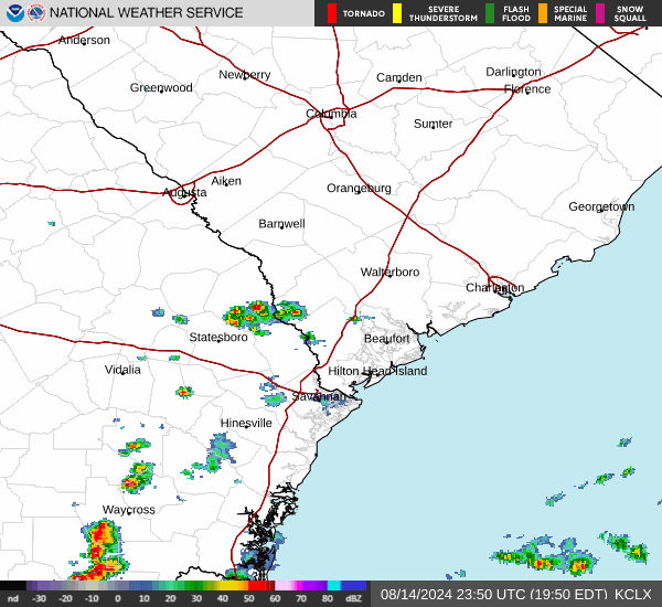
Current Radar Image
Sun Almanac for Darlot, Georgia
Sunrise: 06:52 AM
Sunset: 7:59 PM
Civil Sunrise:06:27 AM
Civil Sunset: 8:24 PM
Nautical Sunrise: 05:57 AM
Nautical Sunset: 8:54 PM
Astro Sunrise: 05:26 AM
Astro Sunset: 9:25 PM
Georgia's Current Temperatures
 Georgia's Satellite Image
 Georgia's Current Wind Direction
| National Summary |
of upper and lower values of current conditions amongst 6559 locations
in the contiguous United States |
|
High
Temp |
79° |
Lake Havasu City, Arizona
|
|
Low
Temp |
-35° |
Front Royal, Virginia
|
|
Wind
Speed |
26mph |
Stanley Municipal A/P, North Dakota
|
|
Wind
Gust |
35mph |
Big Spring, Texas
and 3 other locations
|
|
Wind
Chill |
2° |
Plentywood, Montana
|
|
High
Pressure |
30.40Hg |
Cutbank, Montana
and 1 other location
|
|
Low
Pressure |
29.77Hg |
Willoughby, Ohio
and 1 other location
|
|
| # Locations Reporting Snow |
15 |
|
| # Locations Reporting Rain |
60 |
|
| # Locations Reporting Thunderstorms / Lightning |
7 |
|
| # Locations Reporting Fog |
8 |
|
| Average Temperature in the Contiguous USA |
49° |
|
Any use of the information on this page is at your own risk. This information should not be relied upon in life-threatening situations, potential financial loss situations or in lieu of any officially disseminated information. Visit the
National Weather Service for official information.