Williamsville, Pennsylvania Weather
Issued: 2:24 pm EDT Apr 23, 2024 Latitude: 41.6295068 Longitude: -78.5750231 View on Google Maps
|
|
|
|
|
|
|
|
|
|
 |
 |
 |
 |
|
 |
 |
 |
| High: °F |
Low: °F |
High: °F |
High: °F |
High: °F |
High: °F |
High: °F |
High: °F |
| Low: °F |
Low: °F |
Low: °F |
Low: °F |
Low: °F |
|
| Rain |
Rain |
Rain |
Sunny |
Sunny |
Rain |
Thunderstorms |
Thunderstorms |
Current Conditions at
BRADFORD - (KBFD)
63°
Mostly Clear
as of 1:53 PM EDST
Rel. Humidity: 27%
Dew Point: 28°F
Visibility: 10 Miles
Pressure: 29.91 in.
Flight Rule: VFR
Wind Data
14 MPH
Gust: 29 MPH
220° Southwest
Cloud Level(s): Few at 12000ft
Current Conditions at
DUBOIS - (KDUJ)
63°
Clear
as of 1:53 PM EDST
Rel. Humidity: 29%
Dew Point: 30°F
Visibility: 10 Miles
Pressure: 29.93 in.
Flight Rule: VFR
Wind Data
12 MPH
Gust: 25 MPH
210° Southwest
Cloud Level(s): Clear
Current Conditions at
CLEARFIELD - (KFIG)
64°
Clear
as of 1:54 PM EDST
Rel. Humidity: 27%
Dew Point: 30°F
Visibility: 10 Miles
Pressure: 29.94 in.
Flight Rule: VFR
Wind Data
16 MPH
Gust: 25 MPH
190° South
Cloud Level(s): Clear
Current Conditions at
WELLSVILLE MUNI - (KELZ)
61°
Cloudy
as of 1:56 PM EDST
Rel. Humidity: 25%
Dew Point: 25°F
Visibility: 10 Miles
Pressure: 29.91 in.
Flight Rule: VFR
Wind Data
13 MPH
Gust: 29 MPH
200° South
Cloud Level(s): Solid Overcast at 12000ft
|
This Afternoon... A chance of showers after 4pm. Mostly cloudy, with a high near 63. Southwest wind around 15 mph, with gusts as high as 26 mph. Chance of precipitation is 30%. New precipitation amounts of less than a tenth of an inch possible. |
|
|
Tonight... Showers. Low around 42. Southwest wind 10 to 13 mph, with gusts as high as 22 mph. Chance of precipitation is 90%. New precipitation amounts between a tenth and quarter of an inch possible. |
|
|
Wednesday... Showers likely, mainly before 9am. Cloudy, with a high near 50. West wind 9 to 11 mph. Chance of precipitation is 60%. New precipitation amounts of less than a tenth of an inch possible. |
|
 |
Wednesday Night... Areas of frost after 1am. Otherwise, mostly cloudy, then gradually becoming mostly clear, with a low around 26. Northeast wind 5 to 8 mph. |
|
|
Thursday... Widespread frost before 9am. Otherwise, sunny, with a high near 56. Northeast wind around 6 mph. |
|
|
Thursday Night... Widespread frost, mainly after 4am. Otherwise, mostly clear, with a low around 30. |
|
|
Friday... Areas of frost before 8am. Otherwise, sunny, with a high near 62. |
|
 |
Friday Night... A chance of showers after 2am. Mostly cloudy, with a low around 40. Chance of precipitation is 40%. |
|
|
Saturday... Showers likely, mainly between 8am and 2pm. Mostly cloudy, with a high near 58. Chance of precipitation is 60%. |
|
 |
Saturday Night... A chance of showers and thunderstorms. Mostly cloudy, with a low around 49. Chance of precipitation is 30%. |
|
|
Sunday... A chance of showers and thunderstorms. Partly sunny, with a high near 76. Chance of precipitation is 40%. |
|
|
Sunday Night... A chance of showers and thunderstorms. Mostly cloudy, with a low around 56. Chance of precipitation is 30%. |
|
|
Monday... A chance of showers and thunderstorms. Partly sunny, with a high near 78. Chance of precipitation is 50%. |
|
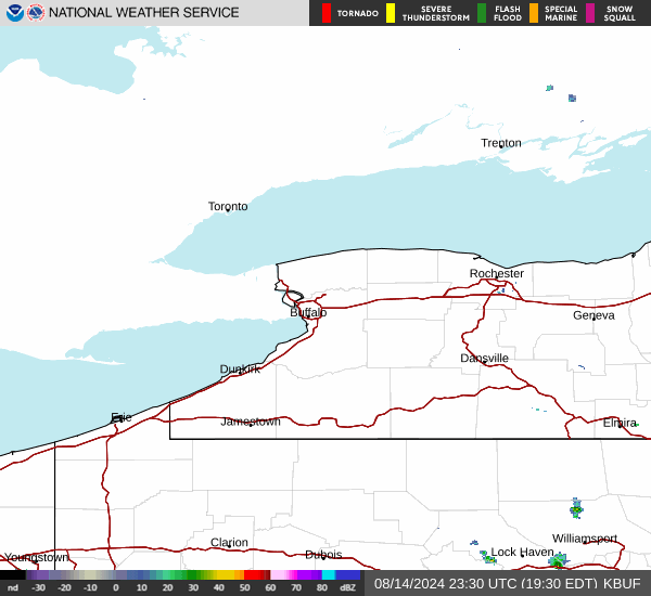
Current Radar Image
Sun Almanac for Williamsville, Pennsylvania
Sunrise: 06:21 AM
Sunset: 8:04 PM
Civil Sunrise:05:51 AM
Civil Sunset: 8:34 PM
Nautical Sunrise: 05:16 AM
Nautical Sunset: 9:09 PM
Astro Sunrise: 04:37 AM
Astro Sunset: 9:48 PM
Pennsylvania's Current Temperatures
 Pennsylvania's Satellite Image
 Pennsylvania's Current Wind Direction
| National Summary |
of upper and lower values of current conditions amongst 7091 locations
in the contiguous United States |
|
High
Temp |
91° |
Gila Bend (Aaf), Arizona
|
|
Low
Temp |
32° |
Berthoud Pass, Colorado
|
|
Wind
Speed |
38mph |
Salida Mountain, Colorado
|
|
Wind
Gust |
43mph |
Waterloo, Iowa
and 1 other location
|
|
Wind
Chill |
18° |
Berthoud Pass, Colorado
|
|
High
Pressure |
30.71Hg |
Ottawa, Ohio
|
|
Low
Pressure |
29.55Hg |
Ephraim, Wisconsin
and 1 other location
|
|
| # Locations Reporting Rain |
46 |
|
| # Locations Reporting Thunderstorms / Lightning |
9 |
|
| Average Temperature in the Contiguous USA |
65° |
|
Any use of the information on this page is at your own risk. This information should not be relied upon in life-threatening situations, potential financial loss situations or in lieu of any officially disseminated information. Visit the
National Weather Service for official information.