
| your sport, your way | ||||
 |  |  |  |  |
|

| Tonight | Wednesday | Thursday | Friday | Saturday | Sunday | Monday | Tuesday |
 |
 |
 |
 |
 |
 |
 |
 |
| Low: 44°F | High: 56°F | High: 62°F | High: 68°F | High: 78°F | High: 81°F | High: 75°F | High: 70°F |
| Low: 37°F | Low: 43°F | Low: 61°F | Low: 65°F | Low: 65°F | Low: 56°F | ||
| Rain | Mostly Sunny | Sunny | Rain | Thunderstorms | Thunderstorms | Thunderstorms | Thunderstorms |


|
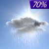
Tonight... Showers likely, mainly before 10pm. Cloudy, then gradually becoming partly cloudy, with a low around 44. West southwest wind 8 to 11 mph, with gusts as high as 18 mph. Chance of precipitation is 70%. New precipitation amounts of less than a tenth of an inch possible. |
|
Wednesday... Mostly sunny, with a high near 56. North northwest wind around 10 mph. |
 |
Wednesday Night... Partly cloudy, with a low around 37. East northeast wind around 9 mph. |
|
Thursday... Sunny, with a high near 62. East wind around 8 mph. |
 |
Thursday Night... Mostly clear, with a low around 43. East wind 7 to 10 mph. |
|
Friday... Showers likely, mainly after 2pm. Mostly cloudy, with a high near 68. Breezy, with a south southeast wind 14 to 20 mph, with gusts as high as 29 mph. Chance of precipitation is 60%. New precipitation amounts of less than a tenth of an inch possible. |
 |
Friday Night... Showers likely and possibly a thunderstorm before 8pm, then a chance of showers and thunderstorms between 8pm and 2am, then a chance of showers after 2am. Mostly cloudy, with a low around 61. Breezy, with a south wind around 22 mph, with gusts as high as 32 mph. Chance of precipitation is 60%. |
|
Saturday... A chance of showers, with thunderstorms also possible after 8am. Mostly cloudy, with a high near 78. Breezy, with a south southwest wind 22 to 25 mph, with gusts as high as 38 mph. Chance of precipitation is 30%. |
 |
Saturday Night... A slight chance of showers and thunderstorms. Mostly cloudy, with a low around 65. Breezy, with a south wind around 21 mph, with gusts as high as 31 mph. Chance of precipitation is 20%. |
|
Sunday... A slight chance of showers, then a chance of showers and thunderstorms after 2pm. Partly sunny, with a high near 81. Breezy, with a south southwest wind 20 to 25 mph, with gusts as high as 38 mph. Chance of precipitation is 30%. |
|
Sunday Night... Showers and thunderstorms likely. Mostly cloudy, with a low around 65. Breezy. Chance of precipitation is 60%. |
|
Monday... Showers likely and possibly a thunderstorm. Mostly cloudy, with a high near 75. Breezy. Chance of precipitation is 70%. |
 |
Monday Night... A 50 percent chance of showers and thunderstorms. Mostly cloudy, with a low around 56. |
|
Tuesday... A 30 percent chance of showers and thunderstorms. Mostly sunny, with a high near 70. |


