
| your sport, your way | ||||
 |  |  |  |  |
|

| This Afternoon | Tonight | Saturday | Sunday | Monday | Tuesday | Wednesday | Thursday | Friday |
 |
 |
|
 |
 |
|
 |
 |
 |
| High: 37°F | Low: 23°F | High: 37°F | High: 58°F | High: 67°F | High: 59°F | High: 72°F | High: 72°F | High: 61°F |
| Low: 23°F | Low: 36°F | Low: 34°F | Low: 39°F | Low: 43°F | Low: 44°F | |||
| Snow | Freezing Drizzle | Freezing Drizzle | Sunny | Rain | Sunny | Thunderstorms | Thunderstorms | Thunderstorms |


|
This Afternoon... A slight chance of snow before 5pm, then a slight chance of snow showers after 5pm. Mostly cloudy, with a high near 37. Northeast wind around 10 mph. Chance of precipitation is 20%. |
|
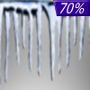
Tonight... A chance of snow showers before midnight, then snow showers likely, possibly mixed with freezing drizzle. Patchy fog after 9pm. Otherwise, cloudy, with a low around 23. East wind 5 to 10 mph. Chance of precipitation is 70%. New ice accumulation of less than a 0.1 of an inch possible. New snow accumulation of less than a half inch possible. |
|
Saturday... Snow showers likely, possibly mixed with freezing drizzle before noon, then a slight chance of snow showers between noon and 2pm. Patchy fog before noon. Otherwise, cloudy, with a high near 37. East wind around 10 mph. Chance of precipitation is 70%. New ice accumulation of less than a 0.1 of an inch possible. New snow accumulation of less than one inch possible. |
 |
Saturday Night... Mostly cloudy, with a low around 23. East southeast wind around 5 mph becoming southwest after midnight. |
|
Sunday... Sunny, with a high near 58. South southwest wind 5 to 15 mph. |
 |
Sunday Night... Partly cloudy, with a low around 36. |
|
Monday... A 20 percent chance of showers after noon. Mostly sunny, with a high near 67. Breezy. |
 |
Monday Night... A slight chance of showers before midnight. Partly cloudy, with a low around 34. Breezy. |
|
Tuesday... Sunny, with a high near 59. Breezy. |
 |
Tuesday Night... A chance of showers, mainly before midnight. Mostly cloudy, with a low around 39. |
|
Wednesday... A slight chance of showers and thunderstorms. Mostly sunny, with a high near 72. |
|
Wednesday Night... A slight chance of showers. Partly cloudy, with a low around 43. |
|
Thursday... A chance of showers and thunderstorms. Partly sunny, with a high near 72. |
|
Thursday Night... A chance of showers. Mostly cloudy, with a low around 44. |
|
Friday... Showers likely and possibly a thunderstorm. Partly sunny, with a high near 61. |


