Sylvester, Pennsylvania Weather
No Watches or Warnings for Sylvester
Issued: 7:04 am EDT Apr 19, 2024 Latitude: 41.963681 Longitude: -77.5588758 View on Google Maps
|
|
|
|
|
|
|
|
|
|
 |
 |
 |
 |
 |
|
|
|
| High: °F |
Low: °F |
High: °F |
High: °F |
High: °F |
High: °F |
High: °F |
High: °F |
| Low: °F |
Low: °F |
Low: °F |
Low: °F |
Low: °F |
|
| Rain |
Rain |
Rain |
Partly Sunny |
Sunny |
Partly Sunny |
Partly Sunny |
Sunny |
Current Conditions at
WELLSVILLE MUNI - (KELZ)
Clear
Mist
as of 6:56 AM EDST
Rel. Humidity: 93%
Dew Point: 45°F
Visibility: 5 Miles
Pressure: 29.96 in.
Flight Rule: MVFR
Wind Data
10 MPH
160° South
Cloud Level(s): Clear
Current Conditions at
ELMIRA - (KELM)
52°
Cloudy
as of 6:53 AM EDST
Rel. Humidity: 81%
Dew Point: 46°F
Visibility: 10 Miles
Pressure: 30.01 in.
Flight Rule: MVFR
Wind Data
8 MPH
130° Southeast
Cloud Level(s): Solid Overcast at 1100ft
Current Conditions at
DANSVILLE - (KDSV)
Clear
as of 6:54 AM EDST
Rel. Humidity: 87%
Dew Point: 45°F
Visibility: 10 Miles
Pressure: 29.94 in.
Flight Rule: VFR
Wind Data
9 MPH
130° Southeast
Cloud Level(s): Clear
Current Conditions at
WILLIAMSPORT - (KIPT)
Cloudy
Mist
as of 6:54 AM EDST
Rel. Humidity: 87%
Dew Point: 45°F
Visibility: 2 1/2 Miles
Pressure: 30.07 in.
Flight Rule: IFR
Wind Data
12 MPH
Gust: 18 MPH
090° East
Cloud Level(s): Solid Overcast at 800ft
|
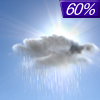
Today... Showers, mainly after 3pm. High near 56. South wind 10 to 18 mph, with gusts as high as 29 mph. Chance of precipitation is 80%. New precipitation amounts of less than a tenth of an inch possible. |
|
|
Tonight... Showers likely, mainly before 8pm. Cloudy, then gradually becoming partly cloudy, with a low around 37. West wind 9 to 13 mph. Chance of precipitation is 60%. New precipitation amounts of less than a tenth of an inch possible. |
|
|
Saturday... Isolated showers. Increasing clouds, with a high near 49. West wind 8 to 18 mph, with gusts as high as 29 mph. Chance of precipitation is 20%. |
|
 |
Saturday Night... Widespread frost after 2am. Otherwise, partly cloudy, with a low around 29. West wind 7 to 13 mph, with gusts as high as 22 mph. |
|
|
Sunday... Partly sunny, with a high near 50. West wind 9 to 14 mph, with gusts as high as 24 mph. |
|
 |
Sunday Night... Mostly clear, with a low around 31. |
|
|
Monday... Sunny, with a high near 53. |
|
|
Monday Night... Mostly clear, with a low around 33. |
|
|
Tuesday... A chance of showers after 2pm. Partly sunny, with a high near 59. Breezy. Chance of precipitation is 30%. |
|
 |
Tuesday Night... Showers likely, mainly after 8pm. Mostly cloudy, with a low around 39. Chance of precipitation is 70%. |
|
|
Wednesday... A chance of showers. Partly sunny, with a high near 49. Chance of precipitation is 50%. |
|
|
Wednesday Night... Mostly clear, with a low around 27. |
|
|
Thursday... Sunny, with a high near 49. |
|
Current Radar Image
Sun Almanac for Sylvester, Pennsylvania
Sunrise: 06:22 AM
Sunset: 7:56 PM
Civil Sunrise:05:53 AM
Civil Sunset: 8:25 PM
Nautical Sunrise: 05:17 AM
Nautical Sunset: 9:01 PM
Astro Sunrise: 04:40 AM
Astro Sunset: 9:39 PM
Pennsylvania's Current Temperatures
 Pennsylvania's Satellite Image
 Pennsylvania's Current Wind Direction
| National Summary |
of upper and lower values of current conditions amongst 6543 locations
in the contiguous United States |
|
High
Temp |
79° |
Port Isabel, Texas
|
|
Low
Temp |
-26° |
Front Royal, Virginia
|
|
Wind
Speed |
40mph |
Berthoud Pass, Colorado
|
|
Wind
Gust |
58mph |
Berthoud Pass, Colorado
|
|
Wind
Chill |
0° |
Berthoud Pass, Colorado
|
|
High
Pressure |
30.41Hg |
Havre, Montana
|
|
Low
Pressure |
29.77Hg |
Grand Marais, Minnesota
and 3 other locations
|
|
| # Locations Reporting Snow |
19 |
|
| # Locations Reporting Rain |
52 |
|
| # Locations Reporting Thunderstorms / Lightning |
2 |
|
| # Locations Reporting Fog |
23 |
|
| Average Temperature in the Contiguous USA |
49° |
|
Any use of the information on this page is at your own risk. This information should not be relied upon in life-threatening situations, potential financial loss situations or in lieu of any officially disseminated information. Visit the
National Weather Service for official information.


